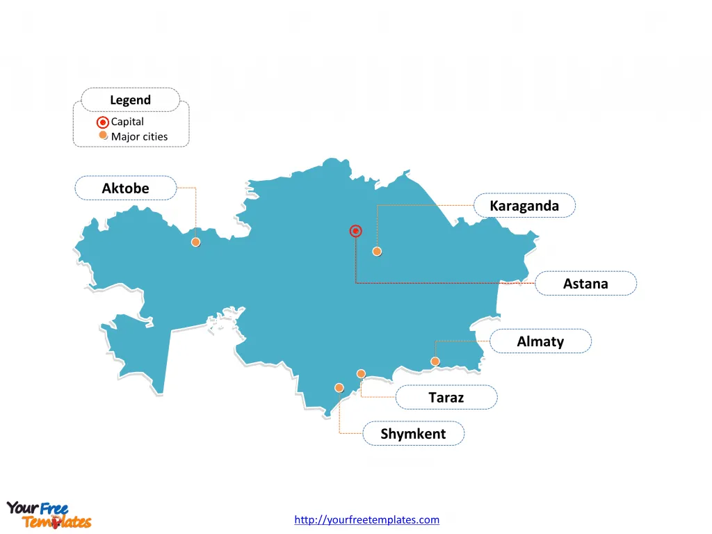
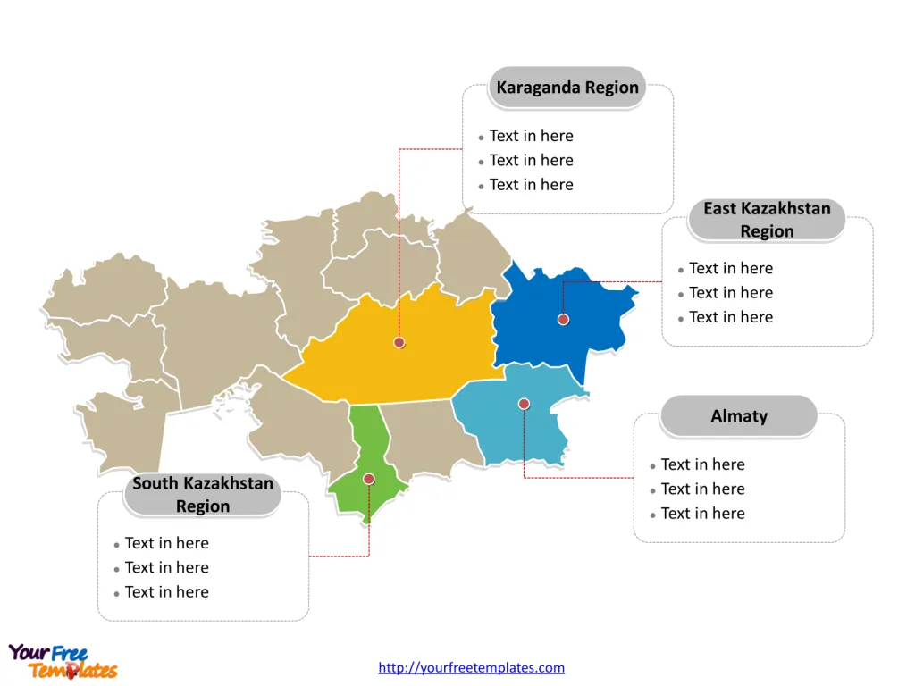
The Kazakhstan Map Template includes two slides. Kazakhstan map with fourteen regions, labeling with major regions, South Kazakhstan Region, Almaty Region, Karaganda Region, and East Kazakhstan Region. Kazakhstan map labeling with national capital and major cities, Almaty, Astana, Shymkent, Karaganda, Aktobe, and Taraz.
Kazakhstan, the ninth-largest country in the world, is strategically located in Central Asia, bordered by Russia to the north, the Caspian Sea to the southwest, Turkmenistan, Uzbekistan, and the Kyrgyz Republic to the south, and China to the east. With a population of 18.4 million, Kazakhstan is a diverse country, with ethnic Kazakhs comprising around 68% of the population, and significant Russian, Uzbek, Ukrainian, Uighur, Tartar, and German minorities.
The country’s economy is heavily reliant on oil, natural gas, and mineral exports, with significant reserves of oil, natural gas, coal, gold, and other minerals. Kazakhstan’s major export partners include China, and it has close ties with the Russian economy. Kazakhstan is a member of the Eurasian Economic Union with Russia, Belarus, Armenia, and Kyrgyzstan, and it has actively sought to diversify its economy by attracting foreign investment and developing industrial clusters.
Slide 1, Kazakhstan map labeled with capital and major cities.
Astana and Almaty is the capital and the largest cityrespectively, other major cities including Shymkent, Karaganda, Aktobe, and Taraz.
Capital and Major Cities on Kazakhstan map
Almaty
Almaty, the largest city in Kazakhstan, is situated in the southeastern part of the country. With a population of over 1.9 million, it is a significant cultural, economic, and educational center known for its picturesque mountainous surroundings, vibrant markets, and historical sites.
Astana (Nur-Sultan)
Astana, now known as Nur-Sultan, serves as the capital and second-largest city in Kazakhstan. Located in the northern part of the country, it has rapidly transformed into a modern urban center, featuring futuristic architecture, government buildings, and cultural landmarks. The city has a population of over 1 million.

Shymkent
Shymkent, the third-largest city in Kazakhstan, is situated in the South Kazakhstan Region. With a population of approximately 1 million, it is an important industrial and cultural hub, contributing significantly to the region’s economic and social dynamics.
Karaganda
Karaganda, located in the Karaganda Region, is a key industrial city with a population exceeding 500,000. Known for its coal mining industry and diverse ethnic population, it plays a vital role in Kazakhstan’s economy.
Aktobe
Aktobe, situated in the Aktobe Region, is a major city located near the Kazakh-Russian border. With a population of around 500,000, it serves as a vital center for commerce, industry, and regional development.
Taraz
Taraz, the capital of the Jambyl Region, is one of the oldest cities in Kazakhstan, with a population of about 400,000. It is renowned for its historical significance, cultural heritage, and vibrant urban atmosphere.
Slide 2, Kazakhstan map labeled with major administration districts.
Kazakhstan map shows the country divided into fourteen regions; they are Akmola Region, Aktobe Region, Almaty, Almaty Region, Astana, Atyrau Region, Baikonur, East Kazakhstan Region, Jambyl Region, Karaganda Region, Kostanay Region, Kyzylorda Region, Mangystau Region, North Kazakhstan Region, Pavlodar Region, South Kazakhstan Region, and West Kazakhstan Region. Every individual political subdivision is an editable shape.
Major Regions on Kazakhstan map
South Kazakhstan Region
The South Kazakhstan Region, with Shymkent as its capital, is an important area known for its agricultural productivity, industrial activities, and cultural diversity, shaping the region’s economic and social landscape.

Almaty Region
The Almaty Region, surrounding the city of Almaty, is a significant economic and cultural center, characterized by its natural beauty, historical sites, and diverse economic activities.
Karaganda Region
The Karaganda Region, with Karaganda as a major city, is a key industrial and mining area, contributing significantly to Kazakhstan’s coal production and urban development.
East Kazakhstan Region
The East Kazakhstan Region, with Oskemen as its capital, is known for its natural resources, including minerals and metals, and plays a pivotal role in the country’s industrial and economic sectors.
In summary, Kazakhstan’s capital, major cities, and regions contribute uniquely to the country’s cultural heritage, economic activities, and regional development. From the bustling urban center of Almaty to the modern capital of Nur-Sultan and the industrial city of Karaganda, each location plays a distinctive role in shaping Kazakhstan’s diverse urban and rural landscape.
Looking for Premium maps, please visit our affiliate site: https://editablemaps.com/ or https://ofomaps.com/
Size: 119K
Type: PPTX
Aspect Ratio: Standard 4:3
Click the blue button to download it.
Download the 4:3 Template
Aspect Ratio: Widescreen 16:9
Click the green button to download it.
Download the 16:9 Template


