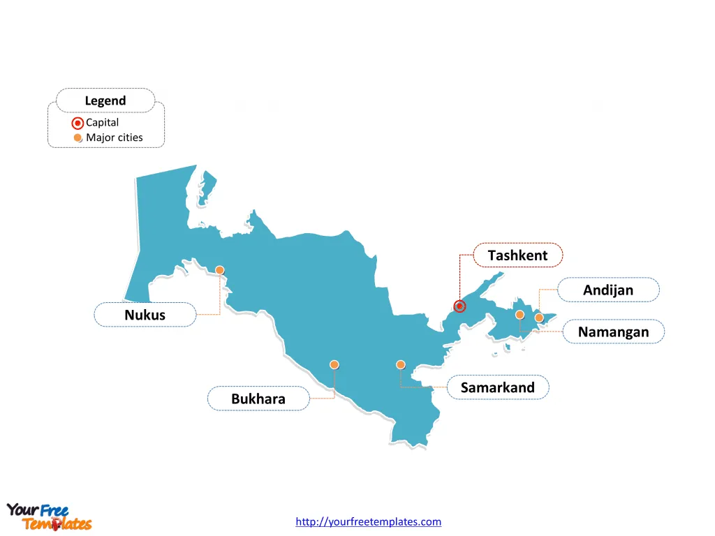
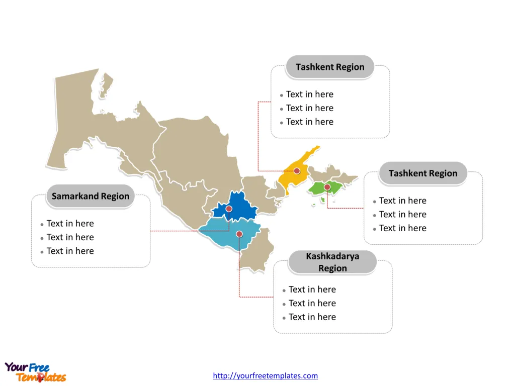
The Uzbekistan Map Template includes two slides. Uzbekistan map with five provinces, labeling with major Regions, Samarkand Region, Fergana Region, Kashkadarya Region, and Tashkent Region. Uzbekistan outline map labeling with national capital and major cities, Tashkent, Namangan, Samarkand, Andijan, Bukhara, and Nukus.
Uzbekistan, located in Central Asia, is bordered by Kazakhstan to the north, Kyrgyzstan to the northeast, Tajikistan to the southeast, Afghanistan to the south, and Turkmenistan to the southwest. With a population of approximately 34 million, it is the most populous country in Central Asia and is known for its diverse ethnic groups and rich cultural heritage.
Uzbekistan’s economy is largely based on natural resources, agriculture, and textiles, with a growing focus on mining and metallurgy. The government has implemented economic reforms to attract foreign investment and diversify the economy, emphasizing sectors such as tourism, energy, and infrastructure to drive future growth and development.
Slide 1, Uzbekistan map labeled with capital and major cities.
Its capital and largest city is Tashkent, other major cities including Namangan, Samarkand, Andijan, Bukhara, and Nukus.
Capital and Major Cities on Uzbekistan map
Tashkent
Tashkent, the capital and largest city of Uzbekistan, is a vibrant urban center known for its cultural diversity, historical sites, and economic significance. With a population of over 2.3 million, it serves as the political, economic, and cultural heart of the country, playing a pivotal role in shaping Uzbekistan’s urban landscape and governance.

Namangan
Namangan, situated in the Namangan Region, is a significant city with a population of approximately 475,700. It is a bustling Islamic center with a rich historical heritage, and it has emerged as a vital trade and industrial hub in eastern Uzbekistan.
Samarkand
Samarkand, the second largest city in Uzbekistan, boasts a population of over 504,000. Renowned for its historical significance and architectural marvels, it is an important cultural and economic center, having thrived as a prominent trade hub on the ancient Silk Road.
Andijan
Andijan, the capital city of the Andijan Region, has a population of about 333,400. With a history dating back to the medieval era, the city has evolved into a major industrial center, housing automobile production plants, textile factories, and other manufacturing facilities.
Bukhara
Bukhara, with a population of around 328,400, is a city steeped in history and is known for its well-preserved architectural gems. It has been a crucial center for trade, culture, and religion, contributing significantly to Uzbekistan’s cultural heritage and tourism.
Nukus
Nukus, located in the Karakalpakstan Autonomous Republic, is a significant city with a population of approximately 230,000. It serves as an important cultural and economic center, particularly known for its Nukus Art Museum and its contributions to the region’s industrial and artistic development.
Slide 2, Uzbekistan map labeled with major administration districts.
Uzbekistan map shows the country divided into twelve provinces, one autonomous republic and one independent city; they are Buxoro Viloyati, Jizzax Viloyati, Navoiy Viloyati, Qashqadaryo Viloyati, Samarqand Viloyati, Sirdaryo Viloyati, Surxondaryo Viloyati, Toshkent Viloyati, Toshkent Shahri, Farg’ona Viloyati, Andijon Viloyati, Namangan Viloyati, Xorazm Viloyati, and Qaraqalpaqstan Respublikasi. Every individual political subdivision is an editable shape.
Major Regions on Uzbekistan map
Samarkand Region
The Samarkand Region, with Samarkand as its major city, is an important area known for its historical significance, cultural heritage, and economic contributions, shaping the region’s economic and social dynamics.

Fergana Region
The Fergana Region, with Fergana as a major city, is a key area known for its agricultural production, industrial activities, and cultural significance, influencing the region’s economic and social landscape.
Kashkadarya Region
The Kashkadarya Region, with Karshi as a major city, is a significant agricultural and industrial area, contributing to Uzbekistan’s cotton production, food processing, and economic development.
Tashkent Region
The Tashkent Region, surrounding the capital city, is a crucial economic and cultural center, characterized by its industrial activities, historical sites, and diverse economic contributions.
Looking for Premium maps, please visit our affiliate site: https://editablemaps.com/ or https://ofomaps.com/
Size: 111K
Type: PPTX
Aspect Ratio: Standard 4:3
Click the blue button to download it.
Download the 4:3 Template
Aspect Ratio: Widescreen 16:9
Click the green button to download it.
Download the 16:9 Template


