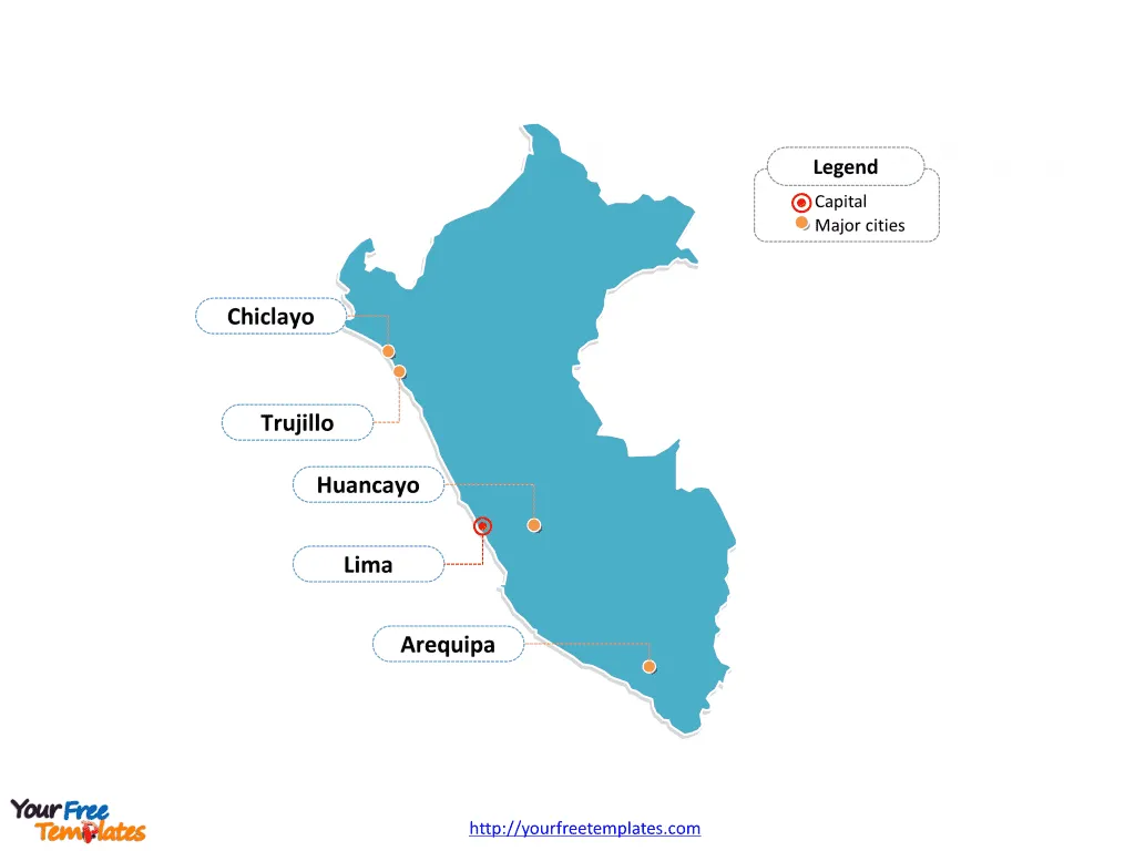
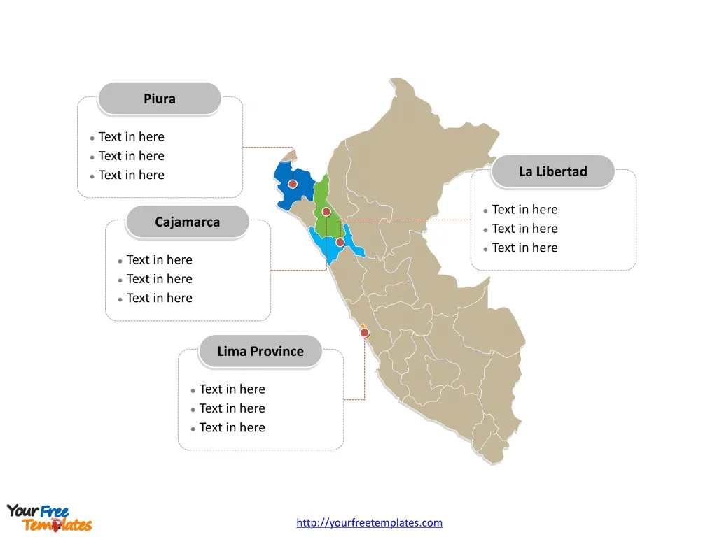
The Peru Map Template in PowerPoint format includes two slides, that is, the Peru outline map and Peru political map. Firstly, our Peru outline map template has capital and major cities on it, which are Lima, Arequipa, Trujillo, Chiclayo, and Huancayo. Secondly, there are 25 regions and the Lima Province in our Peru political map, labeling major divisions that are Lima Province, Piura, La Libertad, and Cajamarca.
Peru is situated in the western part of South America, sharing its northern border with Ecuador and Colombia, to the east with Brazil, to the southeast with Bolivia, and to the south with Chile. Its western boundary is lined by the vast expanse of the Pacific Ocean. This strategic positioning places Peru at the heart of the Andean region, making it a country of significant geographical diversity. From the arid Pacific coastlines through the towering peaks of the Andes, down to the lush Amazonian rainforest in the east, Peru encapsulates a wide range of ecosystems within its borders, showcasing a rich natural heritage.
Slide 1, Peru map labeled with capital and major cities.
Peru, a country with a rich tapestry of culture, history, and natural beauty, is not just about its famous ruins and the Amazon. Its cities and regions offer a mosaic of experiences, each with its unique charm and significance. From the bustling streets of Lima to the historical depth of Arequipa, Peru is a country of contrasts and traditions.
So our Peru map slide has the capital and major cities on the outline. Consequently users can remove cities or include new ones to create their unique Peru maps and suit their specific applications.
Major Cities on Peru map
Lima
As the capital and largest city of Peru, Lima is the beating heart of the nation, offering a blend of colonial heritage and modern sophistication. Overlooking the Pacific Ocean, it boasts a rich architectural landscape, from pre-Columbian temples to Baroque churches. Lima is also a culinary powerhouse, recognized globally for its innovative and diverse cuisine that showcases the best of Peruvian flavors.

Arequipa
Known as the ‘White City’ for its stunning buildings made from sillar, a white volcanic stone, Arequipa lies in the shadow of three majestic volcanoes. It’s Peru’s second-largest city, offering a rich history evident in its well-preserved colonial architecture, especially in the historic city center, a UNESCO World Heritage site. The surrounding landscape, including the Colca Canyon, provides a spectacular backdrop and opportunities for adventure tourism.
Trujillo
Situated on the northwest coast, Trujillo is often referred to as the ‘City of Eternal Spring’ due to its pleasant climate. It is renowned for its archaeological sites, including Chan Chan, the largest pre-Columbian city in the Americas, and the temples of the Sun and Moon. The city is also famous for its vibrant festivals, particularly the Marinera dance.
Chiclayo
Chiclayo, located in the northern coastal region, is known as the ‘City of Friendship’ due to the warm hospitality of its inhabitants. It serves as a commercial and agricultural hub but is equally rich in cultural and archaeological heritage, with the nearby ancient site of Sipán revealing treasures of the Moche civilization.
Huancayo
Nestled in the heart of the central Andes, Huancayo is a vital cultural and commercial center within the Mantaro Valley. Known for its traditional crafts and vibrant market, the city offers a glimpse into Andean life. It’s also the starting point for the Ferrocarril Central Andino, one of the highest railways in the world, offering breathtaking views of the Andean landscapes.
Slide 2, Peru map labeled with major regions.
The Peru map is the country political division of 25 regions and the Lima Province. They are Amazonas, Ancash, Apurímac, Arequipa, Ayacucho, Cajamarca, Callao, Cusco, Huancavelica, Huánuco, Ica, Junín, La Libertad, Lambayeque, Lima, Lima Province, Loreto, Madre de Dios, Moquegua, Pasco, Piura, Puno, San Martín, Tacna, Tumbes, and Ucayali. Furthermore every individual political subdivision is an editable shape.
Major Regions on Peru map
Lima Province
The Lima Province is not only home to the capital city but also encompasses nearby coastal areas. It’s the political, cultural, and economic center of Peru, with a diverse population that reflects the country’s multifaceted identity.

Piura
In the northwestern part of Peru, Piura is known for its beautiful beaches, such as Máncora, a popular surfing destination. The region also has a rich history, with evidence of one of the oldest human settlements in South America, and a strong agricultural economy, particularly in producing bananas, mangoes, and cotton.
La Libertad
La Libertad, home to Trujillo, is a region of historical significance and agricultural productivity. It boasts a variety of landscapes from coastal plains to Andean highlands and is a major producer of sugar cane, asparagus, and shoes.
Cajamarca
Cajamarca is a region steeped in history, most famously as the site of the capture of Inca Emperor Atahualpa by Spanish conquistadors. Its capital, also called Cajamarca, is known for its colonial architecture and thermal baths. The region is also a major mining area and has a strong agricultural sector, particularly in dairy products.
In conclusion, Peru is a country that offers an incredible diversity of experiences, from the urban sophistication and culinary delights of Lima to the historical allure of Arequipa and the natural beauty of its various regions. Whether exploring its major cities or venturing into the heart of its regions, Peru provides a rich tapestry of culture, history, and natural wonders waiting to be discovered.
At the same time you can also refer to the fully labeled Peru map in Wikipedia Peru.
Size:86K
Type: PPTX
Aspect Ratio: Standard 4:3
Click the blue button to download it.
Download the 4:3 Template
Aspect Ratio: Widescreen 16:9
Click the green button to download it.
Download the 16:9 Template


