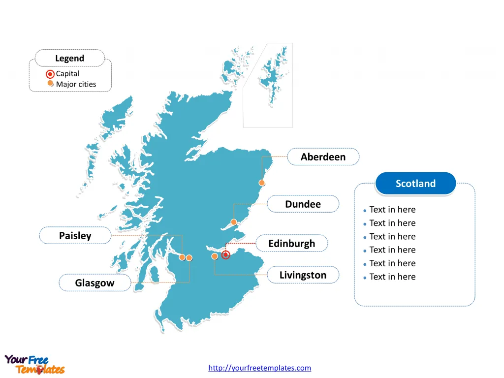
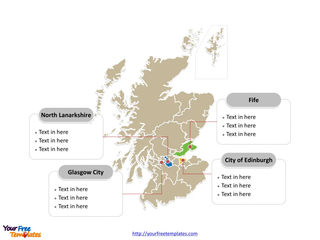
The Scotland map Template includes two slides. Scotland map with 32 council areas, labeling with major council areas, Glasgow City, City of Edinburgh, Fife, and North Lanarkshire. The Scotland map labeling with country capital and major cities, Edinburgh, Glasgow, Aberdeen, Dundee, Paisley, and Livingston.
Scotland is one of the four constituent nations of the United Kingdom, located in the northern part of the island of Great Britain. It is bordered by England to the south, the North Sea to the east, the Atlantic Ocean to the north and west, and the Irish Sea to the southwest. Scotland includes over 790 islands, with the Hebrides, Orkney Islands, and Shetland Islands being the most notable groups. The country is known for its rugged coastline, mountainous terrain, and rich history and culture.
Slide 1, Scotland Map labeled with capital and major cities.
Scotland is a country that is part of the United Kingdom and covers the northern third of the island of Great Britain, which is composing of four countries, which are England, Scotland, Wales and Northern Ireland. Its capital and largest city is Edinburgh, other major cities including Glasgow, Aberdeen, Dundee, Paisley, and Livingston.
Major Cities on Scotland map
Edinburgh: Edinburgh is the capital city of Scotland and its second-largest city. This city is known for its historic and cultural attractions, including the Edinburgh Castle, the Royal Mile, and the annual Edinburgh Festival. The city also serves as a major center for finance, law, tourism, education, and the arts.
Glasgow: Glasgow is the largest city in Scotland and the fourth-largest in the UK. It is situated on the River Clyde in the country’s west central lowlands. Glasgow is renowned for its vibrant cultural scene, architecture, and as a leader in design and innovation. It has a rich industrial past and is now a national cultural hub.
Aberdeen: Known as the ‘Granite City’ for its many enduring grey-stone buildings, Aberdeen is Scotland’s third-largest city. It’s located in the northeast of Scotland and is a key center for the North Sea oil and gas industry, as well as being home to two universities.
Dundee: Dundee is situated on the north bank of the Firth of Tay. It has a history of scientific activities and is known for the RRS Discovery, the ship used by Scott and Shackleton for their Antarctic expedition. Dundee is also recognized for its contributions to the biomedical and technological industries.
Paisley: Located to the west of Glasgow, Paisley is known for its rich textile history, particularly the Paisley shawl and the Paisley Pattern. The town has a strong heritage in manufacturing and is home to significant landmarks such as Paisley Abbey.
Livingston: Livingston, part of the West Lothian council area, is a post-war new town. It has become a focal point for technology and retail sectors and serves as a significant economic hub in the central belt of Scotland.

Slide 2, Scotland Map labeled with major administration districts.
Scotland map shows the country divided into with 32 single-tier council areas, they are Aberdeen City, Aberdeenshire, Angus, Argyll and Bute, City of Edinburgh, Clackmannanshire, Dumfries and Galloway, Dundee City, East Ayrshire, East Dunbartonshire, East Lothian, East Renfrewshire, Falkirk, Fife, Glasgow City, Highland, Inverclyde, Midlothian, Moray, Na h-Eileanan Siar, North Ayrshire, North Lanarkshire, Orkney Islands, Perth and Kinross, Renfrewshire, Scottish Borders, Shetland Islands, South Ayrshire, South Lanarkshire, Stirling, West Dunbartonshire, and West Lothian. Every individual political subdivision is an editable shape.
Major Council Areas on Scotland map
Glasgow City: The Glasgow City council area is the most populous in Scotland and governs the city of Glasgow. It is an important economic center for Scotland and the UK, with a diverse economy spanning various sectors.
City of Edinburgh: The City of Edinburgh council area encompasses the capital city. It is the center of Scottish government and law, with a strong economy based on finance, education, tourism, and technology.
Fife: Fife is located between the Firth of Tay and the Firth of Forth. It is characterized by its coastal towns, rural landscapes, and historical sites. Fife has a strong presence in manufacturing and renewables.
North Lanarkshire: North Lanarkshire is to the east of Glasgow and is part of the central belt of Scotland. It has undergone substantial regeneration since the decline of heavy industries and now focuses on business and service sectors.

Scotland, with its vibrant cities and distinct council areas, offers a blend of history, culture, industry, and natural beauty, making it a unique and integral part of the United Kingdom.
Looking for Premium maps, please visit our affiliate site: https://editablemaps.com/ or https://ofomaps.com/
Size: 268K
Type: PPTX
Aspect Ratio: Standard 4:3
Click the blue button to download it.
Download the 4:3 Template
Aspect Ratio: Widescreen 16:9
Click the green button to download it.
Download the 16:9 Template


