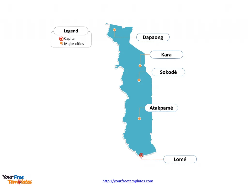
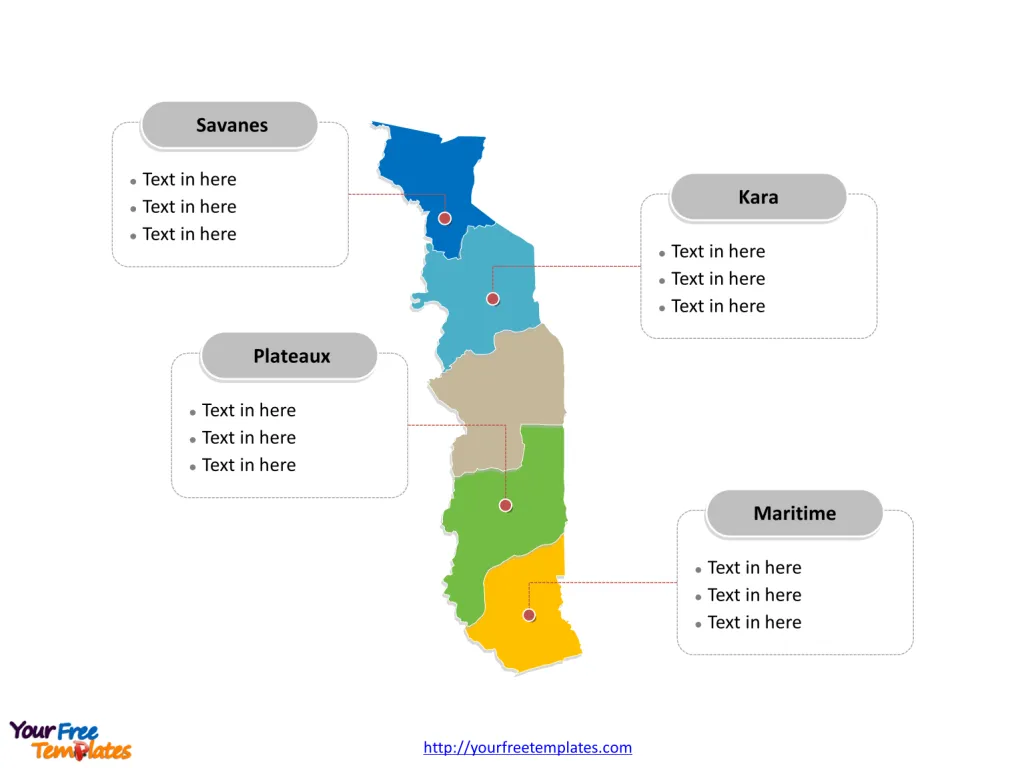
The Togo Map Template includes two slides. Togo map with five regions, labeling major regions, Maritime, Plateaux, Savanes, and Kara. Togo map labeled with capital and major cities, Lomé, Sokodé, Kara, Atakpamé, and Dapaong.
Location of Togo Togo, a country in West Africa, is bordered by Ghana to the west, Benin to the east, and Burkina Faso to the north. It extends south to the Gulf of Guinea, where its capital, Lomé, is located. The geography of Togo is marked by a rolling savanna in the north, hills in the central region, and a savanna, woodland plateau, and coastal plain in the south.
Population Togo has a population of approximately 8.8 million people, with a majority residing in rural areas dedicated to agriculture or pastures. The capital city, Lomé, is the most populous, followed by other urban centers such as Sokodé, Kara, and Kpalimé.
Economy Togo’s economy depends primarily on agriculture, with phosphate deposits and agricultural products such as coffee, cocoa beans, and peanuts contributing significantly to export earnings. The country faces challenges in economic development, with substantial financing needs and efforts to reduce poverty and create jobs.
Neighboring Countries Togo shares its borders with Benin, Burkina Faso, and Ghana. It is a member of the Economic Community of West African States (ECOWAS), and its economy is intertwined with those of its neighboring countries, contributing to regional trade and cooperation.
Slide 1, Togo map labeled with capital and major cities.
The capital and largest city is Lomé, other major cities including Sokodé, Kara, Atakpamé, and Dapaong.
Major Cities on Togo Map
Lomé
- Population: Lomé, the capital and largest city of Togo, had an estimated population of 1,477,658 as per the 2010 census.
- Significance: Lomé is a major urban center and a prominent port city located in the Maritime Region. It serves as a key hub for trade and commerce, with a mixture of old and new commercial and administrative buildings.

Sokodé
- Population: Sokodé, a city in the Centrale Region, had a population of 95,070 as per the 2010 census.
- Significance: Sokodé is an important city known for its cultural and economic influence, particularly in the central part of Togo.
Kara
- Population: Kara, located in the Kara Region, had a population of 94,878 as per the 2010 census.
- Significance: Kara is a significant city known for its historical and economic importance, serving as a major urban center in the northern part of the country.
Atakpamé
- Population: Atakpamé, situated in the Plateaux Region, had a population of 69,261 as per the 2010 census.
- Significance: Atakpamé is a key city known for its role in the agricultural and commercial sectors, contributing to the region’s economic development.
Dapaong
- Population: Dapaong, located in the Savanes Region, had a population of 58,071 as per the 2010 census.
- Significance: Dapaong is a major city known for its cultural diversity and economic activities, particularly in the northern part of Togo.
Slide 2, Togo map labeled with major administration districts.
Togo is a country divided into five regions: they are Centrale, Kara, Maritime, Plateaux, and Savanes. Every individual political subdivision is an editable shape.
Major Regions on Togo Map
Maritime Region
- Capital: Lomé serves as the capital of the Maritime Region.
- Significance: The Maritime Region, with Lomé at its center, is a key economic and administrative hub, playing a significant role in Togo’s trade and transportation sectors.

Plateaux Region
- Capital: Atakpamé serves as the capital of the Plateaux Region.
- Significance: The Plateaux Region is known for its agricultural productivity and cultural diversity, contributing to Togo’s overall development.
Savanes Region
- Capital: Dapaong serves as the capital of the Savanes Region.
- Significance: The Savanes Region is significant for its cultural heritage and economic activities, particularly in the northern part of Togo.
Kara Region
- Capital: Kara serves as the capital of the Kara Region.
- Significance: The Kara Region is known for its historical and economic significance, serving as a major urban and commercial center in the northern part of the country.
These major cities and regions collectively contribute to Togo’s cultural, historical, and economic landscape, playing integral roles in the country’s urban development, trade, and regional connectivity.
Looking for Premium maps, please visit our affiliate site: https://editablemaps.com/ or https://ofomaps.com/
Size: 84K
Type: PPTX
Aspect Ratio: Standard 4:3
Click the blue button to download it.
Download the 4:3 Template
Aspect Ratio: Widescreen 16:9
Click the green button to download it.
Download the 16:9 Template


