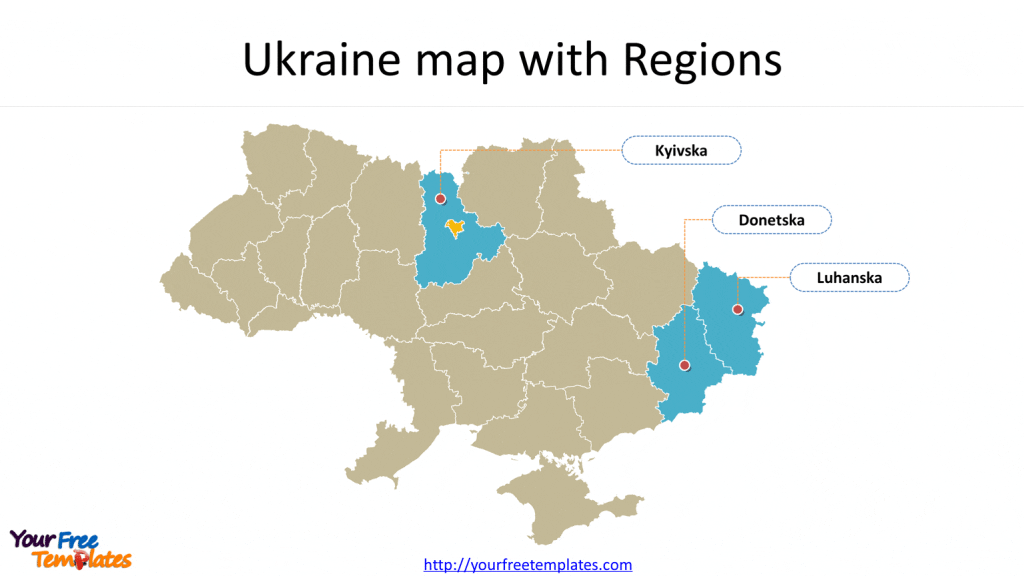
Map of Ukraine with 27 regions and the capital area, highlighting three important regions, which are Donetska, Kyivska, Luhanska. For these three regions, further administrative subdivisions are also provided. If you want the Ukraine outline map, please check Free Ukraine Editable Map.
The Map Template includes four slides.
Slide 1, map of Ukraine with Regions
Ukraine is a sovereign state in Eastern Europe, bordered by Russia to the east and northeast, Belarus to the northwest, Poland and Slovakia to the west, Hungary, Romania, and Moldova to the southwest, and the Black Sea and Sea of Azov to the south and southeast, respectively. Its capital and largest city is Kiev, other major cities including Kharkiv, Odessa, Dnipropetrovsk, and Donetsk.

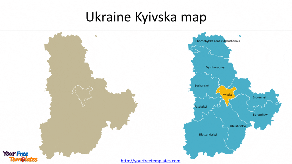
Slide 2, Kiev map
Kyivska has nine districts, which are Chornobylska zona vidchuzhennia, Bilotserkivskyi, Boryspilskyi, Brovarskyi, Buchanskyi, Vyshhorodskyi, Obukhivskyi, Fastivskyi, and Kyivska.

Slide 3, Odessa map
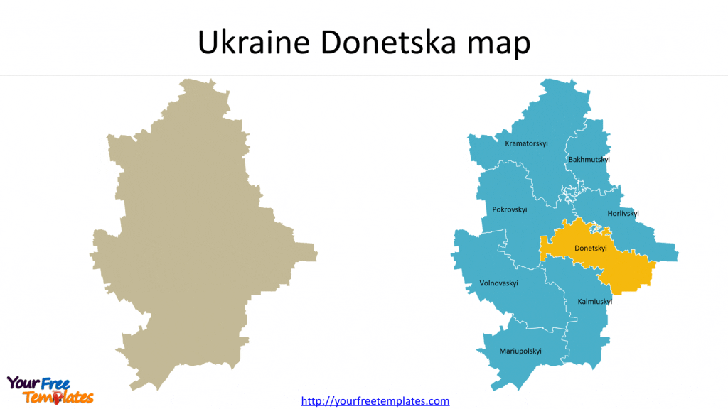
Donetsk has eight districts, which are Bakhmutskyi, Volnovaskyi, Horlivskyi, Donetskyi, Kalmiuskyi, Kramatorskyi, Mariupolskyi, and Pokrovskyi.

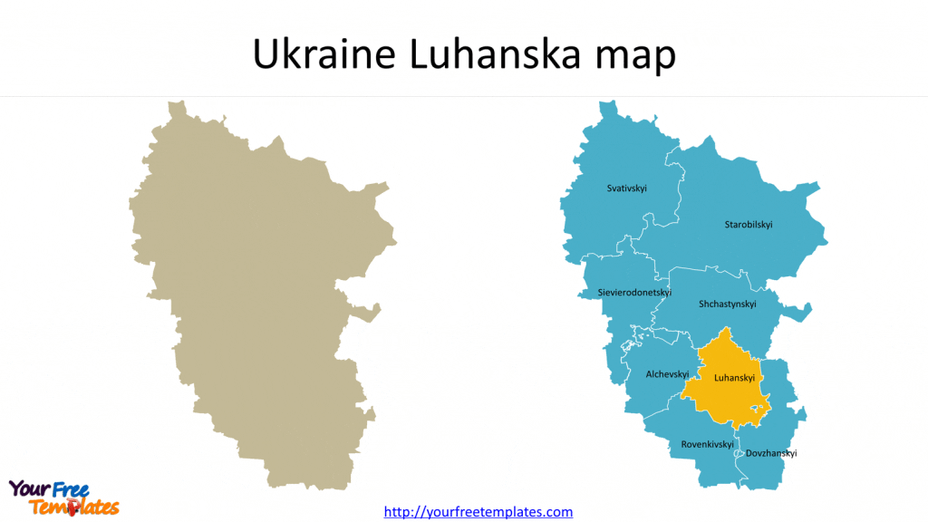
Slide 4, Luhansk map
Luhansk has eight districts, which are Alchevskyi, Dovzhanskyi, Luhanskyi, Rovenkivskyi, Svativskyi, Sievierodonetskyi, Starobilskyi, and Shchastynskyi.

For other interesting maps, pls refer to Ofomaps.com
Size:775K
Type: PPTX
[sociallocker]Aspect Ratio: Standard 4:3
Click the blue button to download it.
Download the 4:3 Template
Aspect Ratio: Widescreen 16:9
Click the green button to download it.
Download the 16:9 Template[/sociallocker]


