As a writer and traveler, I’ve always been fascinated by maps. The way they represent the world in a single sheet of paper or screen always amazes me. But have you ever heard about world outline maps? These maps can be a useful tool for different purposes, such as education, art, and even politics. In this article, I’ll share with you some of the most fascinating projections of the world outline map and their characteristics, history, and uses. By the end of this blog, you’ll have a better understanding of new outline projection for your needs. You can also download our ready-made 7 slides for those projections. Link to (I) World map outline in 7 Projections,or map of the united states outline.
Advantages of using world outline maps
Before diving into the different types of projections, let’s talk about the advantages of using a world outline map. These maps are a simplified representation of the world, showing only the borders and coastlines of countries, without any detail of cities, rivers, or mountains. This simplicity can be an advantage in some situations, such as:
- Education: World outline maps can be a great tool for teaching geography to children and adults. By showing only the borders and coastlines, students can focus on the location and size of each country, without being distracted by other details.
- Art: World outline maps can also be used for artistic purposes, such as creating posters, wallpapers, or paintings. The simplicity of the map can be a blank canvas for artists to fill with their imagination.
- Politics: World outline maps can be used for political purposes, such as showing the territorial claims of a country, or the borders of a disputed territory. By showing only the borders and coastlines, the map can be a neutral ground for discussions and negotiations.
Cylindrical Equal Area Projection
The cylindrical equal area projection is one of the most common projections of the world outline map. This projection represents the earth as a cylinder, with the equator as the base of the cylinder. The map shows the world in two halves, with the Americas on the left and Africa/Europe/Asia on the right.
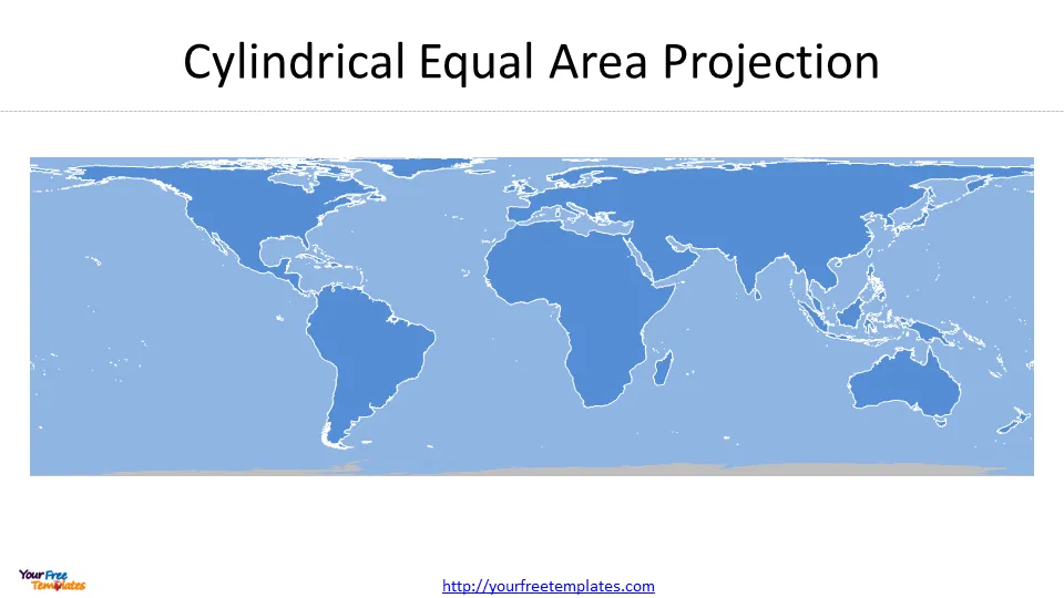 The advantage of this projection is that it preserves the area of each country, meaning that the size of each country is accurate. However, this projection distorts the shapes of the continents, making them appear stretched horizontally. This distortion can be a disadvantage for some uses, such as navigation or weather forecasting.
South Pole Lambert Azimuthal Equal Area Projection
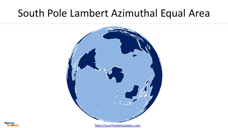
The South Pole Lambert Azimuthal Equal Area Projection is a projection that shows the world from the South Pole. The map shows the world in a circular shape, with the South Pole as the center of the map. The advantage of this projection is that it preserves the area of each country, meaning that the size of each country is accurate. However, this projection distorts the shapes of the continents, making them appear stretched vertically.
 North Pole Lambert Azimuthal Equal Area Projection
The North Pole Lambert Azimuthal Equal Area Projection is a projection that shows the world from the North Pole. The map shows the world in a circular shape, with the North Pole as the center of the map.
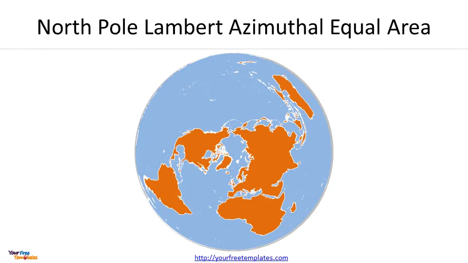 The difference between South Pole Lambert Azimuthal Equal Area and North Pole Lambert Azimuthal Equal Area.
Peirce Quincuncial North Pole Diamond Projection and Peirce Quincuncial North Pole Square Projection are two different map projections that have different shapes. The Peirce Quincuncial North Pole Diamond Projection is a conformal projection that preserves angles, while the Peirce Quincuncial North Pole Square Projection preserves area.
Both projections can be tessellated, meaning they can be repeated infinitely to cover a surface without overlapping or leaving gaps. Additionally, both projections can be rotated and displayed in a lateral projection with hemispheres side-by-side. However, it is important to note that neither of these projections is as widely used as some other map projections, such as the Lambert azimuthal equal-area projection or the Lambert Conformal Conic projection
Peirce Quincuncial North Pole Diamond Projection
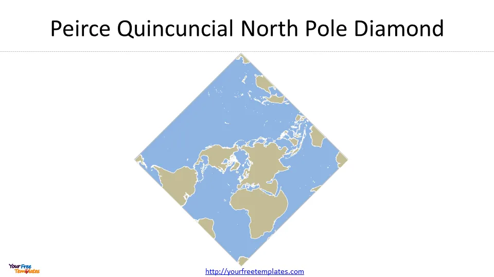
The Peirce Quincuncial North Pole Diamond Projection is a projection that shows the world in a diamond shape, with the North Pole as the center of the map. This projection is unique because it shows the world in a non-rectangular shape, making it an interesting option for artistic purposes. The advantage of this projection is that it preserves the area and shape of each country, meaning that the size and shape of each country is accurate.
 Peirce Quincuncial North Pole Square Projection
The Peirce Quincuncial North Pole Square Projection is a projection that shows the world in a square shape, with the North Pole as the center of the map.
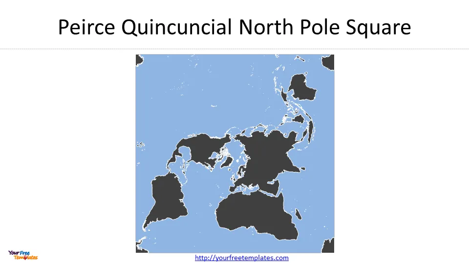 The difference between Peirce Quincuncial North Pole Diamond Projection and Peirce Quincuncial North Pole Square.
The Peirce Quincuncial North Pole Diamond Projection and Peirce Quincuncial North Pole Square Projection have different shapes. The North Pole Square Projection displays the equator as a square rotated relative to the projection edge, while the Diamond Projection transforms the circle of the northern hemisphere into a diamond-shaped figure.
The Southern Hemisphere, in both projections, is split into four isosceles triangles arranged in a quincunx pattern surrounding the square or diamond figure. The Peirce Quincuncial Projection is conformal everywhere, except at the four corners of the inner hemisphere, and can be tessellated in all directions. Both projections can be rotated to optimize distortions and displayed in a lateral projection with hemispheres side-by-side.
Equal Earth Americas Projection
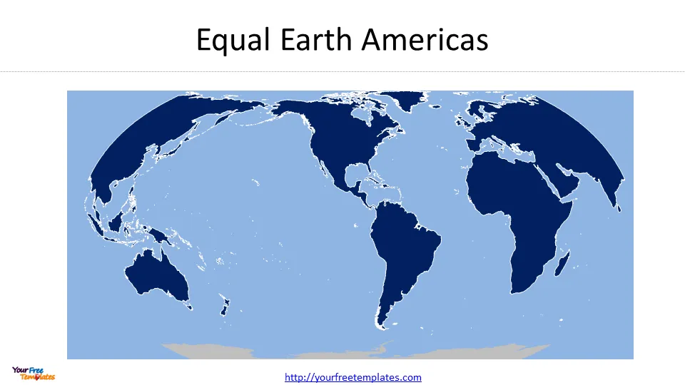
The Equal Earth Americas Projection is a projection that shows the Americas in the center of the map, with Europe and Africa on the left, and Asia and Australia on the right. The advantage of this projection is that it preserves the area and shape of each country, meaning that the size and shape of each country is accurate. This projection is also designed to show a balanced view of the world, giving the same visual weight to each continent.
 Equal Earth Asia Pacific Projection
The Equal Earth Asia Pacific Projection is a projection that shows the Asia-Pacific region in the center of the map, with the Americas on the left, and Europe and Africa on the right.
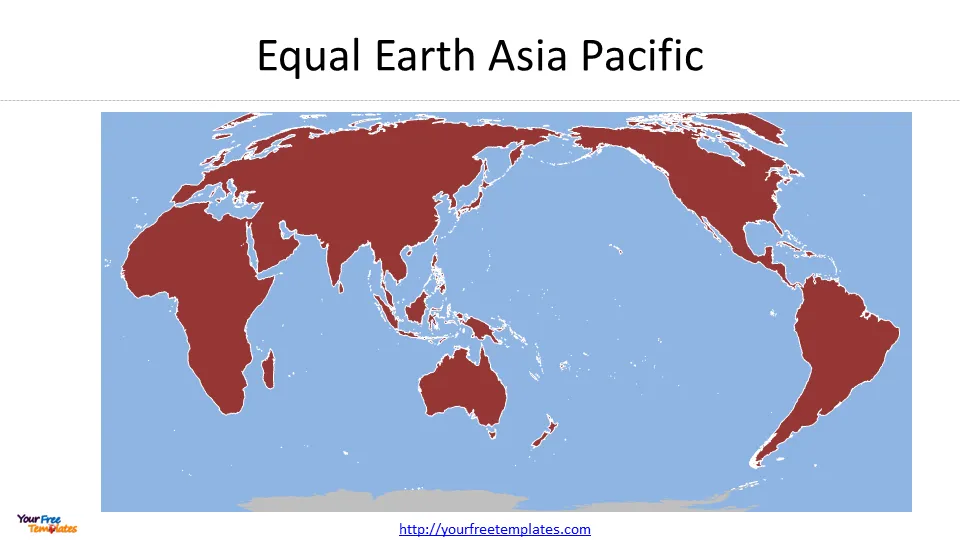 The difference between Equal Earth Americas and Equal Earth Asia Pacific.
The Equal Earth map projection is an equal-area (equivalent) projection that shows land features at their true relative sizes. It is a relatively new projection and has gained widespread adoption since its creation in 2018. However, both the Peirce Quincuncial North Pole Diamond Projection and Peirce Quincuncial North Pole Square Projection are also equal-area projections that can be tessellated.
While these projections have unique shapes, they are not as widely used as other projections like the Lambert azimuthal equal-area projection or the Lambert Conformal Conic projection. As for the difference between Equal Earth Americas and Equal Earth Asia Pacific projections, it is likely that these projections are simply different regional versions of the Equal Earth projection, with the Americas version emphasizing the Americas region and the Asia Pacific version emphasizing the Asia Pacific region.
How to use world outline maps
Now that we’ve explored some of the most fascinating projections of the world outline map, let’s talk about how to use them. Here are some tips:
Choose the right projection for your purpose: Each projection has its own advantages and disadvantages, so choose the one that fits your purpose.
- Use them as a tool for education: World outline maps can be a great tool for teaching geography to children and adults. By showing only the borders and coastlines, students can focus on the location and size of each country, without being distracted by other details.
- Use hem as a tool for art: World outline maps can also be used for artistic purposes, such as creating posters, wallpapers, or paintings. The simplicity of the map can be a blank canvas for artists to fill with their imagination.
- Use them as a tool for politics: World outline maps can be used for political purposes, such as showing the territorial claims of a country, or the borders of a disputed territory. By showing only the borders and coastlines, the map can be a neutral ground for discussions and negotiations.
Conclusion
World outline maps are a fascinating tool for different purposes, such as education, art, and politics. By showing only the borders and coastlines of countries, these maps simplify the representation of the world, making it easier to understand and use. Whether you’re a teacher, an artist, or a politician, world outline maps can be a valuable tool in your arsenal. So, choose the right projection for your purpose, and start exploring the world in a new way.
For other interesting maps, pls visit our ofomaps.com
Size:1776K
Type: PPTX
Aspect Ratio: Standard 4:3
Click the blue button to download the maps.
Download the 4:3 Template
Aspect Ratio: Widescreen 16:9
Click the green button to download the maps.
Download the 16:9 Template


