The US population density maps Template in PowerPoint format include three slides. Firstly we have the diagram to show the total population levels by state. Secondly is the population density of People per square mile. Finally is the population density of People per square kilometer. As the US diagram PowerPoint template series, you can also enjoy 50 US State Shapes Map Template, United States Maps template, United States Map template, and US regions map.
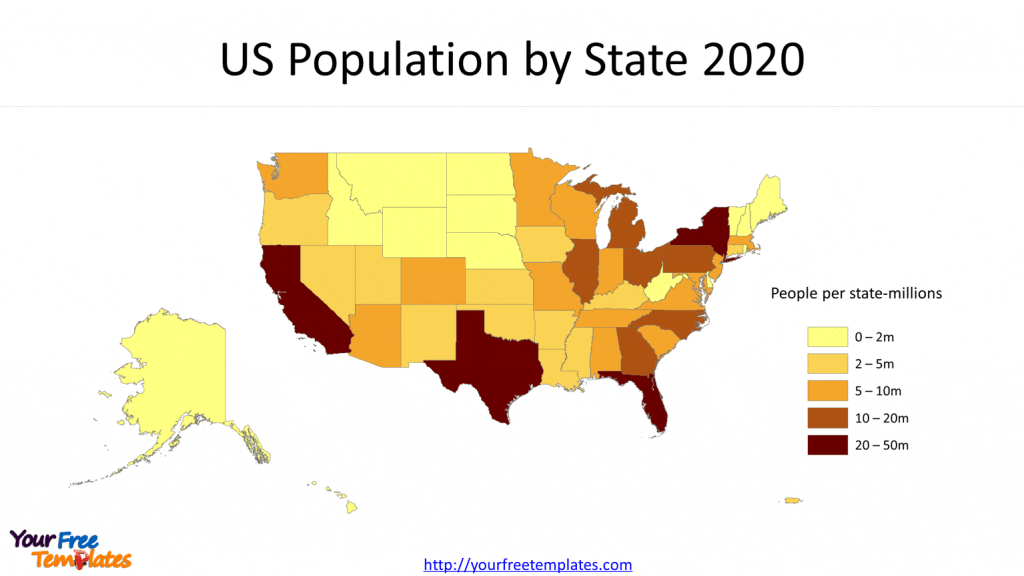
Slide 1, US Population Density Heat map 2020
2020 is the twenty-fourth decennial United States Census, which began on April 1st 2020. The US population has been recorded for 331,449,281. From the chart below you can see that California has been the most populated state with 39.5 million populations, while Texas, Florida and New York states occupied the top four with populations over 20 million. Other states with 10 million are Pennsylvania, Illinois, Ohio, Georgia, North Carolina and Michigan.

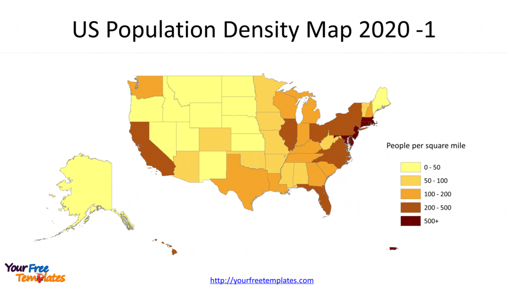
Slide 2 US Population Density Map 2020 -1
From the perspective of People per square mile, that is the state population divided by the land area, it is 94 people per square mile for the whole country. It is obvious that most populated states concentrated in the northeast New England ones.
- 500+, District of Columbia, New Jersey, Rhode Island, Massachusetts, Puerto Rico, Connecticut, Maryland, U.S. Virgin Islands, and Delaware
- 200-500, New York, Florida, Pennsylvania, Ohio, California, Illinois, Hawaii, Virginia, North Carolina
- 100-200, Indiana, Georgia, Michigan, South Carolina, Tennessee, New Hampshire, Washington, Kentucky, Texas, Wisconsin, Louisiana

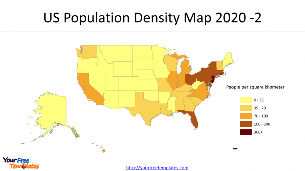
Slide 3 US Population Density Map 2020 -2
From the perspective of People per square kilometer, that is the state population divided by the land area, it is 36 people per square kilometer for the whole country.
- 300+, District of Columbia, Rhode Island, New Jersey, Puerto Rico,
- 100-300, Massachusetts, Connecticut, Maryland, Delaware, New York, Florida, Ohio, Pennsylvania

For premium maps of US counties by state, please visit our ofomaps.com.
Size:890K
Type: PPTX
[sociallocker]Aspect Ratio: Standard 4:3
Click the link to download it.
Download the 4:3 Template
Aspect Ratio: Widescreen 16:9
Click the link to download it.
Download the 16:9 Template[/sociallocker]


