The US Region map Template in PowerPoint format includes four slides. Firstly the country map group by census regions. Secondly the country map with four census regions. Thirdly USA region group by census divisions. Finally US Region map with census division outline only. So our US Region maps PowerPoint templates have four regions or nine divisions on it. The regions are Northeast, Midwest, South, and West. For the USA state maps series, you can enjoy United States Map Template, Free USA PowerPoint Map, Free US map with states, and US map with Mid-Atlantic States, US maps with South Atlantic States and US New England map.
USA’s Census Regions and Divisions
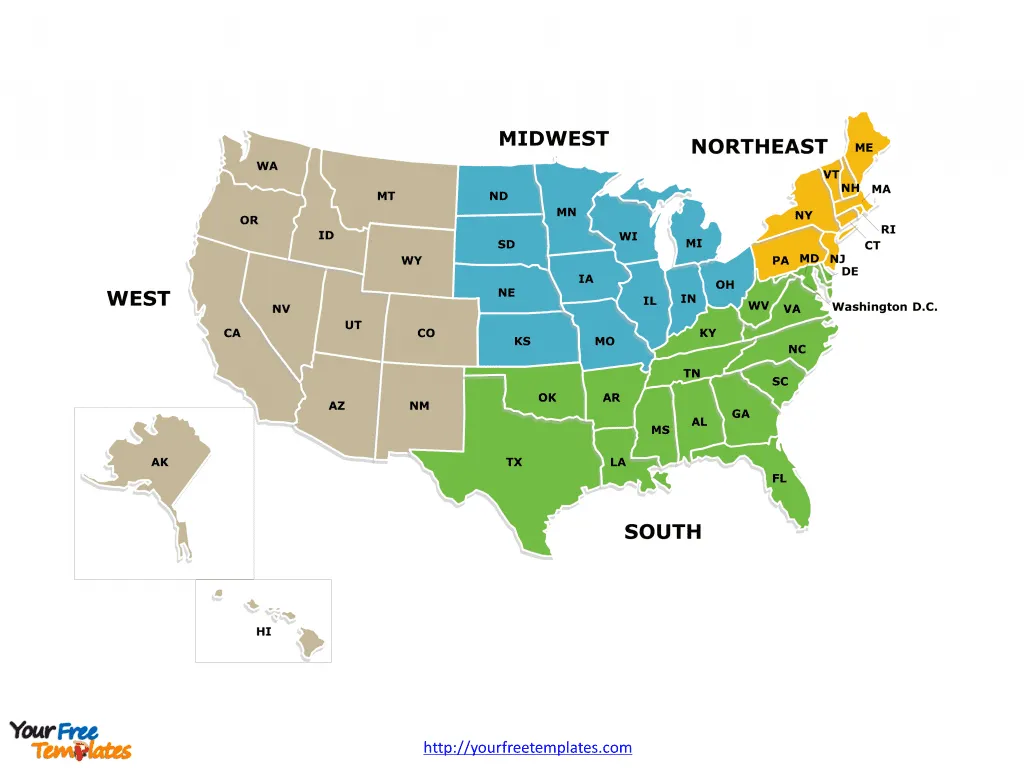
The United States Census Bureau divides the country into four broad regions: Northeast, Midwest, South, and West. Each region is further subdivided into nine census divisions. These regions and divisions are used for data collection and analysis, reflecting geographical, cultural, and economic similarities within these areas.
Slide 1, US Region map in PowerPoint templates with 4 census regions
Northeast Region
The Northeast is the nation’s most economically developed, densely populated, and culturally diverse region. This region is historically rich, being the site of the earliest European settlements.
New England Division
This division includes six states: Connecticut, Maine, Massachusetts, New Hampshire, Rhode Island, and Vermont. Known for its colonial past, the area has a strong maritime tradition and is famous for its autumn foliage and historic destinations like Boston.
Middle Atlantic Division
Comprising New Jersey, New York, and Pennsylvania, this division is known for being a financial and cultural hub, home to New York City, the nation’s most populous city, and Philadelphia, a city with profound historical significance.

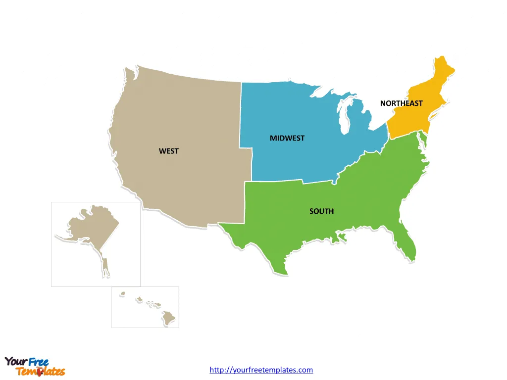
Slide 2, US Region map PowerPoint templates with states by region
Midwest Region
Often referred to as “America’s Heartland,” the Midwest is known for its agricultural industries and as the historical center of the country’s manufacturing sector.
East North Central Division
This division includes Illinois, Indiana, Michigan, Ohio, and Wisconsin. It features major cities such as Chicago and Detroit, which are central to the country’s manufacturing and automotive industries.
West North Central Division
Containing Iowa, Kansas, Minnesota, Missouri, Nebraska, North Dakota, and South Dakota, this division is characterized by its vast prairies and farmlands, with a strong presence of agricultural production.

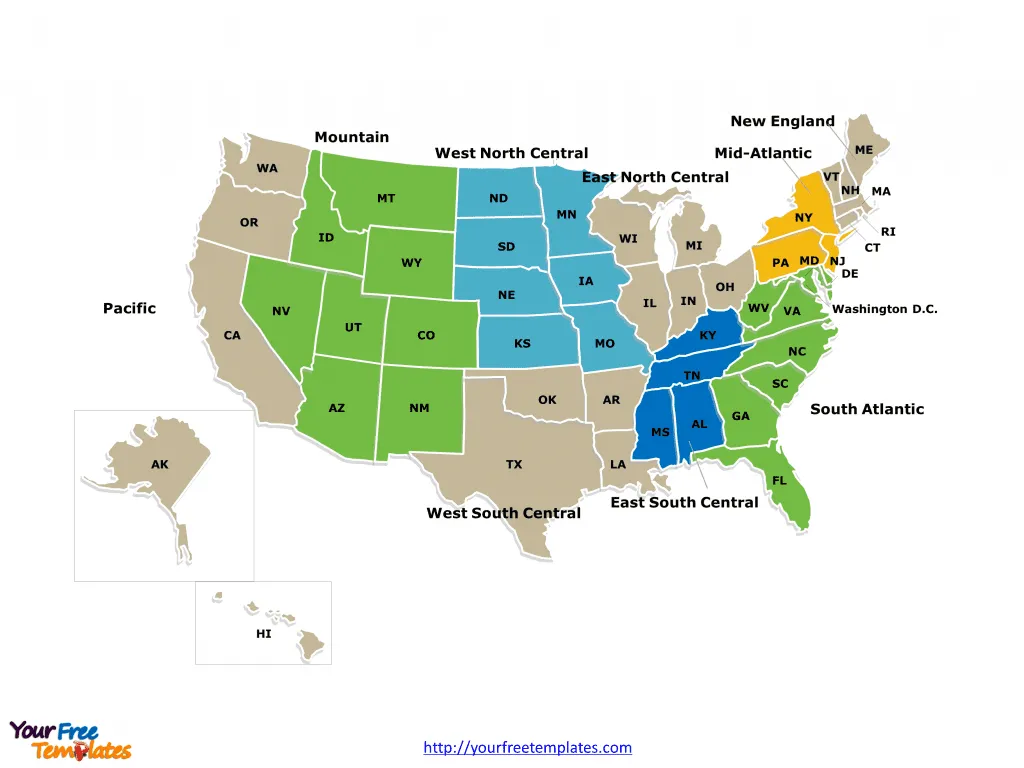
Slide 3, US map with region in PowerPoint templates with 9 census divisions
South Region
The South is the largest region by both area and population. It has a diverse economy with a strong historical association with agriculture, particularly the cotton and tobacco industries.
South Atlantic Division
Encompassing Delaware, Florida, Georgia, Maryland, North Carolina, South Carolina, Virginia, District of Columbia, and West Virginia, this division ranges from the Atlantic coastline to the Appalachian Mountains and includes rapidly growing metropolitan areas like Atlanta and Miami.
East South Central Division
This division is home to Alabama, Kentucky, Mississippi, and Tennessee. It is known for its deep cultural roots in music, particularly country and blues, and its historical role in the Civil Rights Movement.
West South Central Division
Arkansas, Louisiana, Oklahoma, and Texas make up this division. Texas, with its vast oil reserves, dominates the division economically, while Louisiana is famous for its unique French-Creole culture and cuisine.

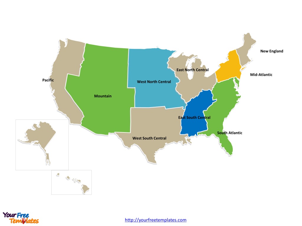
Slide 4, US map with Region in PowerPoint templates with census division
West Region
The West is the largest and most sparsely populated region, known for its wide-open spaces, national parks, and the tech-industry powerhouse of Silicon Valley.
Mountain Division
Including Arizona, Colorado, Idaho, Montana, Nevada, New Mexico, Utah, and Wyoming, the Mountain Division is characterized by its dramatic landscapes and booming cities like Denver, Phoenix, and Las Vegas.
Pacific Division
This division comprises Alaska, California, Hawaii, Oregon, and Washington. The Pacific Division is known for its natural beauty, from the Alaskan wilderness to the beaches of Hawaii, and is a leading region for technology, entertainment, and international trade.

The regional and divisional classification by the U.S. Census Bureau not only serves as a tool for efficient data collection and analysis but also highlights the rich tapestry of geographic and cultural diversity across the United States. Each region and division reflects distinct aspects of American life, contributing uniquely to the national character. From the bustling streets of the Northeast’s cities to the expansive natural beauty of the West, these regions and divisions encapsulate the varied facets of the United States.
The labels and shapes are layers of different groups on our US region map. In a word, you can change the texts, colors, sizes, and add your charts. At the same time you can also refer to the fully labeled US Region in Wikipedia.
Size: 290K
Type: PPTX
Aspect Ratio: Standard 4:3
Click the blue button to download it.
Download the 4:3 Template
Aspect Ratio: Widescreen 16:9
Click the green button to download it.
Download the 16:9 Template


