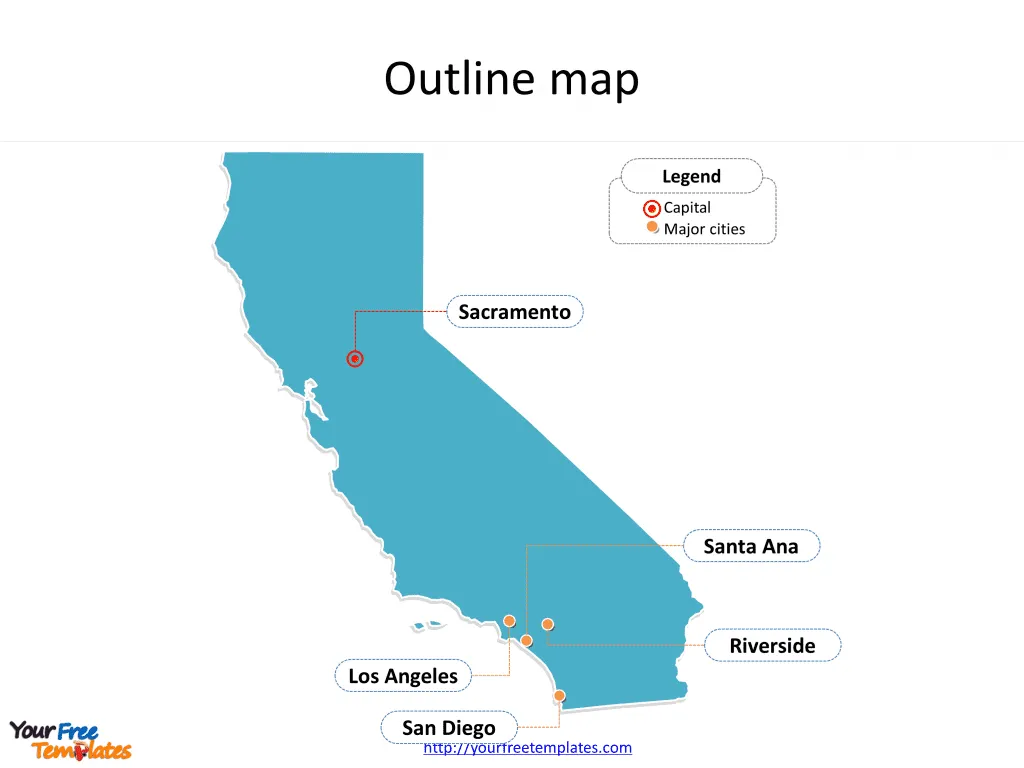
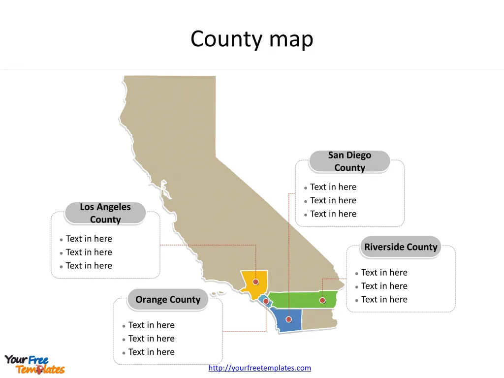
The State of California map Template in PowerPoint format includes two slides. Firstly the California maps with outline is labeling with capital and major cities. Secondly the California maps with outline is labeling with major counties. So our California maps PowerPoint templates have capital and major cities on it. They are Sacramento, Los Angeles, San Diego, Santa Ana, and Riverside. Finally the most populated counties are Los Angeles County, San Diego County, Orange County, and Riverside County.
California is a state located on the west coast of the United States. It is the most populous state in the U.S. and the third-largest by area. California is bordered by Oregon to the north, Nevada and Arizona to the east, the Mexican state of Baja California to the south, and the Pacific Ocean to the west. Its diverse geography ranges from the Pacific Coast in the west to the Sierra Nevada mountain range in the east, and from the redwood–Douglas fir forests in the northwest to the Mojave Desert in the southeast.
Slide 1, California maps PowerPoint templates labeling with capital and major cities
Our maps of California are for the state in the Pacific Region of the United States. It is also part of the Western and the Mountain states. Firstly Oregon is neighboring from the north. Secondly Nevada is neighboring from the east. Thirdly Mexico country is neighboring from the south. Fourthly the Pacific Ocean is neighboring from the west. Finally Arizona is neighboring from the southwest.
Its capital and largest city is Sacramento and Los Angeles, other major cities including San Diego, Santa Ana, and Riverside. You can found them in our California maps PowerPoint templates.
Major Cities on California Maps
Sacramento: Sacramento is the capital city of California and the seat of Sacramento County. Located at the confluence of the Sacramento River and the American River in Northern California, it is the sixth-largest city in the state. Sacramento is known for its history, tree-lined streets, and growing culinary scene.
Los Angeles: Los Angeles is the largest city in California and the second-largest in the United States. Known for its Mediterranean climate, ethnic diversity, the entertainment industry, and its sprawling metropolis, LA is a prominent cultural, technological, and economic center on the West Coast.

San Diego: San Diego lies on the coast of the Pacific Ocean in Southern California, immediately adjacent to the Mexican border. It is known for its mild year-round climate, natural deep-water harbor, extensive beaches, long association with the U.S. Navy, and recent emergence as a healthcare and biotechnology development center.
Santa Ana: Santa Ana is located in Southern California adjacent to the Santa Ana River. It is part of Orange County and is known for its beautifully preserved historic buildings, the Bowers Museum, and the Santa Ana Zoo.
Riverside: Riverside is a city in Riverside County, California, and part of the Inland Empire metropolitan area. It is known for its citrus industry, historic Mission Inn, and the annual Riverside Festival of Lights.
Slide 2, California maps PowerPoint templates labeling with major counties
The most populated counties in California State are Los Angeles County, San Diego County, Orange County, and Riverside County. What is more, with 39.3 million residents, California is the most populous state in the United States and the third most extensive by area. The labels and shapes are layers of different groups. In a word, you can change the texts, colors, sizes, and add your charts.
Major Counties on California Map
Los Angeles County: Los Angeles County is the most populous county in the U.S. and contains more than a quarter of California’s population. It is an economic powerhouse, with industries ranging from entertainment to aerospace.
San Diego County: San Diego County encompasses coastal beach towns, mountains, and deserts. It is known for its military presence, biotechnology, and healthcare sectors.

Orange County: Orange County is famous for its tourism attractions such as Disneyland and its beaches along more than 40 miles of coastline. It’s also a significant economic contributor with a strong base in technology and finance.
Riverside County: Riverside County spans from the greater Los Angeles area to the Arizona border. This county has a diverse economy with sectors including manufacturing, retail, and healthcare.
California’s unique combination of geography, climate, and resources have made it an iconic and prosperous state, with its major cities and counties contributing significantly to its status as an economic and cultural hub.
Looking for Premium maps, please visit our affiliate site: https://editablemaps.com/ or https://ofomaps.com/
Size:77K
Type: PPTX
Aspect Ratio: Standard 4:3
Click the blue button to download it.
Download the 4:3 Template
Aspect Ratio: Widescreen 16:9
Click the green button to download it.
Download the 16:9 Template


