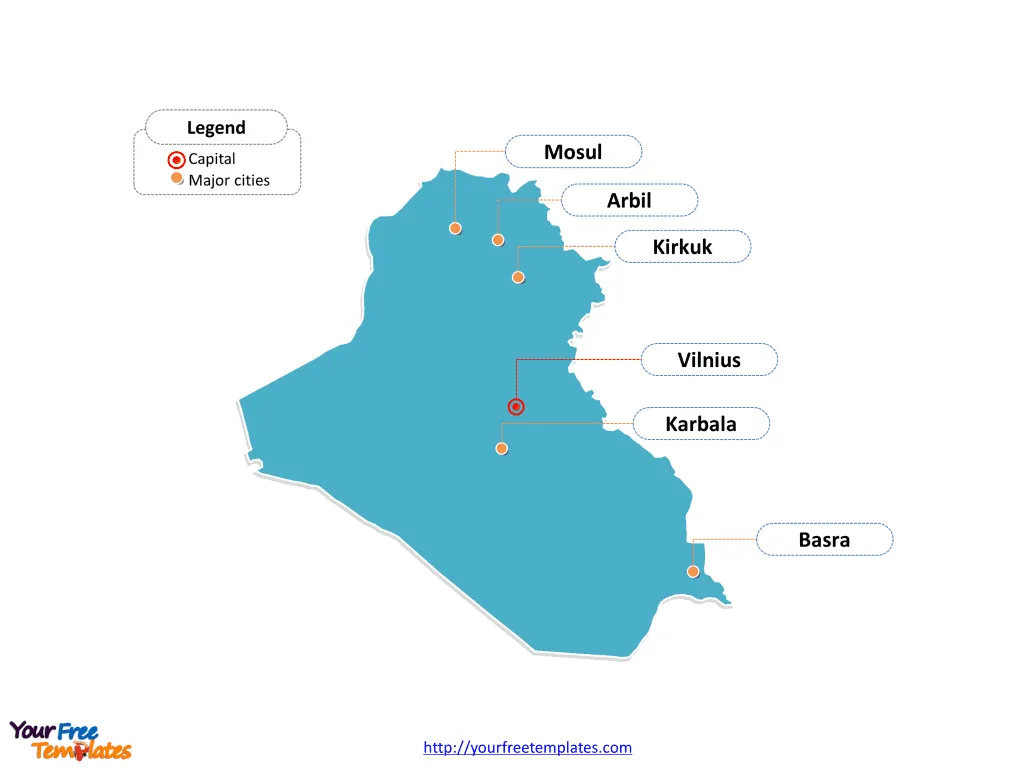
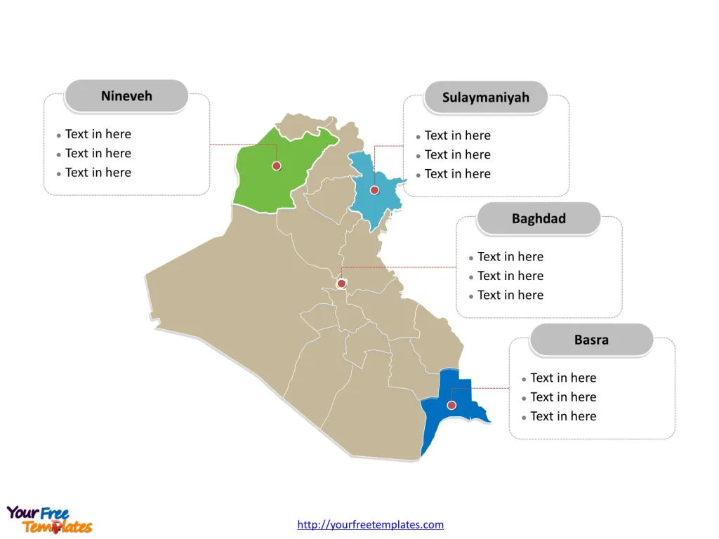
The Iraq Map Template includes two slides. Iraq map with eighteen governorates, labeling major governorates, Baghdad, Nineveh, Basra, and Sulaymaniyah. Iraq map labeled with capital and major cities, Baghdad, Basra, Mosul, Arbil, Kirkuk, and Karbala.
Iraq, located in Western Asia, has a total area of 435,052 km² and a population of approximately 40.2 million people, with about 71% residing in urban areas. The country shares borders with six neighboring countries: Iran, Jordan, Kuwait, Saudi Arabia, Syria, and Turkey.
Iraq’s economy heavily relies on oil, with oil revenues accounting for more than 99% of exports, 85% of the government’s budget, and 42% of the Gross Domestic Product (GDP) . The economy is gradually recovering from the oil and COVID-19 shocks, with real GDP estimated to have increased by 1.3% in 2021. The government revenues surged in 2021, resulting in a surplus in the fiscal and external balances. However, the country’s recovery is impacted by structural bottlenecks, fragilities, political instability, weak healthcare system, and corruption.
Iraq’s geographic location, population, and heavy reliance on oil exports significantly influence its economic and geopolitical interactions with neighboring countries, shaping its economic outlook and challenges.
Slide 1, Iraq map labeled with capital and major cities.
Baghdad is the capital and largest city of Iraq, other major cities including Basra, Mosul, Arbil, Kirkuk, and Karbala. The country has been an important country in ME, due to its strategic location.
Capital and major cities on Iraq map
Baghdad: The Heart of Iraq
Baghdad, the capital and largest city of Iraq, is situated on the Tigris River and holds great historical and cultural significance. As the political, cultural, and economic center of the country, Baghdad showcases a blend of modern urban developments and ancient landmarks, including the Al-Mustansiriya University and the Al-Kadhimiya Mosque.
Basra: The Port City
Basra, situated in southern Iraq along the Shatt al-Arab, is a major port city and serves as a hub for the country’s oil industry. The city’s strategic location and economic importance make it a vital center for trade and commerce, contributing to Iraq’s economic landscape.

Mosul: A Cultural Hub
Mosul, located in the Nineveh Governorate, is celebrated for its rich cultural heritage and historical significance. The city’s ancient roots and architectural landmarks, such as the Great Mosque of al-Nuri, make it a notable destination for history enthusiasts and cultural explorers.
Arbil: The Gateway to Kurdistan
Arbil, also known as Erbil, serves as the capital of the Kurdistan Region. The city, with its ancient citadel and vibrant bazaars, offers a glimpse into the region’s historical legacy and modern development, making it a significant cultural and economic center.
Kirkuk: A Mosaic of Cultures
Kirkuk, a city known for its diverse ethnic and cultural composition, is situated in the Kirkuk Governorate. The city’s unique blend of traditions, including Kurdish, Arab, and Turkmen influences, contributes to its cultural richness and historical significance.
Karbala: A Center of Religious Importance
Karbala, located in the Karbala Governorate, holds immense religious significance for Shia Muslims. The city’s historical connections to the Battle of Karbala and the revered Imam Husayn Shrine make it a prominent destination for religious pilgrimages and spiritual reflection.
Slide 2, Iraq map labeled with major administration districts.
Iraq map shows the country divided into eighteen governorates: Al Anbar, Babil, Al-Qādisiyyah, Baghdad, Basra, Dhi Qar, Diyala, Dohuk, Erbil, Karbala, Kirkuk, Maysan, Muthanna, Najaf, Nineveh, Saladin, Sulaymaniyah, and Wasit. The most populated governorates are Baghdad, Basra, Nineveh and Sulaymaniyah. Every individual political subdivision is an editable shape.
Major governorates on Iraq map
Baghdad Governorate encompasses the capital city and serves as a significant administrative, cultural, and economic hub, playing a pivotal role in shaping Iraq’s national identity and development.

Nineveh Governorate, with Mosul as its largest city, offers a blend of historical richness and cultural diversity, contributing to the region’s heritage and significance within Iraq.
Basra Governorate covers the port city of Basra and its surrounding areas, playing a vital role in Iraq’s economy as a prominent center for trade, commerce, and the oil industry.
Sulaymaniyah Governorate, situated in the Kurdistan Region, is known for its cultural vibrancy and economic significance, contributing to the region’s unique identity and development.
Iraq’s capital and major cities, along with its significant governorates, collectively contribute to the country’s cultural, historical, and economic landscape, making it a captivating destination for visitors and a dynamic hub for residents.
Looking for Premium maps, please visit our affiliate site: https://editablemaps.com/ or https://ofomaps.com/
Size: 94K
Type: PPTX
Aspect Ratio: Standard 4:3
Click the blue button to download it.
Download the 4:3 Template
Aspect Ratio: Widescreen 16:9
Click the green button to download it.
Download the 16:9 Template


