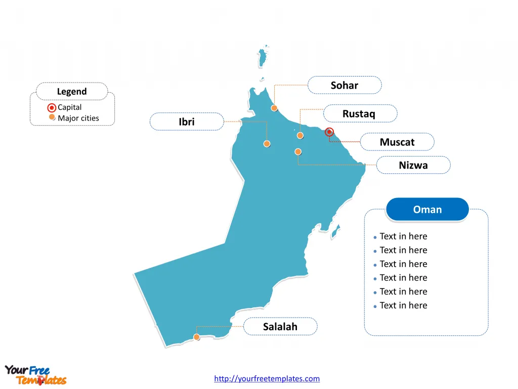
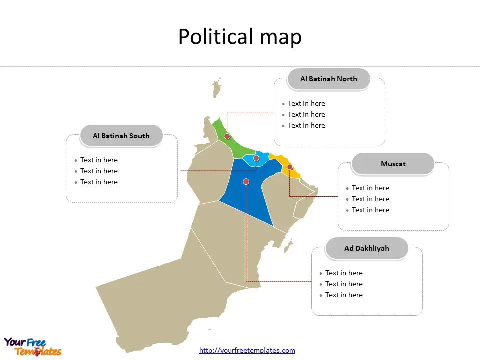
The Oman Map Template includes two slides. Oman map with eleven governorates, labeling with major governorates, Muscat, Al Batinah North, Ad Dakhliyah, and Al Batinah South. Oman map labeling with national capital and major cities, Muscat, Salalah, Sohar, Ibri, and Rustaq.
Oman, located in Southwest Asia on the Arabian Peninsula, has a strategic position adjacent to the Arabian Sea, Gulf of Oman, and the Persian Gulf, bordering Saudi Arabia, the United Arab Emirates, and Yemen. The country covers an area of 309,500 square kilometers with a coastline of 2,092 kilometers. With a population of 3,833,465, Oman is sparsely populated, with approximately 88% of the population residing in urban areas.
The country’s economy, characterized by a GDP per capita of $41,724, is classified as a developing high-income economy. Oman’s major export destinations include Japan, China, and South Korea, and its economy is supported by sectors such as petroleum, copper, and natural gas. Oman is a member of various international organizations including the Arab League, the Gulf Cooperation Council (GCC), and the United Nations.
Slide 1, Oman map labeled with capital and major cities.
Its capital and largest city is Muscat, other major cities including Salalah, Sohar, Ibri, and Rustaq.
Capital and Major Cities on Oman map
Muscat Muscat, the capital of Oman, is a vibrant city nestled between the sea and the mountains. With a population of around 1.4 million, it serves as the country’s political, economic, and cultural hub. Muscat is known for its stunning architecture, including the iconic Sultan Qaboos Grand Mosque and the Al Jalali and Al Mirani forts, and it plays a pivotal role in Oman’s trade and commerce.

Salalah Salalah, located in the Dhofar Governorate, is the second-largest city in Oman, with a population of approximately 420,000. Known for its unique monsoon season, the city is a significant center for trade and tourism, with its historical landmarks and natural beauty attracting visitors from around the world.
Sohar Sohar, situated in the Al Batinah North Governorate, is a major industrial and commercial city with a population of around 140,000. Its strategic location and thriving port have contributed to its status as a key economic center in Oman.
Ibri Ibri, the capital of the Al Dhahirah Governorate, is a historical city with a population of over 100,000. It is renowned for its traditional architecture and cultural heritage, serving as an important urban center in the region.
Rustaq Rustaq, located in the Al Batinah South Governorate, is an ancient city with a population of approximately 75,000. It is known for its historical significance, including the imposing Rustaq Fort, and plays a vital role in the governorate’s economic and social development.
Slide 2, Oman map labeled with major administration districts.
Oman is a country with eleven governorates; they are Ad Dakhliyah, Adh Dhahirah, Al Batinah North, Al Batinah South, Al Buraymi, Al Wusta, Ash Sharqiyah North, Ash Sharqiyah South, Dhofar, Musandam, and Muscat. Every individual political subdivision is an editable shape.
Major Governorates on Oman map
Muscat Governorate The Muscat Governorate, centered around the capital city, encompasses key urban and coastal areas, serving as the political, economic, and administrative heart of Oman.

Al Batinah North Governorate Al Batinah North, with Sohar as a major city, is a vital region for industrial and commercial activities, contributing significantly to Oman’s economy.
Ad Dakhliyah Governorate Ad Dakhliyah, with Nizwa as its cultural capital, is known for its historical and cultural heritage, playing a pivotal role in preserving Oman’s traditions and history.
Al Batinah South Governorate Al Batinah South, with Rustaq as a prominent city, is an important region known for its historical landmarks and economic activities, contributing to the governorate’s growth and development.
In summary, Oman’s capital, major cities, and governorates reflect the country’s rich history, cultural diversity, and economic significance. From the bustling metropolis of Muscat to the historical allure of Rustaq, each location contributes uniquely to Oman’s regional dynamics and national development.
Looking for Premium maps, please visit our affiliate site: https://editablemaps.com/ or https://ofomaps.com/
Size: 99K
Type: PPTX
Aspect Ratio: Standard 4:3
Click the blue button to download it.
Download the 4:3 Template
Aspect Ratio: Widescreen 16:9
Click the green button to download it.
Download the 16:9 Template


