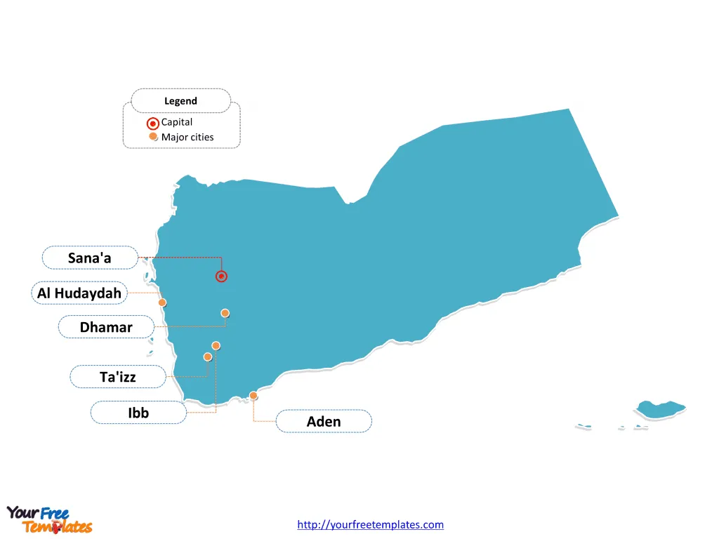
The Yemen Map Template includes four slides. Yemen map with twenty governorates and one municipality, labeling major districts, Ta`izz, Al Hudaydah, Ibb, and San`a’ City. Yemen map labeled with capital and major cities, Sana’a, Aden, Ta’izz, Al Hudaydah, Ibb, and Dhamar.
Yemen, located at the southern end of the Arabian Peninsula in Western Asia, shares its borders with Saudi Arabia to the north and Oman to the east. With a population of approximately 30 million, Yemen has faced significant challenges due to ongoing conflicts, political instability, and economic hardships. The economy, traditionally reliant on agriculture and oil, has been severely impacted by the prolonged conflict, leading to widespread poverty and food insecurity.
Yemen’s strategic location at the Bab el Mandeb strait gives it significance for international trade and maritime security. The country’s proximity to key global shipping routes adds to its geopolitical importance. Additionally, Yemen’s tumultuous relationship with neighboring Saudi Arabia and Oman has further shaped its geopolitical dynamics and regional influence.
Slide 1, Yemen map labeled with capital and major cities.
Yemen is a country located in Western Asia, occupying the southwestern to southern end of the Arabian Peninsula. Sana’a is the capital of Yemen and the centre of San‘a’ Governorate, other major cities including Aden, Ta’izz, Al Hudaydah, Ibb, and Dhamar.
Yemen’s Capital and Major Cities on Yemen map
Sana’a: The Historic Capital
Sana’a, the capital and largest city of Yemen, is steeped in history, with a heritage spanning over 2,500 years. The city serves as a significant center for commerce, industry, and political administration in Yemen. Sana’a’s Old City is a UNESCO World Heritage site, renowned for its ancient mosques, hammams, and thousands of pre-11th-century houses, showcasing exceptional craftsmanship and traditional Islamic architecture.

Aden: A Coastal Hub
Aden, a major port city, has been a key center for trade and commerce, contributing significantly to Yemen’s maritime industry. The city’s strategic location has historically made it a vital hub for international trade and maritime activities.
Ta’izz: Cultural and Historical Center
Ta’izz, known for its rich cultural and historical significance, stands as a vibrant city with a diverse population. The city is celebrated for its historical landmarks and cultural heritage, making it a compelling destination for visitors and a dynamic hub for residents.
Al Hudaydah: Coastal Charm
Al Hudaydah, a major coastal city, offers a blend of coastal allure and urban vibrancy, contributing to Yemen’s diverse urban fabric. The city’s strategic coastal location makes it a significant center for maritime trade and commerce.
Ibb: Scenic Beauty
Ibb, known for its scenic beauty and cultural charm, offers a tranquil and inviting atmosphere. The city’s picturesque landscapes and rich cultural scene make it an appealing destination for travelers and a serene haven for residents.
Dhamar: Historical Significance
Dhamar, situated in the heart of Yemen, is celebrated for its historical landmarks and cultural allure. The city’s rich historical heritage and warm community spirit contribute to its allure as a captivating destination for visitors and a serene haven for residents.
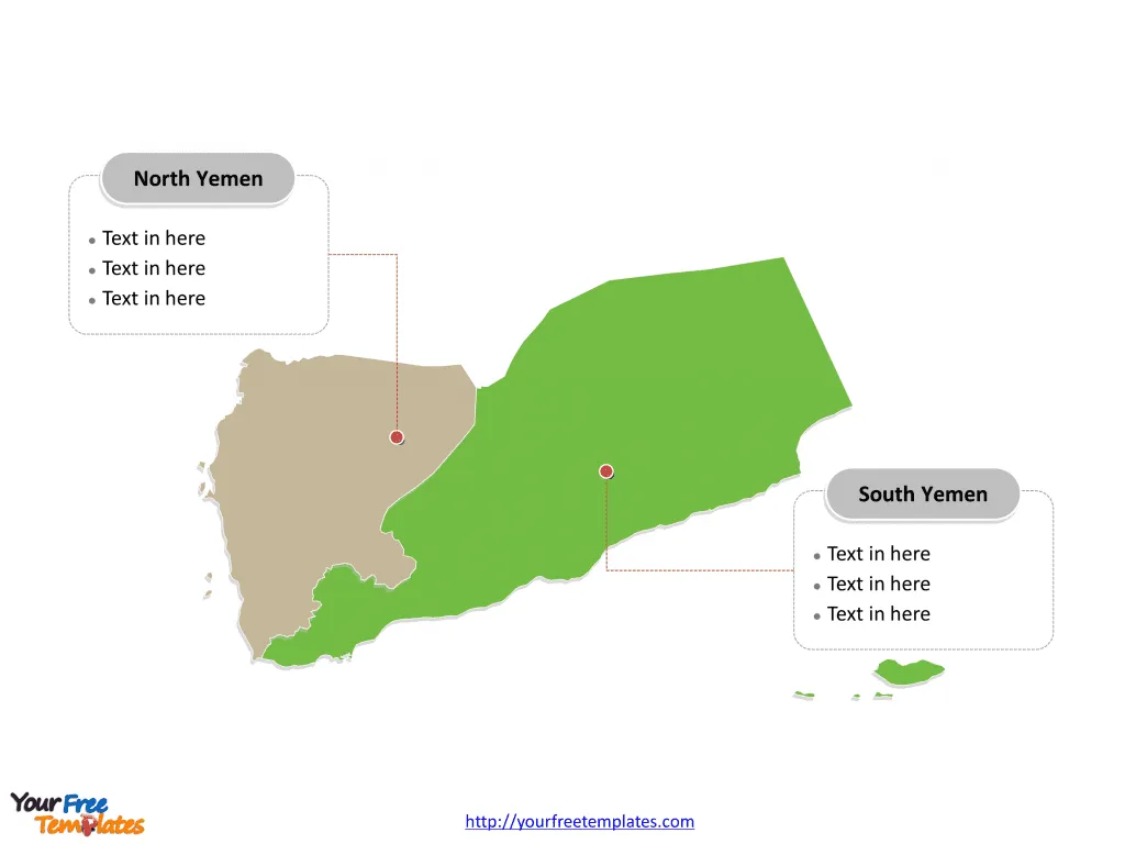
Slide 2, Yemen map before reunification.
Yemen is a country divided into north Yemen and south Yemen until 22 May 1990, to form the present-day Yemen.

Slide 3, Yemen map labeled with major administration districts.
Yemen is a country divided into twenty one governorates and one municipality: ‘Aden, ‘Amran, Abyan, Ad-Dali’, Al Bayda’, Al Hudaydah, Al Jawf, Al-Mahrah, Al-Mahwit, Amanat Al-Asemah, Dhamar, Hadhramaut, Hajjah, Ibb, Lahij, Ma’rib, Raymah, Sa’dah, Sana’a, Shabwah, and Taiz. Every individual political subdivision is an editable shape.
Major governorates on Yemen map
Ta’izz governorate
The Ta’izz governorate, encompassing the city of Ta’izz, serves as a significant administrative, economic, and cultural hub, playing a pivotal role in shaping Yemen’s regional identity and development.
Al Hudaydah governorate
The Al Hudaydah governorate, with Al Hudaydah as a major city, offers a blend of coastal allure and urban vibrancy, contributing to the region’s diverse urban fabric.
Ibb governorate
The Ibb governorate is known for its scenic beauty and cultural charm, offering a tranquil and inviting atmosphere, shaping the region’s serene and vibrant urban landscape.
Sana’a City municipality
The Sana’a City municipality, encompassing the capital city of Sana’a, serves as a significant administrative, economic, and cultural hub, playing a pivotal role in shaping Yemen’s national identity and development.

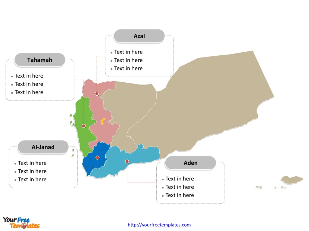
Slide 4, Yemen map labeled with major regions.
In 2014, a constitutional panel decided to divide the country into six regions and capital Sana’a outside of any region: Aden, Al-Janad, Azal, Hadramawt, Sana’a, Sheba, and Tahamah. Every individual political subdivision is an editable shape.

Yemen’s capital, major cities, and significant governorates collectively contribute to the country’s cultural, historical, and economic landscape, making it a captivating destination for visitors and a dynamic hub for residents. The diverse array of urban centers and significant districts showcases Yemen’s unique blend of historical heritage, urban vibrancy, and economic significance, making it a compelling subject for exploration and discovery.
Looking for Premium maps, please visit our affiliate site: https://editablemaps.com/ or https://ofomaps.com/
Size: 225K
Type: PPTX
Aspect Ratio: Standard 4:3
Click the blue button to download it.
Download the 4:3 Template
Aspect Ratio: Widescreen 16:9
Click the green button to download it.
Download the 16:9 Template


