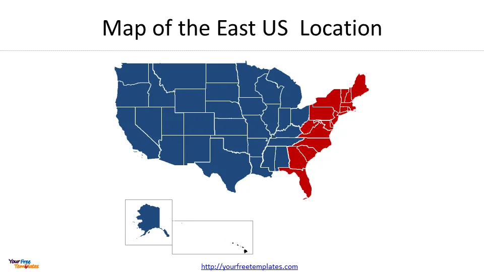
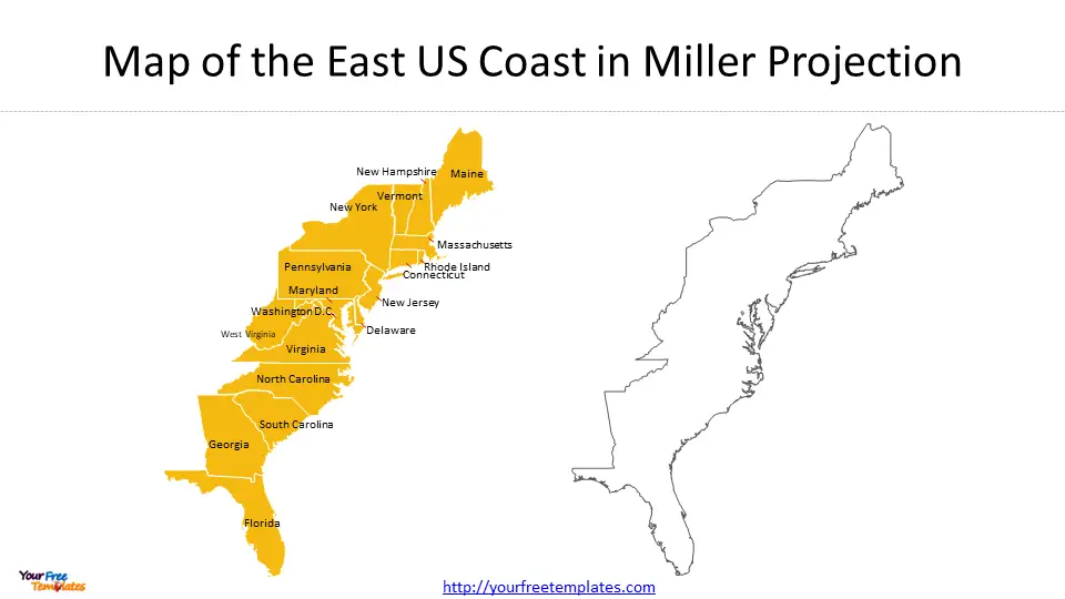
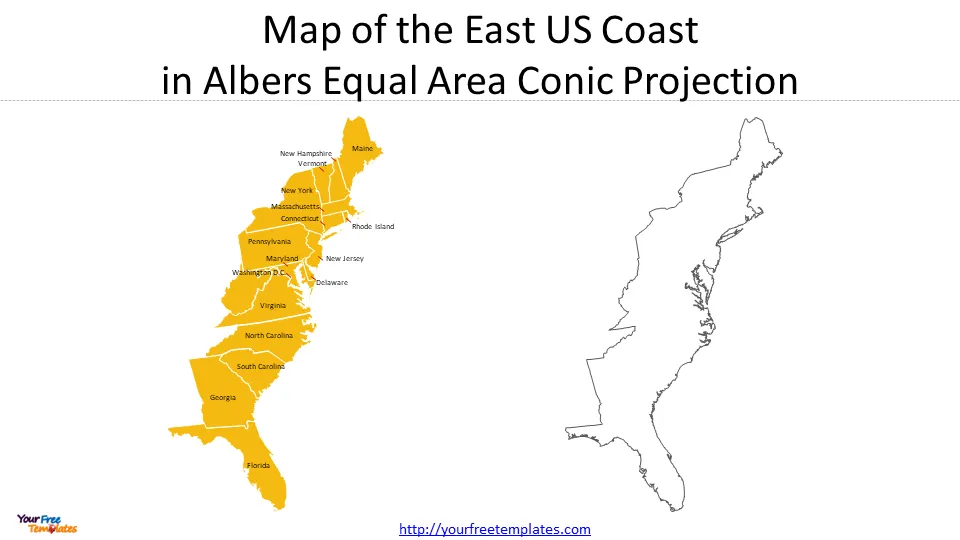
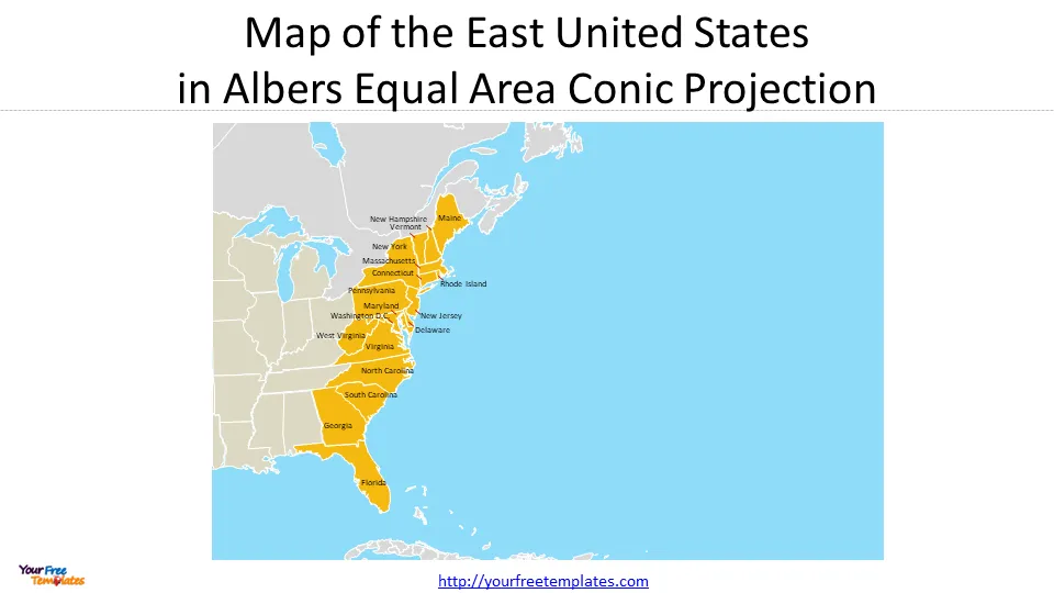
The US map East Coast template in PowerPoint format includes 5 slides. Firstly, we highlighted 17 states and the national capital in the USA state map. Secondly, we present the US map east coast in Miller projection. Thirdly US east coast map in Albers Equal Area Conic Projection. As the same diagram PowerPoint template series, you can also find our Carbon footprint, Carbon neutral, Data Mining, Machine Learning, cloud computing, Artificial Intelligence and BlockChain or US Cities including Denver, Fort Worth, Indianapolis, Columbus, and Baltimore PowerPoint templates.
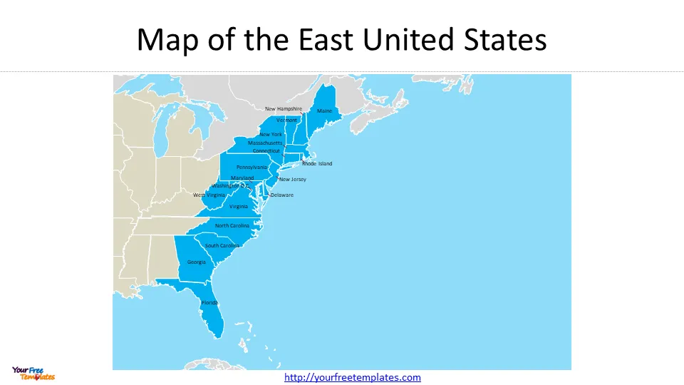
According to the definition of US Department of Energy, East Coast of the United States includes 17 states plus Washington, D.C., They are coastline states which are Connecticut, Delaware, Florida, Georgia, Maine, Maryland, Massachusetts, New Hampshire, New Jersey, New York, North Carolina, Rhode Island, South Carolina, and Virginia, as well as the federal capital of Washington, D.C., and non-coastline states: Pennsylvania, Vermont, and West Virginia.
Slide 1, US map East Coast Location
It presents the state map of USA with East Coast states highlighted. Mercator Projection is applied in this slide, which is used by Google maps. The East Coast can be divided into several distinct regions, each with its own unique charm and attractions. From the rugged coastline of New England to the tropical paradise of Florida, these regions offer a diverse range of experiences. In 2017, about 94.7 million people lived in the 255 coastline counties on the US East Coast, which accounted for approximately 29.1% of the total US population.
Slide 2, US East Coast map in Miller Projection
The US East Coast is home to several famous and popular cities, including Boston, New York, Washington D.C., Philadelphia, Baltimore, and Miami. These cities offer diverse attractions, from historic landmarks and cultural institutions to natural scenery and culinary experiences. Visitors can explore these cities through various transportation options, including driving, Amtrak train services, and overnight buses, which provide convenience, scenic routes, and cost-effective travel. Overall, the East Coast offers a well-connected transportation network for exploring its cities and landscapes.
Slide 3, US East Coast Map
The weather on the US East Coast varies depending on the season. Summers are generally hot and humid, with temperatures often reaching above-average levels. The National Weather Service provides detailed forecasts for the region, including information on highs, lows, and other weather patterns. It is advisable to check the 4-day forecast for the Eastern United States to plan your activities accordingly.
Slide 4, US East Coast Map in Albers Equal Area Conic Projection
Transportation options along the US East Coast are abundant, making it easy to explore the region. While driving is a popular choice, there are other options available as well. Amtrak provides train services that connect major cities, allowing travelers to enjoy scenic routes and avoid traffic.
Additionally, there are overnight buses that offer cost-effective transportation between states. These options are particularly useful for those who prefer not to drive or want to save money on accommodation by traveling overnight. Overall, the East Coast offers a well-connected transportation network to explore its vibrant cities and picturesque landscapes.
Slide 5, US map East Coast
The US East Coast has a range of advantages for those who choose to live there. One of the biggest pros is the diverse range of options available, from Miami’s tropical weather to the beautiful fall foliage in Connecticut.
Additionally, the East Coast has a rich history, with many famous landmarks and museums. Another advantage is the good access to public transport, especially in cities like New York. Furthermore, being on the East Coast means being closer to Europe for direct flights and having time zone dominance. This has led to a growing trend of people moving to the East Coast in search of a better life. Finally, the East Coast is known for its delicious food, including seafood, pizza, and bagels.
For other interesting maps, pls visit our ofomaps.com
Size:963K
Type: PPTX
Aspect Ratio: Standard 4:3
Click the blue button to download the maps.
Download the 4:3 Template
Aspect Ratio: Widescreen 16:9
Click the green button to download the maps.
Download the 16:9 Template


