
If you are looking for Germany Frankfurt GIS data, administrative boundaries, WFS services, GML files, or Shapefiles, one of the best places to start is the official geographic data provided by the City of Frankfurt am Main.
Rather than downloading boundaries from an unknown third-party website, GIS users can access Frankfurt’s official Web Feature Service (WFS) and extract geographic features directly.
This guide explains where to find the data, how the Frankfurt WFS is structured, and how to use QGIS to download and convert the data into commonly used GIS formats. QGIS originally stood for Quantum GIS, but the official project name is now simply QGIS. It is a free, open-source Geographic Information System (GIS)
Rather than simply providing a finished Frankfurt map, this guide shows you where the underlying geographic data comes from and how to obtain the polygon boundaries yourself using the city’s official WFS service and QGIS.
1. Where Can You Find Frankfurt GIS Data?
Frankfurt’s municipal geographic information is provided through the city’s surveying and geoinformation services.
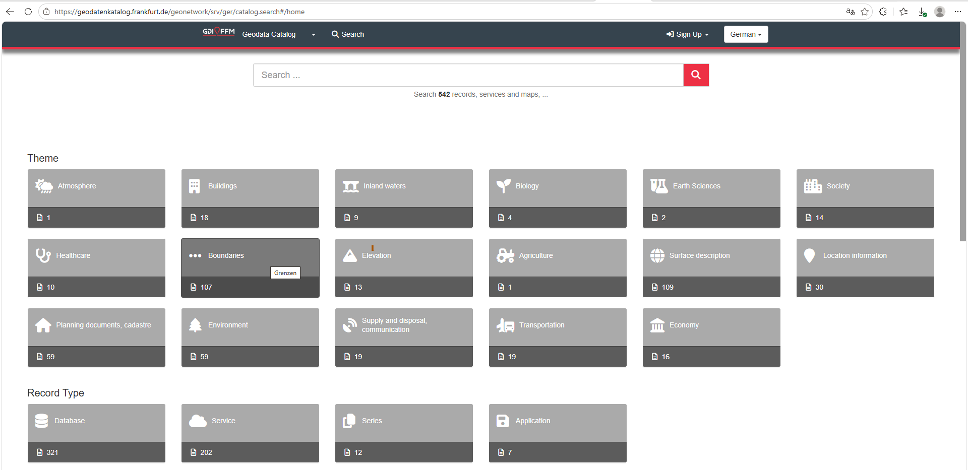
You can select the “Boundary” theme for administrative division GIS files in the Geodata Catalog.
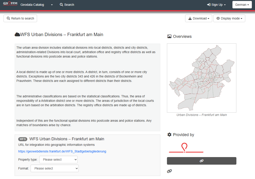
By clicking the link, https://geodatenkatalog.frankfurt.de/geonetwork/srv/ger/catalog.search#/metadata/e6b55634-0e2e-4257-87fa-6bf617bee383 , you can find all the urban divisions for Frankfurt.
2. Frankfurt WFS data Service
The Frankfurt geographic service can be accessed through the following WFS, however it doesn’t provide Frankfurt shapefile directly as the format is GML. GML (Geography Markup Language) is an XML standard defined by the Open Geospatial Consortium (OGC) for storing and exchanging geographic information.
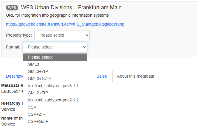
WFS_Stadtgebietsgliederung
The service URL is in blue:
https://geowebdienste.frankfurt.de/WFS_StadtgebietsgliederungA WFS is different from a normal map image service.
A WMS generally provides a rendered map image, while a WFS provides the actual geographic features and their attributes.
This means that a WFS can be particularly useful when you need to obtain:
- Polygon boundaries
- Feature names
- Administrative identifiers
- Attributes
- Geographic coordinates
Unlike a WMS, which mainly provides a rendered map image, a WFS provides the underlying geographic features and their attributes. This means you can download, edit, analyze, reproject, and export the actual polygon boundaries.
3. Understanding the Frankfurt Layers of Frankfurt GIS data
When connecting to the WFS, you may see layer names such as:
| WFS Layer | Recommended English name | Type |
|---|---|---|
Stadtgebietsgliederung:Ortsbezirke |
Area Districts | Municipal subdivision |
Stadtgebietsgliederung:Stadtteile |
City Districts | Municipal subdivision |
Stadtgebietsgliederung:Stadtbezirke |
City Boroughs | Municipal subdivision |
Stadtgebietsgliederung:Schiedsamtsbezirke |
Conciliation Office Districts | Service/jurisdiction |
Stadtgebietsgliederung:Polizeireviere |
Police Precincts | Police jurisdiction |
Stadtgebietsgliederung:Ortsgerichtsbezirke |
Local Court Districts | Judicial jurisdiction |
Stadtgebietsgliederung:Standesamtsbezirke |
Civil Registry Districts | Civil registration |
The most important three municipal geographic levels are:
16 Ortsbezirke → 46 Stadtteile → 121 Stadtbezirke
However, these should not simply be interpreted as three identical hierarchical administrative levels. The boundaries serve different purposes within Frankfurt’s municipal geographic system.
Knowing the purpose of each layer prevents a common GIS mistake—assuming that every Frankfurt boundary represents the same type of administrative division.
4. Frankfurt’s Coordinate System for Frankfurt GIS data
The Frankfurt WFS data may be provided using the projected coordinate system:
ETRS89 / UTM Zone 32N
with:
EPSG:25832
In ArcGIS this may appear as:
ETRS_1989_UTM_Zone_32N
The coordinate system uses metres as its unit and is well suited to mapping Frankfurt and other parts of western and central Germany.
For a local Frankfurt GIS project, keeping the data in EPSG:25832 is usually a sensible choice.
Knowing the original CRS helps avoid unnecessary reprojection and prevents problems when combining Frankfurt boundary data with other GIS datasets.
5. How to Add the Frankfurt WFS to QGIS
QGIS provides a convenient way to connect directly to the Frankfurt WFS. If you don’t have the app, pls download it first through Download · QGIS.
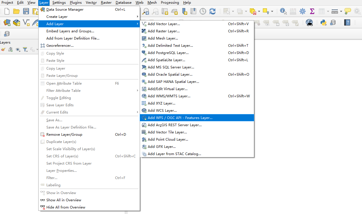
Open QGIS and select:
Layer → Add Layer → Add WFS / OGC API – Features Layer
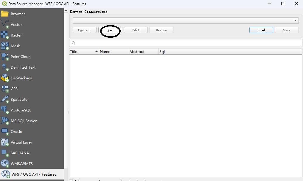
Click New.
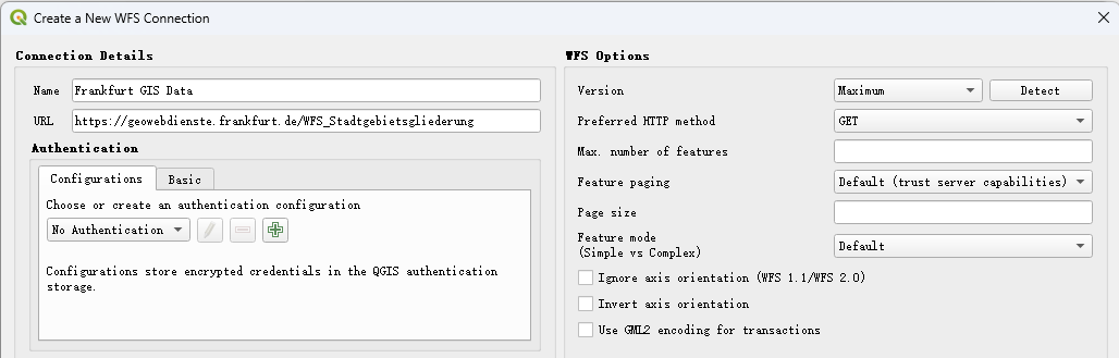
For the connection name, enter: Frankfurt GIS Data
For the URL, enter:
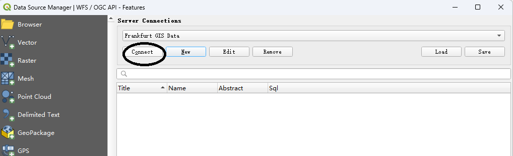
https://geowebdienste.frankfurt.de/WFS_StadtgebietsgliederungClick OK, then Connect.
QGIS should retrieve the available feature layers from the service.
6. Select one or all Frankfurt Boundary Layer(s) with Frankfurt GIS data
All the layers from this Frankfurt WFS data will be listed. You can just select one or all of them. For example, select:
Stadtgebietsgliederung:OrtsbezirkeThen click Add. You will get the Ortsbezirke data only.
Here we select all layers by holding on “Ctrl” key and clicking the layers one by one, click Add.
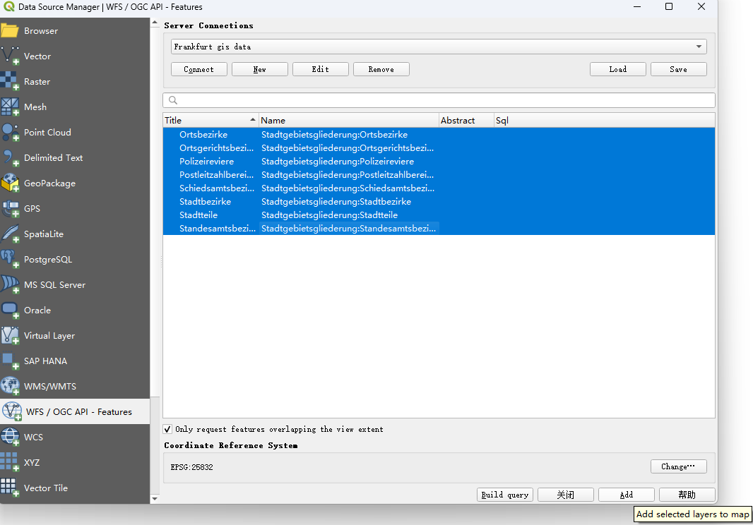
QGIS will download the geographic features and display the polygons on the map.
7. Export the WFS Data as Shape File
Once the layers have been loaded, you do not have to keep working directly from the online WFS.
Select: Stadtgebietsgliederung:Ortsbezirke
Right-click the layer and select:
Export → Save Features As…
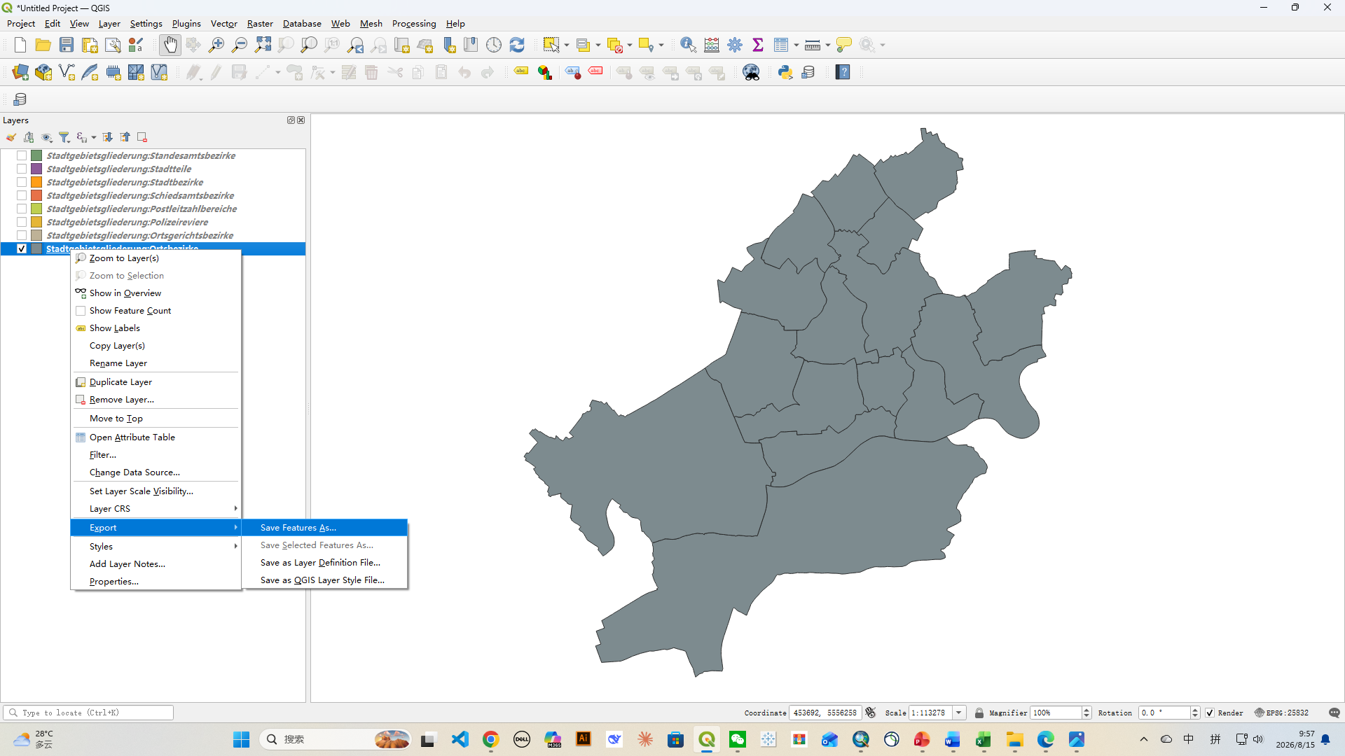
QGIS allows you to save the data in formats such as:
- GeoPackage
- ESRI Shapefile
- GeoJSON
- KML
- other supported vector formats
For a modern GIS workflow, GeoPackage is often preferable because it can store multiple layers in one file.
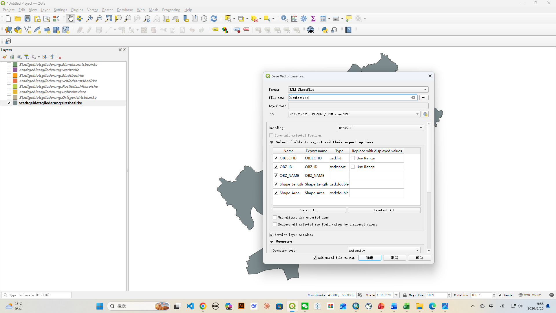
For compatibility with older GIS software, including ArcMap, ESRI Shapefile remains useful, here we select ESRI Shapefile, and give the name of Ortsbezirke to the Shapefile. You can find the export file in your document category. Also you can select the path for this file by clicking the icon after the file name box.
8. From Shape file to PowerPoint
Once you have the polygons, they can be further processed for presentation.
A typical workflow is:
Frankfurt WFS
→ QGIS
→ Shapefile
→ GIS editing (Arcmap)
→ Adobe Illustration/EPS/EMF
→ PowerPoint
9. Free Frankfurt GIS Data vs. Ready-to-Use Maps
The official Frankfurt WFS is useful if you want to create your own maps.
However, obtaining the raw geographic data is only one part of producing a presentation-ready map. You may still need to:
- clean the data
- simplify polygons
- select appropriate boundaries
- label features
- adjust fonts
- create a color scheme
- organize layers
- convert the map into an editable presentation format
Conclusion
You may also be interested in our related Germany templates: