

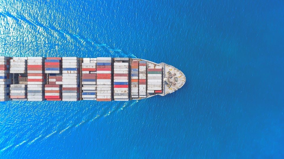
The Strait of Hormuz is more than just a line on a chart; it is the geographic lynchpin of the global economy. Situated between the Persian Gulf and the Gulf of Oman, this narrow passageway sees the transit of nearly a fifth of the world”s total oil consumption and a quarter of its liquefied natural gas.
For strategists, economists, and historians, understanding the strait of hormuz map location is essential to grasping the dynamics of Middle Eastern geopolitics. However, to truly understand its significance, one cannot look at the strait in isolation. By designing a four-part PPT template that zooms out from the strait to the entire Eastern Hemisphere, you have created a powerful tool to visualize how a local disruption can become a global crisis.
At the end of this post, you can download our Strait of Hormuz Map PowerPoint template to fit your purpose. As the same diagram PowerPoint template series, you can also find our Middle East map, Strait of Malacca Map, Red Sea with Trade Routes, India-Middle East-Europe Economic Corridor Map
Here is how we can explore the significance of your strait of hormuz map series.
Map 1: The Nodal Point – Strait of Hormuz, Oman, and Iran
The first slide in your deck zooms in on the strait itself. At its narrowest point, the Strait of Hormuz is just 21 nautical miles wide. However, the shipping lanes are much tighter. The outbound and inbound traffic lanes are separated by a two-mile-wide buffer zone, meaning tankers are funneled into a very confined space.
A strait of hormuz map at this scale usually highlights the territorial waters of Iran to the north and Oman (specifically the Musandam Peninsula) to the south. The Musandam Peninsula is an exclave of Oman that juts into the strait, giving Oman—alongside Iran—joint control over the entrance to the Gulf . This close proximity is why any military confrontation in the region immediately raises fears of the strait being closed .
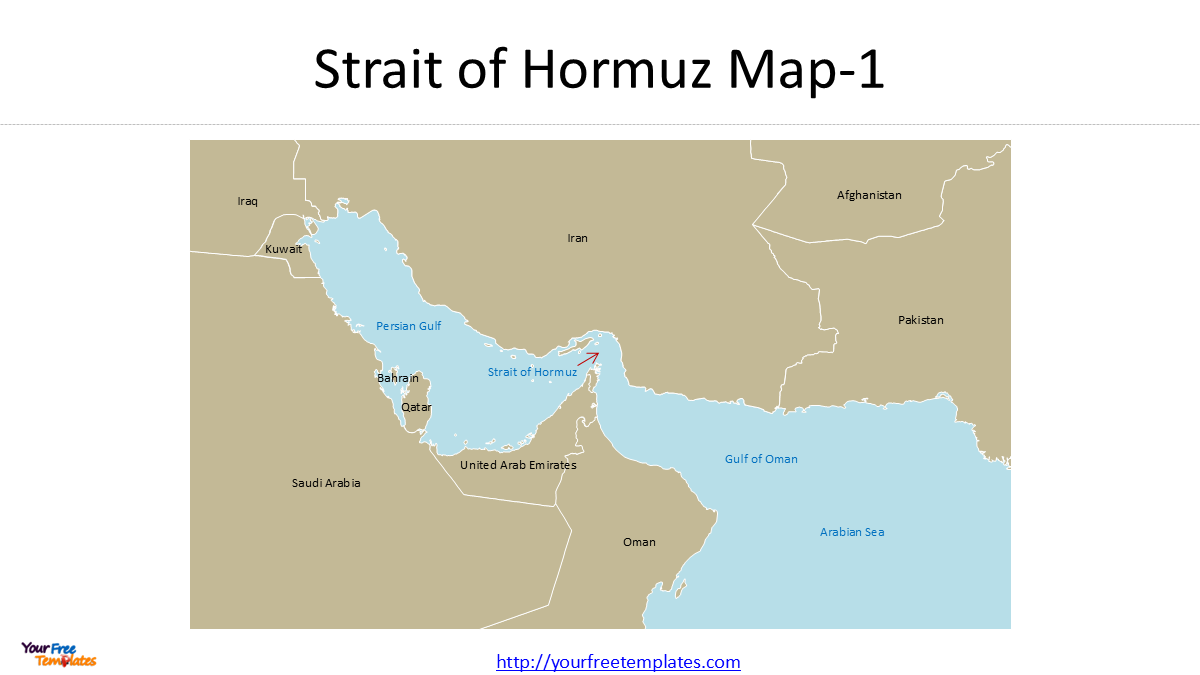
Map 2: The Regional Waters – Persian Gulf, Gulf of Oman, and the Arabian Sea
Zooming out slightly, your second map places the strait within the context of the Persian Gulf and the Gulf of Oman. This view explains why the strait is so important.
To the west, the Persian Gulf is bordered by the oil powerhouses of Saudi Arabia, Kuwait, Iraq, Qatar, and the UAE. For these nations, the Strait of Hormuz is the only maritime exit for their exports. While pipelines exist, they cannot handle the volume required to replace the strait .
To the east, the Gulf of Oman opens into the Arabian Sea. This is where tankers queue up, waiting to enter the Gulf to pick up cargo, or assemble outside waiting for convoys or safe passage. This map view is crucial for showing the “waiting room” of global energy supply.
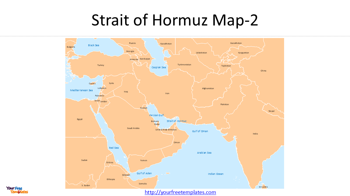
Map 3: The Wider Middle East – Red Sea, Arabian Sea, and the Indian Ocean
Your third map expands the frame to include the Red Sea, the Gulf of Aden, and the Western Indian Ocean. This slide connects the Strait of Hormuz to the other great maritime chokepoint: the Bab el-Mandeb Strait (between Yemen and Djibouti).
Including the Red Sea and Gulf of Aden allows for a discussion of piracy (off Somalia) and the recent history of attacks on shipping by Houthi rebels. It also bridges the gap between the Gulf states and the Suez Canal. For Mediterranean audiences, this map shows how energy from the Gulf travels through the Suez Canal to reach European markets.
Additionally, this slide begins to hint at the involvement of non-Middle Eastern powers, such as India, which looks west through the Arabian Sea to protect its energy supplies and expatriate population in the Gulf.
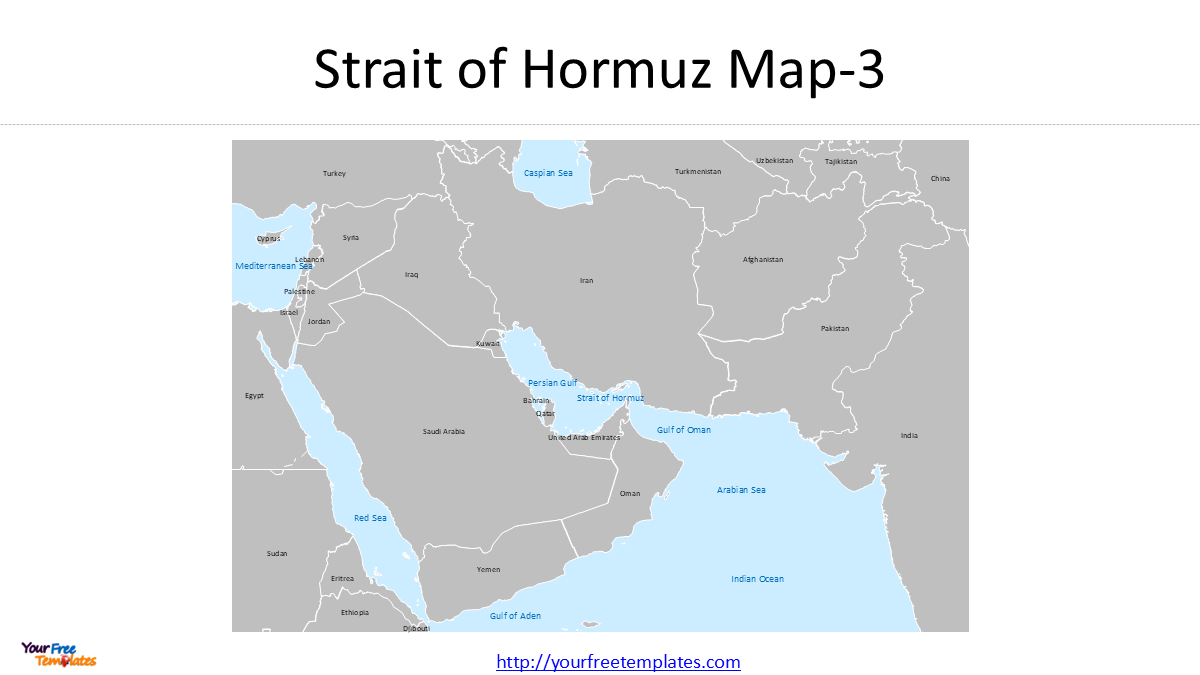
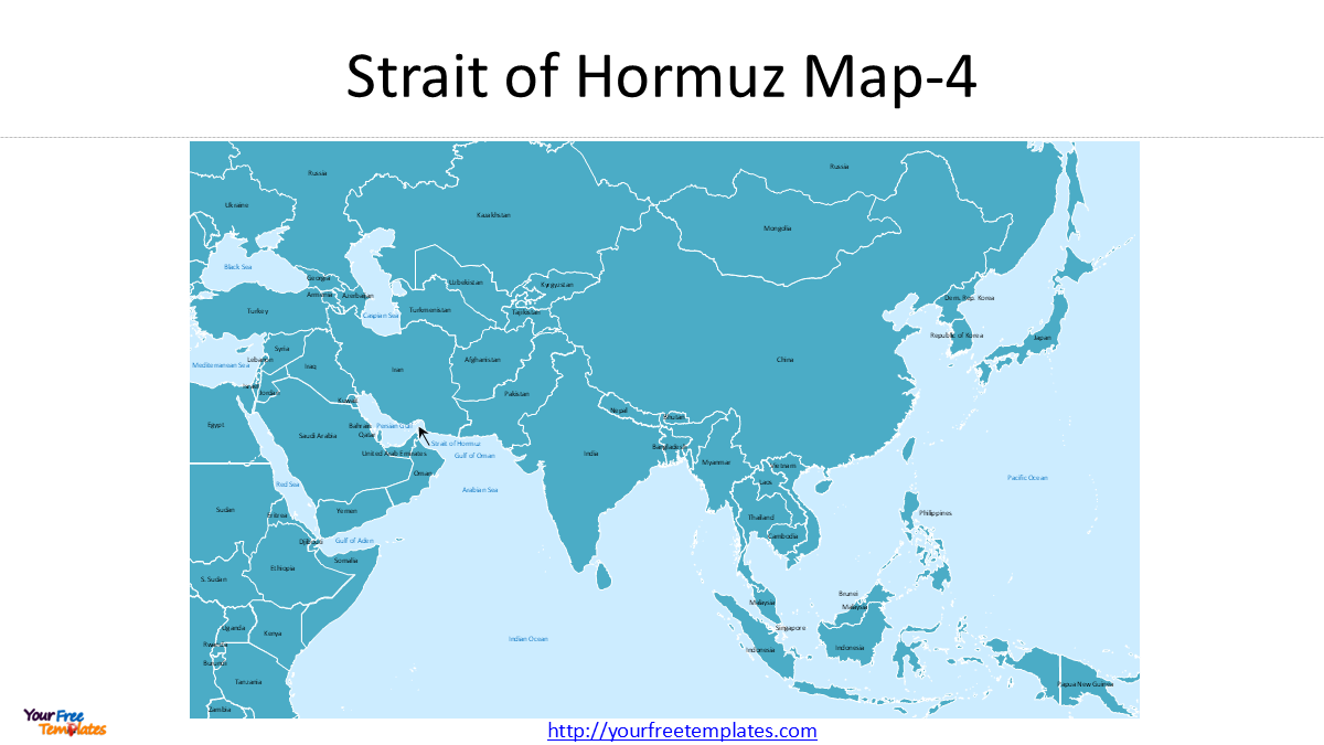
Map 4: The Global Stage – Mediterranean, Black Sea, Caspian, and the Pacific
The final slide in your series takes a macro view, stretching from the Western Pacific to the Mediterranean. This perspective underscores the global nature of energy security.
-
The Pacific: This reminds viewers that the largest consumers of Gulf oil are in Asia (China, Japan, South Korea, and India). The map visually represents the long sea lines of communication that these nations depend on.
-
The Mediterranean and Black Sea: Including these bodies of water acknowledges the European theater and the complex pipeline politics involving the Caspian Sea region. It links the hydrocarbon wealth of the Middle East to the energy needs of NATO and the European Union.
-
The Caspian Sea: While landlocked, the Caspian is vital for pipeline politics. Oil from Kazakhstan and Azerbaijan often flows via pipeline to Mediterranean ports, becoming part of the same global pool that competes with—and is priced against—oil passing through Hormuz.
The Context of Crisis
Given the current geopolitical climate, your choice of this map series is timely. As of early 2026, tensions remain high regarding the Strait of Hormuz. Recent editorials in regional media have highlighted the delicate balance of the strait. There is a growing sentiment that “no one has the right to choke out the global economy,” a reference to fears that the strait could be weaponized in regional conflicts .
By creating this map series, you are enabling presenters to discuss not just geography, but strategy. They can show how ships are currently avoiding northern (Iranian) waters and sticking to Omani waters, and how the strait”s closure would instantly idle a fifth of the world”s LNG output.
Conclusion
A strait of hormuz map is a snapshot of a location. But a series of four maps—zooming out from the strait to the Pacific—is a story. It is the story of how a narrow waterway flanked by Iran and Oman connects the energy fields of the Persian Gulf to the factories of China, the cars of America, and the homes of Europe.
Your PPT template is more than just a presentation aid; it is a visual narrative of globalization and vulnerability.
Looking for Premium maps, please visit our affiliate site: https://editablemaps.com/ or https://ofomaps.com/
Size:1003K
Type: PPTX
Strait of Hormuz Map Template
Click the link to download it.
Aspect Ratio: Widescreen 16:9
Click the green button to download it.
Download the 16:9 Template