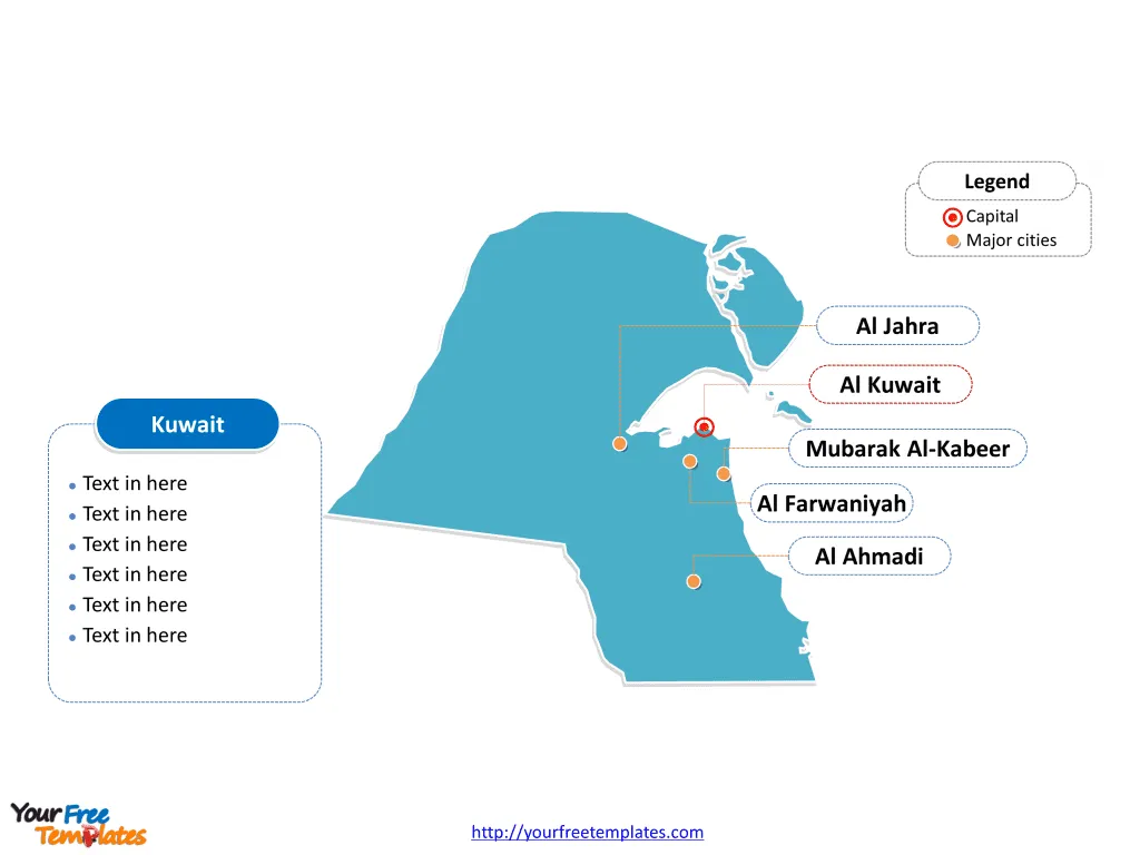
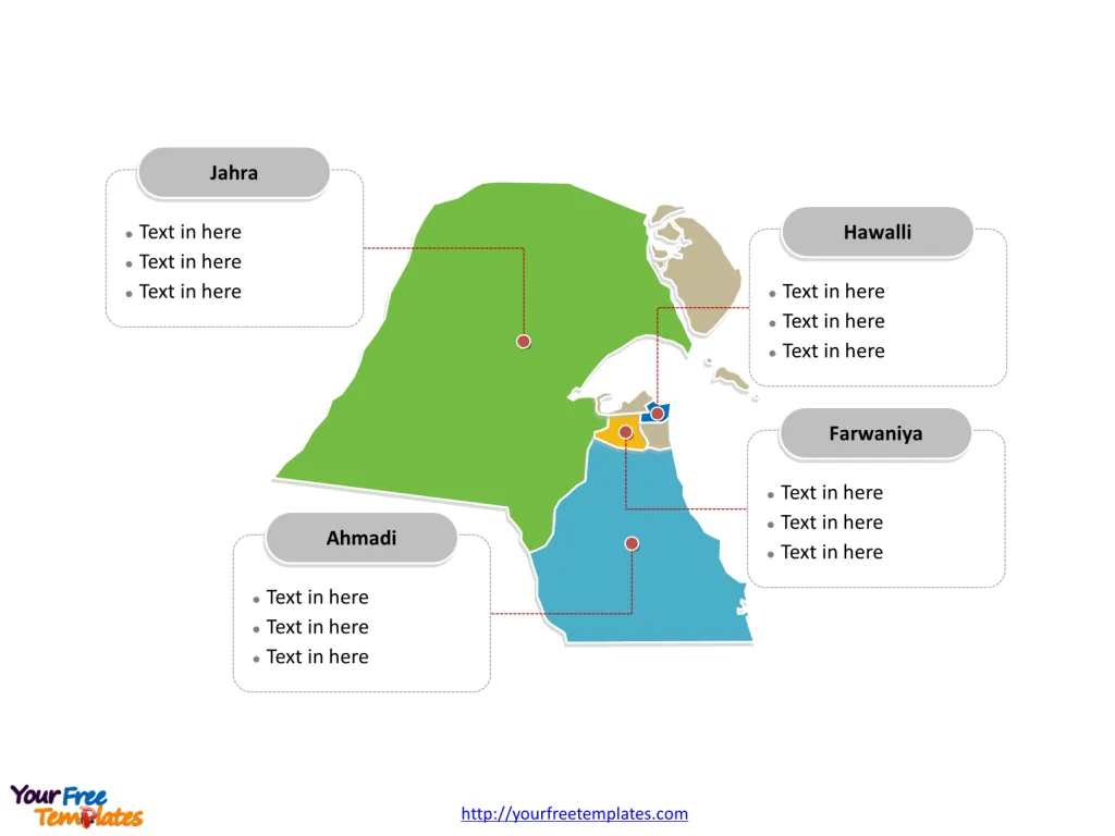
The Kuwait Map Template includes two slides. Kuwait map with 6 governorates, labeling with major Governorates, Farwaniya Governorate, Hawalli Governorate, Ahmadi Governorate, and Jahra Governorate. Kuwait map labeling with national capital and major cities, Al Kuwait, Al Jahra, Mubarak Al-Kabeer, Al Farwaniyah, and Al Ahmadi.
Kuwait, located in the Middle East, is situated at the northern edge of Eastern Arabia on the tip of the Persian Gulf, which it shares borders with Iraq and Saudi Arabia. With a population of approximately 4.5 million people, the majority of whom are expatriates, Kuwait is known for its petroleum-based economy, with oil reserves being the sixth-largest in the world.
The country’s economy is heavily reliant on oil exports, which account for the majority of government revenue and GDP. Kuwait has made efforts to diversify its economy, focusing on sectors such as finance, real estate, and tourism, to reduce its dependence on oil. The strategic location of Kuwait and its economic stability have made it a key player in the region’s commerce and trade.
Slide 1, Kuwait map labeled with capital and major cities.
Kuwait City is the capital and largest city of Kuwait, other major cities including Al Jahra, Mubarak Al-Kabeer, Al Farwaniyah, and Al Ahmadi.
Capital and Major Cities on Kuwait Map
Al Kuwait
Al Kuwait, the capital and largest city of Kuwait, is a vibrant urban center known for its modern architecture, bustling souks (markets), and cultural landmarks. With a population of over 2.5 million, it serves as the political, economic, and cultural heart of the country, playing a pivotal role in shaping Kuwait’s urban landscape and governance.

Al Jahra
Al Jahra, located to the west of the capital, is a significant city known for its historical significance and cultural heritage. With a population of approximately 155,000, it is an essential hub for trade, agriculture, and regional development.
Mubarak Al-Kabeer
Mubarak Al-Kabeer, situated in the Mubarak Al-Kabeer Governorate, is a major city with a population of around 222,000. It serves as a vital center for commerce, industry, and cultural exchange, influencing the dynamics of the governorate.
Al Farwaniyah
Al Farwaniyah, part of the Al Farwaniyah Governorate, is a significant city with a population of approximately 220,000. It is renowned for its commercial activities, diverse community, and urban development, contributing to the governorate’s economic and social landscape.
Al Ahmadi
Al Ahmadi, located in the Al Ahmadi Governorate, is a key industrial city with a population exceeding 600,000. Known for its oil refineries and industrial infrastructure, it plays a vital role in Kuwait’s economy and energy sector.
Slide 2, Kuwait map labeled with major administration districts.
Kuwait is a country composed of 6 governorates (muhafazah): Al Ahmadi, Al Asimah (Al Kuwayt), Al Farwaniyah, Al Jahra, Hawalli, and Mubarak Al-Kabeer. Every individual political subdivision is an editable shape.
Major Governorates on Kuwait Map
Farwaniya Governorate
The Farwaniya Governorate, with Al Farwaniyah as a major city, is an important area known for its commercial activities, residential development, and diverse community, shaping the governorate’s economic and social dynamics.

Hawalli Governorate
The Hawalli Governorate, with its proximity to the capital, is a significant urban area characterized by its commercial centers, educational institutions, and vibrant urban atmosphere.
Ahmadi Governorate
The Ahmadi Governorate, with Al Ahmadi as a major city, is a key region known for its oil industry, industrial infrastructure, and economic contributions to Kuwait.
Jahra Governorate
The Jahra Governorate, with Al Jahra as its major city, is known for its historical significance, cultural heritage, and agricultural activities, contributing to the governorate’s economic and social development.
In summary, Kuwait’s capital, major cities, and governorates contribute uniquely to the country’s cultural heritage, economic activities, and urban development. From the modern urban center of Al Kuwait to the industrial significance of Al Ahmadi and the historical allure of Al Jahra, each location plays a distinctive role in shaping Kuwait’s diverse urban landscape.
Looking for Premium maps, please visit our affiliate site: https://editablemaps.com/ or https://ofomaps.com/
Size: 93K
Type: PPTX
Aspect Ratio: Standard 4:3
Click the blue button to download it.
Download the 4:3 Template
Aspect Ratio: Widescreen 16:9
Click the green button to download it.
Download the 16:9 Template


