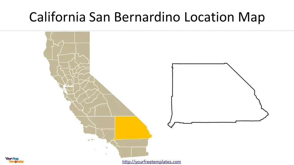
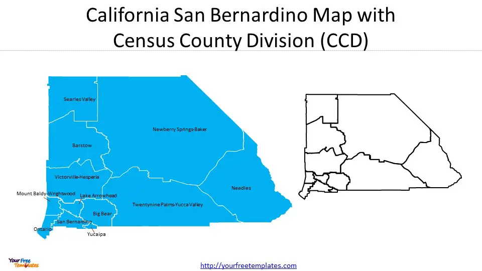
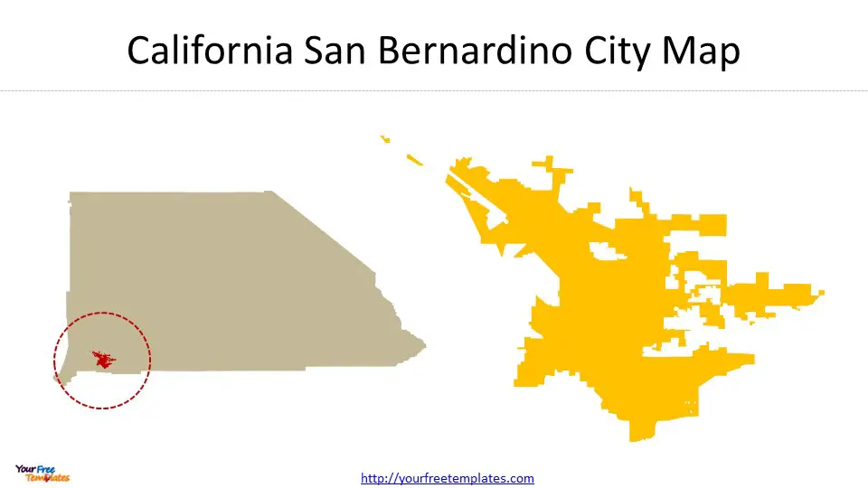
The San Bernardino map template in PowerPoint format includes 3 slides. Firstly, we have the San Bernardino map template location for the county outline. Secondly, we present San Bernardino County map for Census County Divisions. In the end it is San Bernardino map template for San Bernardino city location and outline. As the same diagram PowerPoint template series, you can also find our San Diego, San Jose, California City 1, California City 2, Orange County and California counties map PowerPoint templates.
San Bernardino County, situated in the southeastern part of California, is the largest county by area in the United States, covering over 20,000 square miles. It sprawls across a significant portion of the Southern California region, ranging from the outskirts of the Los Angeles metropolitan area to the Nevada border and the Colorado River.
Slide 1, California San Bernardino Map of Location

Economy
The economy of San Bernardino County is diverse and multifaceted, reflecting its vast geographic spread. Key sectors include logistics, due to the county’s strategic location as a transportation hub with significant rail, road, and air infrastructure. This includes major facilities such as the Ontario International Airport and extensive freight rail systems. Manufacturing and warehousing also play crucial roles, buoyed by the county’s ample space and connectivity.
Agriculture remains a vital part of the economy in the more rural parts of the county, taking advantage of the varied climates within its borders. Additionally, the county benefits from the presence of numerous educational institutions, healthcare providers, and a growing technology sector, further diversifying its economic base.
Importance in California
San Bernardino County’s significance in California lies not just in its size but also in its economic contributions and natural resources. It serves as a critical logistics and transportation corridor, connecting the Greater Los Angeles area with the rest of the country. Its vast natural spaces, including parts of the Mojave Desert and San Bernardino National Forest, are crucial for conservation efforts and as a recreation destination for Southern Californians.
Major Cities
- San Bernardino: The county seat, known for its historic sites, government offices, and cultural institutions.
- Ontario: An important commercial center, home to the Ontario International Airport and the Ontario Mills shopping mall.
- Rancho Cucamonga: Recognized for its vineyards, upscale residential areas, and the Victoria Gardens shopping center.
- Fontana: Hosts the Auto Club Speedway and is known for its logistics and manufacturing industries.
San Bernardino County’s blend of urban and rural areas, economic diversity, and strategic importance continues to play a pivotal role in the growth and development of Southern California.
Slide 2, California San Bernardino County Map with 12 Census County Divisions (CCD)

San Bernardino County, California, is divided into 12 Census County Divisions (CCDs) based on 2020 Census data that represent its most populous areas. These CCDs include Fontana, San Bernardino, and Victorville-Hesperia labeled on San Bernardino map.
- Fontana is known for its booming logistics and manufacturing sectors, driven by its strategic location near major transportation corridors.
- San Bernardino, the county seat, serves as a government and cultural center, offering various historic sites and institutions.
- Victorville-Hesperia CCD, encompassing both Victorville and Hesperia cities, is recognized for its rapidly growing population and serves as a key residential and commercial hub within the High Desert region.
Together, these 12 CCDs accounted for 2,193,656 people as of the 2020 Census, highlighting the county’s significant urbanized areas amidst its vast desert and mountainous landscapes.
Slide 3, California San Bernardino Map of City

San Bernardino City, California: Economy and Importance
San Bernardino City, located in California, stands as a significant hub within San Bernardino County, contributing notably to the regional and state economy. As of 2022, the city had a population of approximately 213,708 people, showcasing a modest growth and an increasingly diverse community. The median household income in San Bernardino City witnessed a substantial increase from $49,287 in 2020 to $55,372 in 2021, indicating positive economic momentum.
The economy of San Bernardino City is characterized by a diverse employment landscape, with Transportation & Warehousing, Retail Trade, and Health Care & Social Assistance being the largest industries, employing thousands of residents. This diversification underscores the city’s role as a critical logistics and service hub in Southern California, facilitated by its strategic location and infrastructure.
Employment in San Bernardino City grew by 3.89% from 2020 to 2021, reflecting the city’s resilience and its capacity to adapt and thrive in changing economic conditions. The presence of key sectors like transportation and warehousing benefits from the city’s proximity to major highways and the San Bernardino International Airport, reinforcing its status as a pivotal transportation and logistics center.
Moreover, the city’s economic landscape is also supported by a range of public and private investments in education and healthcare, further adding to its importance within the region. As San Bernardino City continues to develop, its economic contributions are likely to expand, playing a vital role in the broader economic fabric of San Bernardino County and California.
For other interesting maps, pls visit our ofomaps.com
Size:450K
Type: PPTX
Aspect Ratio: Standard 4:3
Click the blue button to download the maps.
Download the 4:3 Template
Aspect Ratio: Widescreen 16:9
Click the green button to download the maps.
Download the 16:9 Template


