The San Jose Map California Template in PowerPoint format includes six slides. You can enjoy the San Jose outline Map, 10 Council Districts and members, 15 Planning Areas, Growth Areas 2040, 7 Hospital distribution map and 25 library location maps. You can also enjoy our blank or labeled Florida state map, Texas state map, Chicago map, Los Angeles map, New York map, Washington DC map and US map with states.
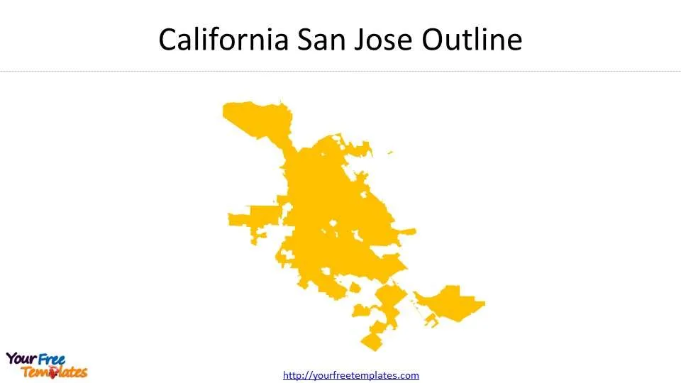
Slide 1, California San Jose Outline
San Jose is in the central part of California state and the county seat of Santa Clara. With a population of 1.78 million people, San Jose has been the third largest city in California and the tenth populated city in the US.
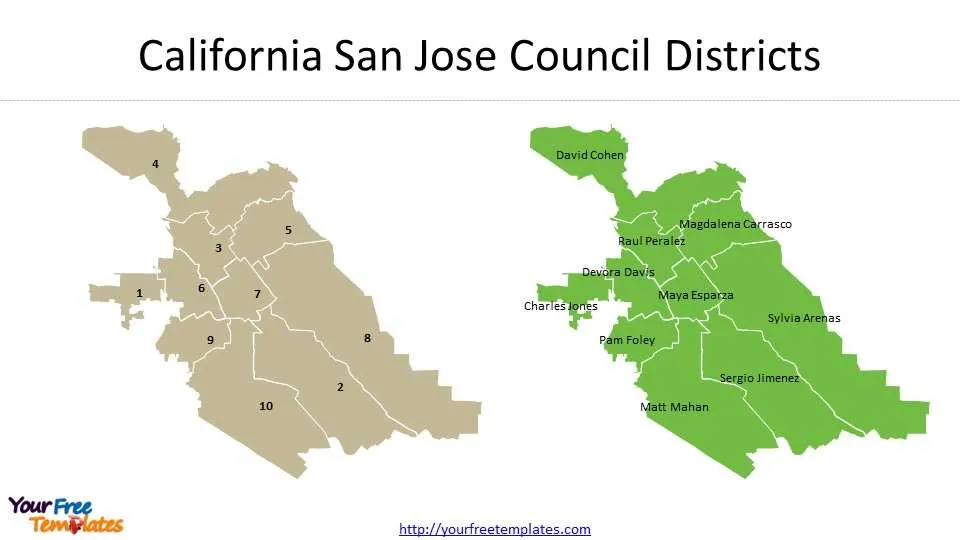
Slide 2, San Jose Map California with Council Districts
It has ten council districts in the San Jose Map, together with their representative council members.
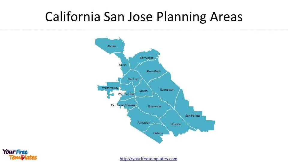
Slide 3, San Jose Map California with Planning Areas
There are 15 Planning Areas in the San Jose. They are Almaden, Alum Rock, Alviso, Berryessa, Calero, Cambrian/Pioneer, Central, Coyote, Edenvale, Evergreen, North, San Felipe, South, West Valley, and Willow Glen.
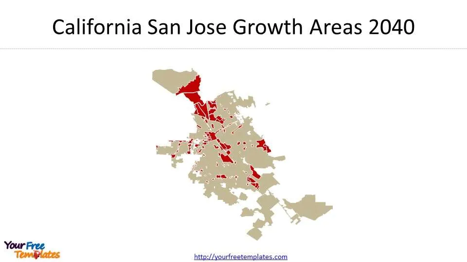
Slide 4, California San Jose Growth Areas 2040
Boundaries of GP 2040 are identified growth areas in San Jose, updating on a weekly basis.
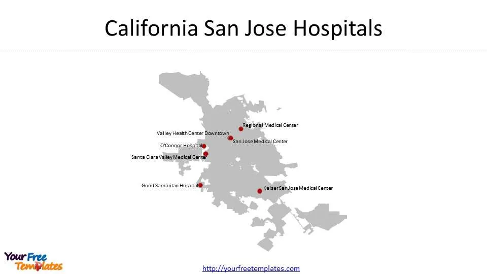
Slide 5, California San Jose Hospitals
There are seven hospitals in San Jose city. The map shows the location of each hospital in the city. They are Good Samaritan Hospital, Kaiser San Jose Medical Center, O’Connor Hospital, Regional Medical Center, San Jose Medical Center, Santa Clara Valley Medical Center, and Valley Health Center Downtown.
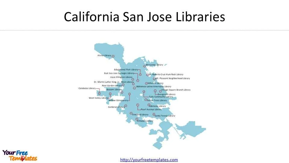
Slide 6, San Jose Map California with Libraries
There are 25 libraries in San Jose City. The map shows the location of each library in the city. They are Almaden Library, Alviso Library, Bascom Library, Berryessa Library, Biblioteca Latino-Americana Library, Calabazas Library, Cambrian Library, Dr. Martin Luther King, Jr. Main Library, Dr. Roberto Cruz Alum Rock Library, East San Jose Carnegie Library, Edenvale Library, Educational Park Library, Evergreen Library, Hillview Library, Joyce Ellington Library, Mt. Pleasant Neighborhood Library, Pearl Avenue Library, Rose Garden Library, Santa Teresa Library, Seven Trees Library, Tully Community Library, Village Square Branch Library, Vineland Library, West Valley Library, and Willow Glen Library.
For other interesting maps, pls visit our ofomaps.com
You can check our site for more US cities.
- For Chicago map covering 7 slides showing City Boundary, 77 Community Plan Areas, 50 wards, Central Business District, 26 Industrial Corridors, 6 Enterprise Zones, and 22 Police Districts
- For Los Angeles map covering 5 slides showing city Boundary,7 Area Planning Commission, 35 Community Plan Area, 15 Council Districts and 99 Neighborhoods.
- For Washington DC map covering 8 slides showing Washington DC Boundary, Quadrants, 8 Wards, 7 Police Districts, 21 Police Sectors, and 57 Police Service Areas (PSAs).
Size:533K
Type: PPTX
[sociallocker]Aspect Ratio: Standard 4:3
Click the blue button to download it.
Download the 4:3 Template
Aspect Ratio: Widescreen 16:9
Click the green button to download it.
Download the 16:9 Template[/sociallocker]


