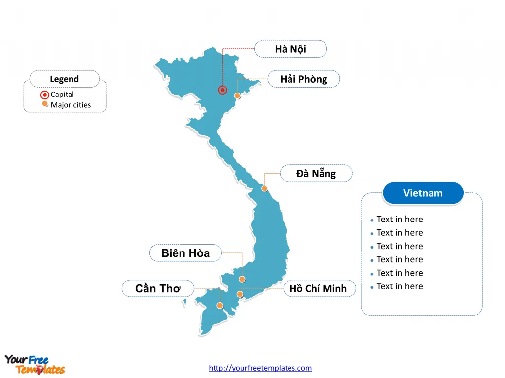
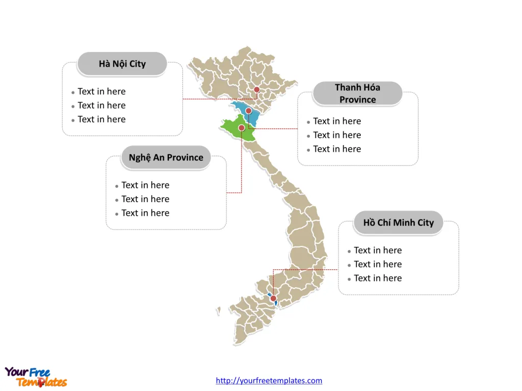
Free Vietnam map with 58 provinces and five municipalities, highlighting Hồ Chí Minh City, Hà Nội City, Thanh Hóa Province, and Nghệ An Province. Vietnam editable map labeled with national capital and major cities, Hanoi, Ho Chi Minh City, Hải Phòng, Cần Thơ, Biên Hòa, and Đà Nẵng.
Vietnam is a captivating country located in the southeastern part of Asia, nestled on the eastern edge of the Indochinese peninsula. It shares borders with China to the north, Laos to the northwest, Cambodia to the southwest, and the South China Sea to the east. This elongated country is known for its diverse landscapes which include lush mountains, fertile deltas, primeval forests, and almost 3,500 kilometers of coastline boasting beautiful beaches. Vietnam has 100.3 million people in 2023, it is the world‘s 14th-most-populous country, and the ninth-most-populous Asian country.
The Vietnam Map Template includes two slides.
Slide 1, Vietnam map of outline labeled with capital and major cities.
The capital and largest city is Hanoi and Ho Chi Minh City respectively, other major cities including Hải Phòng, Cần Thơ, Biên Hòa, and Đà Nẵng on the Vietnam map.
Major Cities
Vietnam boasts several major cities, each brimming with culture, history, and unique attractions:
- Hanoi: The capital of Vietnam, Hanoi is located in the northern part of the country. Known for its centuries-old architecture, vibrant street markets, and rich culture, Hanoi is the political and cultural heart of Vietnam. The city is also famous for its historical sites, including the Ho Chi Minh Mausoleum and the Old Quarter, which offers a glimpse into the past with its well-preserved colonial buildings and ancient pagodas.
- Ho Chi Minh City (formerly Saigon): The largest city in Vietnam and the economic powerhouse of the country, Ho Chi Minh City is located in the southern region. It is a bustling metropolis characterized by its dynamic atmosphere, skyscrapers, and traffic-laden streets. The city is also known for its role in the Vietnam War, with sites like the War Remnants Museum drawing in those interested in the country’s modern history.
- Da Nang: Situated in central Vietnam, Da Nang is a coastal city known for its sandy beaches and history as a French colonial port. The city is a gateway to several UNESCO World Heritage Sites, including the Imperial City of Hue, the Old Town of Hoi An, and the My Son ruins.
- Hai Phong: As a major port city in northern Vietnam, Hai Phong serves as a crucial maritime and trade center. It’s also the gateway to the famous Halong Bay, known for its emerald waters and thousands of towering limestone islands topped with rainforests.

Slide 2, Vietnam map of political divisions labeled with major administration districts.
Major Provinces and Municipalities
Vietnam is divided into 58 provinces and 5 municipalities. These provinces and municipalities are significant for their economic contribution, cultural heritage, and natural beauty with the important ones labeled on the Vietnam map:
- Quang Ninh Province: Home to the UNESCO World Heritage Site of Halong Bay, Quang Ninh is located in the northeastern part of Vietnam. Its spectacular seascape of limestone pillars is one of the country’s top tourist attractions.
- Lao Cai Province: Bordering China, Lao Cai is known for the mountainous town of Sapa, which is famed for its terraced rice fields, diverse ethnic communities, and the highest peak in Vietnam, Fansipan.
- Thua Thien-Hue Province: This central province is home to the ancient imperial city of Hue, another UNESCO World Heritage Site. The city’s historical monuments and the annual Hue Festival attract visitors interested in the cultural and historical depth of Vietnam.
- Khanh Hoa Province: Located on the south-central coast, Khanh Hoa is famous for the resort city of Nha Trang, which offers beautiful beaches, a vibrant nightlife, and offshore islands that are perfect for snorkeling and diving.
- Can Tho: As the largest city in the Mekong Delta, Can Tho is known as the “Western Capital” of Vietnam. It’s famous for its floating markets, where life on the water can be experienced firsthand, and its intricate network of waterways.
- Da Lat: Situated in the Central Highlands, Da Lat is known as the “City of Eternal Spring” for its temperate climate. It is a popular destination for both domestic and international tourists, with its beautiful flower gardens, pine-covered hills, and French colonial architecture.

Vietnam’s rich tapestry of cities, provinces, and municipalities contributes to its unique charm as a travel destination. The country’s geographic diversity, from bustling urban centers to serene landscapes, offers a journey through a land of historical significance and natural splendor. Whether exploring the cultural depths of Hanoi, the dynamic pulse of Ho Chi Minh City, or the natural wonders found in its provinces, Vietnam promises an unforgettable experience for any traveler. Each region presents a piece of a larger mosaic that is the vibrant, resilient, and captivating nation of Vietnam.
Detailed Vietnam map of political administrative divisions please refer to Wikipedia Vietnam.
Size: 206K
Type: PPTX
Aspect Ratio: Standard 4:3
Click the blue button to download it.
Download the 4:3 Template
Aspect Ratio: Widescreen 16:9
Click the green button to download it.
Download the 16:9 Template


