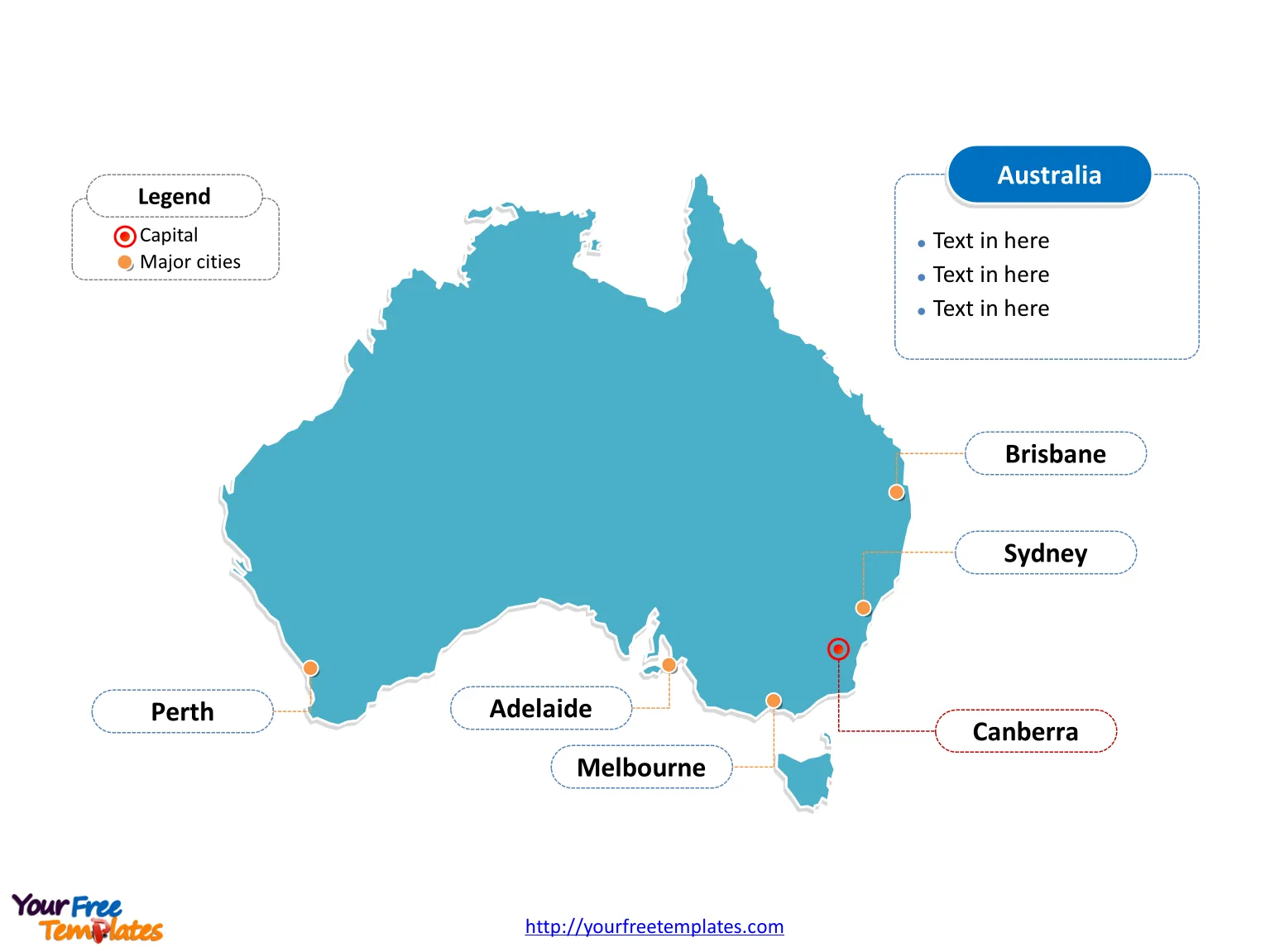
Free map Australia or Aus map with six states and two major mainland territories, highlighting New South Wales, Victoria, Queensland, and Western Australia states. Country Outline map labeled with Canberra, Sydney, Melbourne, Brisbane, Perth, and Adelaide cities.
Slide 1, This map Australia labeled with capital and major cities.
Australia is a country comprising the mainland of the Australian continent, the island of Tasmania and numerous smaller islands. It is the world’s sixth-largest country by total area. The neighboring countries are Papua New Guinea, Indonesia and East Timor; the Solomon Islands and Vanuatu; and New Zealand.
Australia’s Capital, Major Cities on map Australia
Australia, the world’s sixth-largest country, is a vast land known for its diverse landscapes, vibrant cities, and unique wildlife. It comprises six states and two major mainland territories, each with its own capital and distinct identity. The major cities on our map Australia are not only centers of commerce and culture but also gateways to Australia’s natural wonders.
Major Cities
Canberra – The Capital City
Canberra, located in the Australian Capital Territory (ACT), is the political heart of the nation. Designed by the American architects Walter Burley Griffin and Marion Mahony Griffin, it is a planned city known for its geometric layout and abundant green spaces. Canberra houses the Parliament House, the High Court, and numerous national monuments and museums, like the Australian War Memorial and the National Gallery of Australia.
Sydney
Sydney, the capital of New South Wales, is Australia’s most populous city. Renowned for its iconic Sydney Opera House and Harbour Bridge, Sydney offers a bustling harbor life, beautiful beaches like Bondi and Manly, and a dynamic arts and culture scene.
Melbourne
The capital of Victoria, Melbourne, is considered Australia’s cultural capital. Famous for its vibrant arts scene, coffee culture, and sports events, such as the Australian Open, Melbourne is a cosmopolitan city with a network of Victorian laneways filled with street art, boutiques, and bars.
Brisbane
Brisbane, the capital of Queensland, is known for its youthful zeal and a subtropical climate. The city has a relaxed outdoor lifestyle, with attractions like the South Bank Parklands and close proximity to renowned beaches of the Gold Coast and Sunshine Coast.
Perth
Located in Western Australia, Perth is one of the most isolated major cities in the world. It boasts stunning beaches, the expansive Kings Park, and a laid-back lifestyle. The city also serves as a gateway to the diverse landscapes of Western Australia, from wine regions to the rugged Kimberley.
Adelaide
Adelaide, the capital of South Australia, is celebrated for its festivals, food, and wine. Known as the “City of Churches,” Adelaide is the wine capital of Australia, surrounded by famous regions like the Barossa Valley and McLaren Vale.
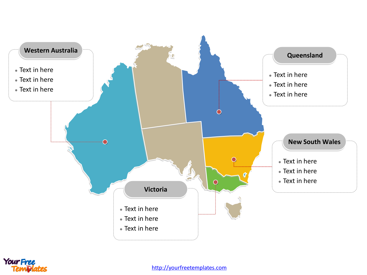
Slide 2, Aus map labeled with 8 administration divisions.
Map Australia is a country divided into six states and two major mainland territories, New South Wales (NSW), Queensland (QLD), South Australia (SA), Tasmania (TAS), Victoria (VIC) and Western Australia (WA), and the Australian Capital Territory (ACT) and the Northern Territory (NT). Every individual political subdivision is an editable shape.
States and Territories on our Aus map
New South Wales (NSW)
The oldest and most populous state, New South Wales is home to Sydney and a range of environments from the Blue Mountains to the Outback towns of Broken Hill.
Victoria (VIC)
Known for Melbourne, Victoria is the smallest mainland state by area but highly urbanized and cultural. It features the Great Ocean Road and numerous national parks.
Queensland (QLD)
Queensland is famous for the Great Barrier Reef, the Daintree Rainforest, and its tropical climate. Brisbane and the Gold Coast are key urban centers.
Western Australia (WA)
Western Australia is the largest state by area, with Perth as its capital. It’s known for its vast desert landscapes, long coastline, and mineral resources.
South Australia (SA)
South Australia, with Adelaide as its capital, is a state renowned for its wine regions and the wilderness of Kangaroo Island and the Flinders Ranges.
Tasmania (TAS)
Tasmania is an island state known for its rugged wilderness and protected parks, with Hobart as the capital. It offers a quieter, cooler alternative to the mainland.
Australian Capital Territory (ACT)
The ACT is a small territory that houses Canberra and serves as the center of government.
Northern Territory (NT)
The Northern Territory, although not a state, is home to Darwin, its capital, and natural wonders such as Uluru (Ayers Rock) and Kakadu National Park.
Australia’s states and territories each offer distinct experiences, from urban sophistication to outback adventures. The country’s major cities are not only economic powerhouses but also cultural beacons that highlight Australia’s diversity and innovative spirit.
- Canberra stands apart as a symbol of political unity, while cities like Sydney and Melbourne showcase Australia’s global cultural influence.
- In Brisbane, Perth, and Adelaide, one can experience the unique blend of urban development and proximity to nature.
- Tasmania and the Northern Territory, though less urbanized, offer some of the most breathtaking natural landscapes and Aboriginal cultural experiences.
- Together, these states, territories, and cities form the multifaceted nation of Australia, a country that continues to attract visitors and migrants with its opportunities, lifestyle, and natural beauty.
Detailed Australia map of political administrative divisions please refer to Wikipedia Australia. You can also try our templates for:
- Australia New South Wales Map template
3 slides, covering New South Wales location map, Greater Capital City Statistical Areas (GCCSA) map with greater Sydney outline map, and outline map with major cities
New South Wales Map - Map of Queensland template
4 slides, covering Queensland location map, Greater Capital City Statistical Areas (GCCSA) map with greater Brisbane outline map, and outline map with major cities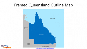
Map of Queensland - Australia Melbourne map template
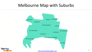
3 slides, covering city ofmunicipal boundary, 17 postcodes, and 14 suburbs
Size: 235K
Type: PPTX
Aspect Ratio: Standard 4:3
Click the blue button to download it.
Download the 4:3 Template
Aspect Ratio: Widescreen 16:9
Click the green button to download it.
Download the 16:9 Template


