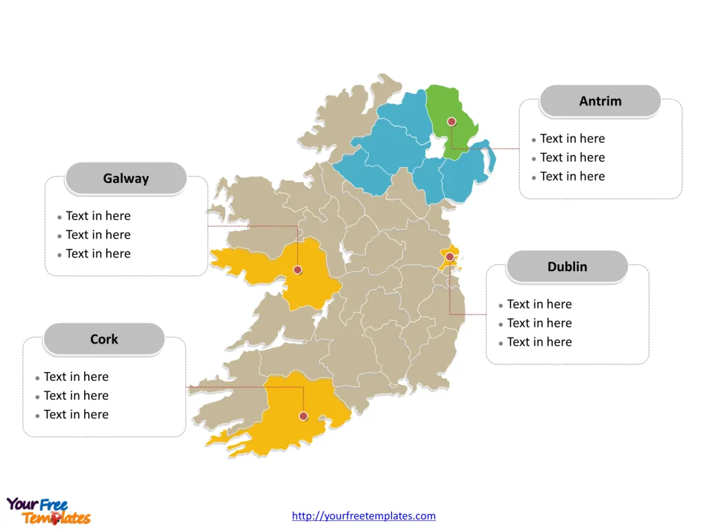
The Map of Ireland and Northern Ireland Template includes three slides. Map of Ireland and Northern Ireland with 34 counties, labeling major counties, Dublin, Antrim, Cork, and Galway. Ireland Island map labeled with capital and major cities, Dublin, Belfast, Cork, Limerick and Waterford.
Ireland, often referred to as the Emerald Isle due to its lush greenery, is located in the North Atlantic Ocean, to the west of Great Britain. It occupies most of the island of Ireland, with Northern Ireland (part of the United Kingdom) occupying the northeastern corner. The Republic of Ireland is the sovereign nation covering the majority of the island. Its only land neighbor is the United Kingdom (Northern Ireland). Beyond its immediate neighbor, Ireland is surrounded by water, with the Atlantic Ocean to the west, the Celtic Sea to the south, the St. George’s Channel to the southeast, and the Irish Sea to the east, separating it from Great Britain.
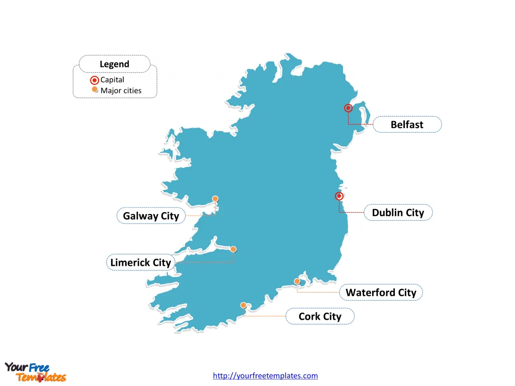
Slide 1, Ireland Island map labeled with capital and major cities.
The island is composing of the Republic of Ireland, which covers just under 56% of the island area, and Northern Ireland, a part of the United Kingdom, which covers the remaining 44% and is located in the northeast of the island. Dublin is the capital and largest city of Republic of Ireland, other major cities including Belfast, Cork, Limerick, Galway, and Waterford.
Ireland, a country renowned for its lush landscapes, rich history, and vibrant culture, is home to several major cities and counties, each with its unique charm and significance. From the bustling streets of Dublin to the historic sites of Belfast, and the scenic beauty of counties like Cork and Galway, Ireland offers a diverse range of experiences.
Major Cities on Map of Ireland and Northern Ireland
- Dublin: As the capital city of Ireland, Dublin is the heart of Irish culture, history, and economy. It’s home to iconic landmarks such as Trinity College, the Book of Kells, and the Guinness Storehouse. Dublin’s vibrant nightlife, bustling streets, and historical architecture make it a must-visit city. The River Liffey divides the city, creating a picturesque setting for Ireland’s most populous urban area.
- Belfast: Located in Northern Ireland, Belfast is known for its rich industrial heritage and its role in the story of the Titanic. The city boasts the Titanic Belfast museum, a tribute to its shipbuilding past. Belfast has transformed into a hub of arts, culture, and gastronomy, offering a blend of historical and modern attractions.
- Cork: Situated in the southwest, Cork is known for its culinary excellence and lively arts scene. It’s a city of contrasts, with medieval streetscapes and modern architectural developments. The English Market, a food market dating back to the 18th century, is a focal point for locals and tourists alike.
- Limerick: Limerick, on the River Shannon, blends medieval heritage with contemporary culture. King John’s Castle and St. Mary’s Cathedral highlight its historical significance, while the Limerick City Gallery of Art reflects its modern artistic endeavors.
- Waterford: Famous for its namesake crystal, Waterford is Ireland’s oldest city, founded by Vikings in 914 A.D. The city’s rich history is evident in its well-preserved Viking relics and medieval structures, including Reginald’s Tower.
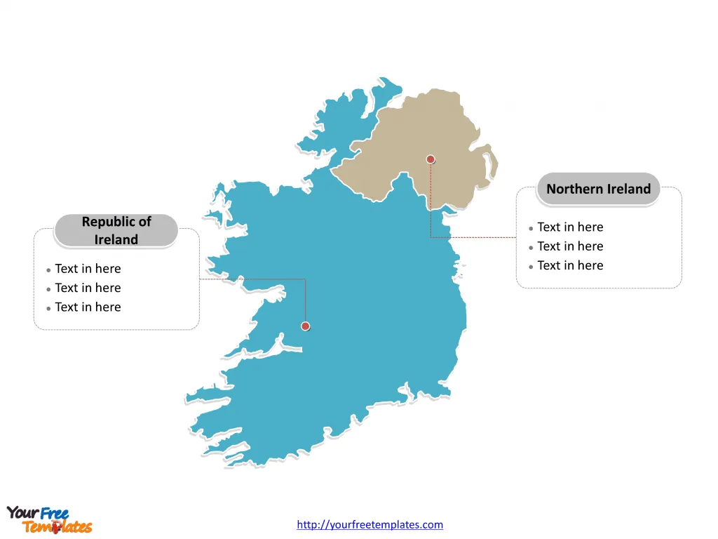
Slide 2, Map of Ireland and Northern Ireland labeled with Republic of Ireland and Northern Ireland.
Ireland is an island divided into Republic of Ireland and Northern Ireland, one country of UK. Every individual political subdivision is an editable shape.
Slide 3, Map of Ireland and Northern Ireland labeled with major administration districts.
Ireland is an island divided into 34 counties, 28 for Ireland and 6 for Northern Ireland: Antrim, Armagh, Carlow, Cavan, Clare, Cork, Donegal, Down, Fermanagh, Galway, Kerry, Kildare, Kilkenny, Laois, Leitrim, Limerick, Londonderry, Longford, Louth, Mayo, Meath, Monaghan, Offaly, Roscommon, Sligo, Tipperary, Tyrone, Waterford, Westmeath, Wexford, Wicklow, Dún Laoghaire–Rathdown, Fingal, and South Dublin. The most populated counties are Dublin, Cork, Galway and Antrim. Every individual political subdivision is an editable shape.
Major Counties on Map of Ireland and Northern Ireland
- Dublin: Beyond the city, County Dublin encompasses suburban and rural areas offering scenic beauty and tranquility. It’s a mix of modern living and historical sites, with coastal towns like Howth and Dalkey providing picturesque escapes.
- Antrim: In Northern Ireland, County Antrim is home to the Giant’s Causeway, a UNESCO World Heritage site. The county’s rugged coastline, historic castles, and the vibrant city of Belfast make it a region of considerable interest.
- Cork: County Cork, with its spectacular coastline, charming villages, and the vibrant city of Cork, is known for its cultural richness and natural beauty. It’s a haven for food lovers, history enthusiasts, and nature seekers.
- Galway: County Galway is synonymous with traditional Irish culture, hosting the famous Galway Arts Festival. Its stunning landscapes, including Connemara and the Aran Islands, along with the lively city of Galway, make it a popular destination for visitors seeking the essence of Ireland.
Each of these cities and counties contributes to Ireland’s allure, offering a blend of history, culture, and natural beauty that captivates travelers from around the world.
Please check our premium maps in ofomaps.com.
Size: 205K
Type: PPTX
Aspect Ratio: Standard 4:3
Click the blue button to download it.
Download the 4:3 Template
Aspect Ratio: Widescreen 16:9
Click the green button to download it.
Download the 16:9 Template


