The Georgia counties map Template in PowerPoint format includes eleven slides. You can enjoy the Georgia on the United States Map, Framed Georgia map with surrounding states, the outline boundary of Georgia, Blank or labeled Georgia County Map, Georgia Regional Commission Boundaries, Georgia Major River Basins, Georgia Municipal Solid Waste Landfills, 7 Georgia Department of Transportation Districts, Georgia Power Outages View and Georgia Senate Districts. You can also enjoy our blank or labeled Florida state map, Texas state map, Chicago map, Los Angeles map, New York map, Washington DC map and US map with states.
All the GIS data has been extracted from the Georgia State’s ARC Open Data & Mapping Hub. Different layers of data have been combined for analysis or demonstration only and should not be regarded as the actual boundaries.
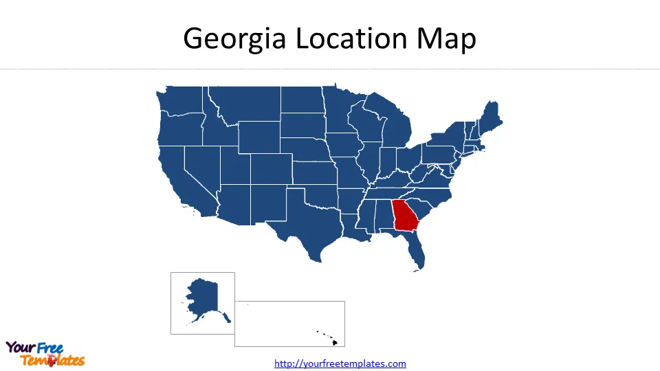
Slide 1, Georgia location map
Our State of Georgia map is for the southeast state of the United States. It is one of 50 states for the western country plus a federal district, Washington DC. The states of Alaska and Hawaii have been placed under the mainland for the purpose of demonstration only. The city of Atlanta was known as the host of 1996 Summer Olympics games.
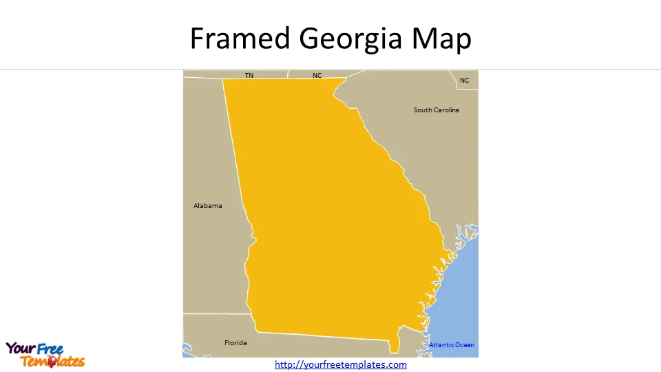
Slide 2, Framed Georgia Map
The neighboring states are Tennessee, North Carolina, South Carolina, Florida, and Alabama. The Atlantic Ocean is surrounding the state from the east.
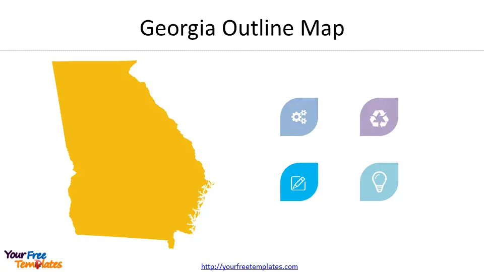
Slide 3, Georgia Outline Map
The blank Outline Map of Georgia has been decorated with small icons; you can add your icons or text to present your ideas, such as cloud computing, Olympic games, artificial intelligence, and something like that.
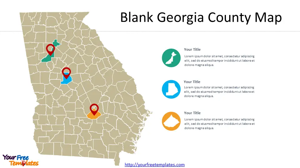
Slide 4, Blank Georgia counties Map
There are 159 Counties in this Georgia County Map. As showed in this map, you can highlight any counties you like, in the right the most populated target counties will be filled in white to show information on them.
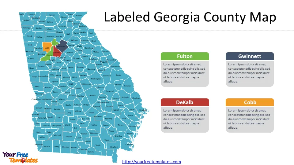
Slide 5, Labeled Georgia County Map with 159 counties
We have grouped the text and shapes respectively, so you can easily deal with it to fit your purpose. You can check the 159 Counties in Wikipedia, List of counties in Georgia. The top four populated counties have been highlighted including Fulton County, Gwinnett County, Cobb County, and DeKalb County.
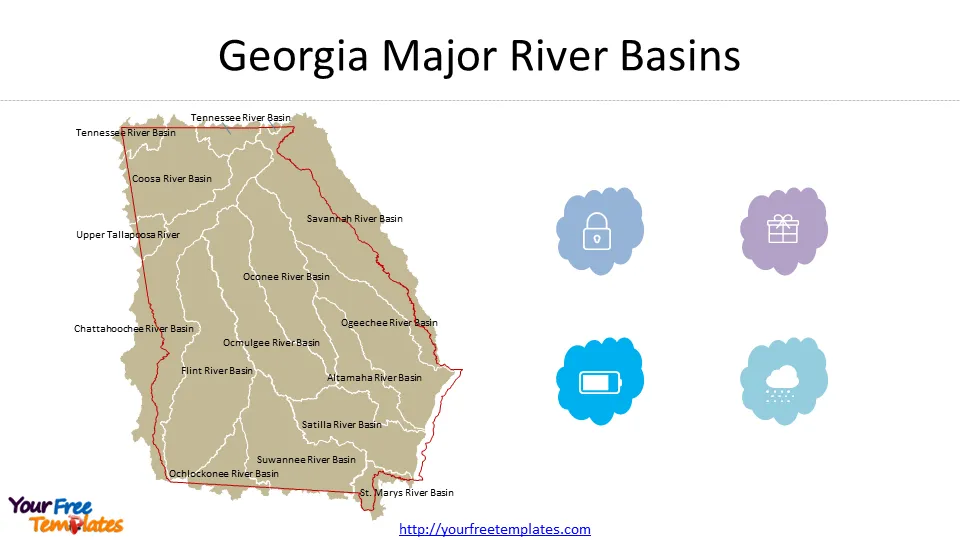
Slide 6, Georgia Major River Basins
There are 14 Major River Basins for the Georgia state, which are Altamaha River Basin, Chattahoochee River Basin, Coosa River Basin, Flint River Basin, Ochlockonee River Basin, Ocmulgee River Basin, Oconee River Basin, Ogeechee River Basin, Satilla River Basin, Savannah River Basin, St. Marys River Basin, Suwannee River Basin, Tennessee River Basin, Upper Tallapoosa River. We put the State boundary over the 14 River Basins to see how the state share basins with neighboring states. You can learn this topic in detailed from Meyer, Judith and Gretchen Loeffler. “River Basins.” New Georgia Encyclopedia, last modified Dec 10, 2019.
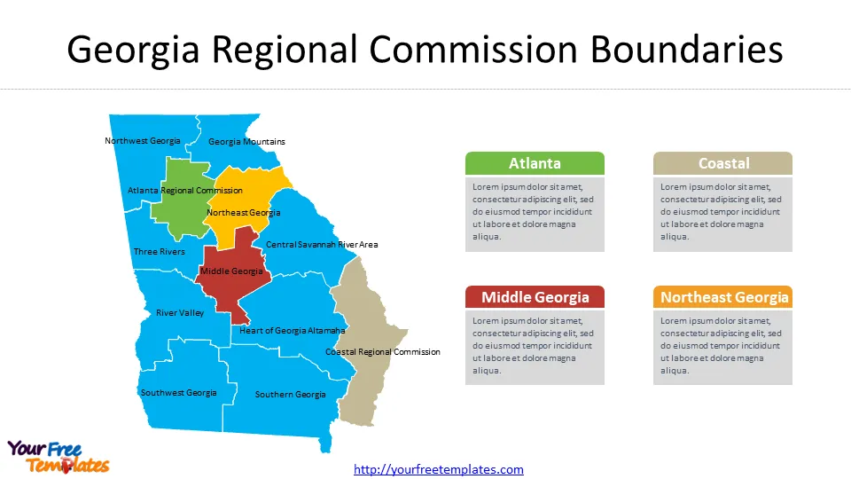
Slide 7, Twelve Georgia Regional Commission Boundaries
Georgia’s twelve regional commissions are public agencies created and established by the Georgia Planning Act to assist local governments to develop, promote and assist in establishing coordinated and comprehensive planning in the state. The 12 regional commission are Atlanta Regional Commission, Central Savannah River Area, Coastal Regional Commission, Georgia Mountains, Heart of Georgia Altamaha, Middle Georgia, Northeast Georgia, Northwest Georgia, River Valley, Southern Georgia, Southwest Georgia, and Three Rivers. It is interesting to put the Regional Commission boundaries above Georgia counties map template, as showed on the right.
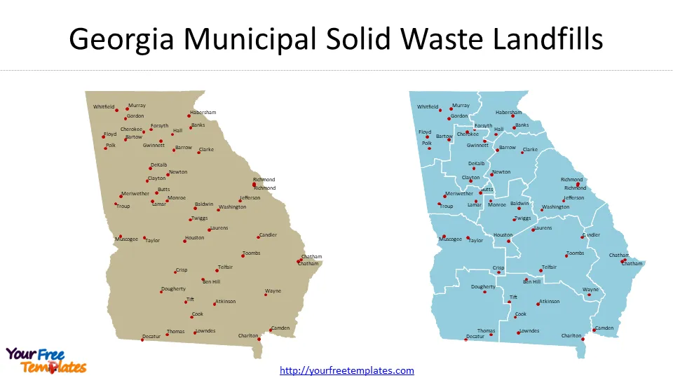
Slide 8, Georgia Municipal Solid Waste Landfills
The definition from EPA is that A municipal solid waste landfill (MSWLF) is a discrete area of land or excavation that receives household waste. There are 49 MSWLFs in Georgia, which marked with their county names as you can see in the left chart. The Georgia Regional Commission Boundaries have been placed over the marks of MSWLF, showing Georgia Municipal Solid Waste Landfills by regions. You can also try other boundaries to fit your purpose.
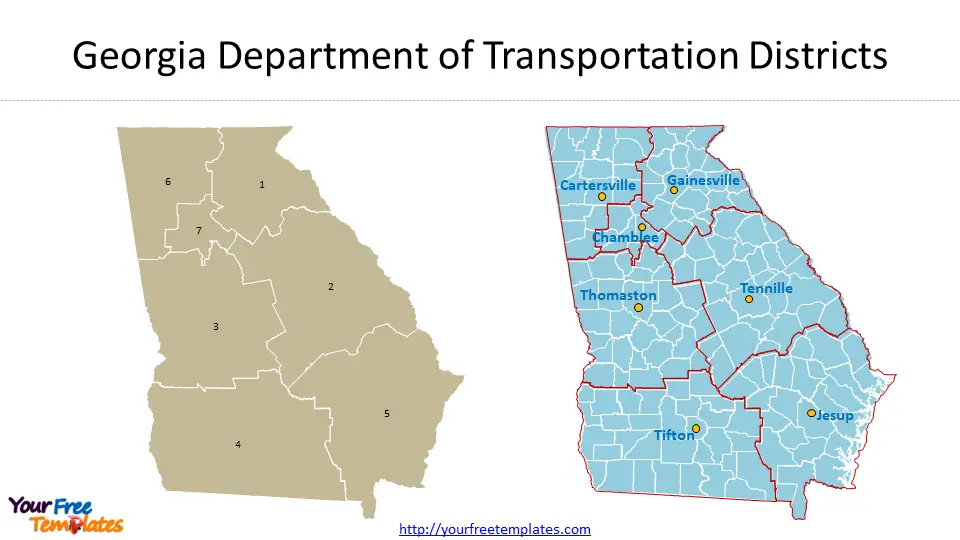
Slide 9, Seven Georgia Department of Transportation Districts
As the Georgia state government describes that The Georgia Department of Transportation (GDOT) has committed to moving people and goods through the state in a timely and efficient manner, the GDOT works to maintain safety on roadways and relieve congestion on the interstates. There are seven transportation districts in Georgia State. Based in the state office complex in downtown Atlanta, GDOT also operates seven district offices, in Cartersville, Chamblee, Gainesville, Jesup, Tennille, Thomaston, and Tifton. The seven offices are marked in Georgia counties map template, combined with the outline of transportation districts.
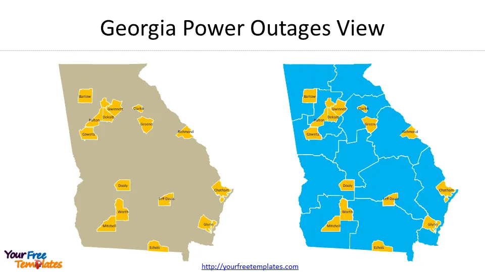
Slide 10, Georgia Power Outages View
It is from the Georgia Power that It’s important to stay informed throughout storm season. The outage cause could be Severe Weather including Thunderstorms, Snow/Ice, and Winter, Hurricanes and Tornadoes etc. The 15 counties labeled on the map have witnessed outage in last October, including Bartow, Chatham, Clarke, Coweta, Dekalb, Dooly, Echols, Fulton, Glynn, Greene, Gwinnett, Jeff Davis, Mitchell, Richmond, and Worth.
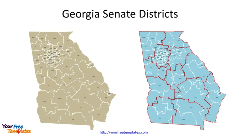
Slide 11, 56 Georgia Senate Districts
The official explanation is from Georgia Senate. Composed of 56 members elected every two years, the Georgia Senate meets over a non-consecutive 40-day period beginning in mid-January to set the state’s annual operating budget and to create and amend a variety of laws on topics ranging from healthcare to public safety. The 3-digit district numbers are labeled on the map, likewise we put the regional Commission Boundaries over it to present the concentration of senate districts in Atlanta region.
For other interesting maps, pls visit our ofomaps.com
Size:508K
Type: PPTX
[sociallocker]Aspect Ratio: Standard 4:3
Click the blue button to download it.
Download the 4:3 Template
Aspect Ratio: Widescreen 16:9
Click the green button to download it.
Download the 16:9 Template[/sociallocker]


