


How a Four-Part Strait of Gibraltar Map Series Reveals Europe’s Gateway as the Last Line of Defense in Global Trade
A Strait of Gibraltar map is often viewed as a simple geographical reference—a narrow blue gap between Spain and Morocco connecting the Mediterranean Sea to the Atlantic Ocean. But in the context of the current Middle East conflict, a Strait of Gibraltar map tells a far more urgent story. As of March 2026, with the Strait of Hormuz effectively closed to commercial shipping and the Bab-el-Mandeb strait under constant threat from Houthi forces in Yemen, the world’s maritime trade network has been forced to reroute. And that rerouting has made the Strait of Gibraltar map one of the most closely watched documents in global shipping. Every vessel that wishes to access the Mediterranean from the Atlantic must pass through this 8.9-mile-wide passage. Every oil tanker redirected from the Suez Canal must navigate it. Every container ship carrying goods from Asia to Europe via the Cape of Good Hope must eventually pass through it. To truly understand the Strait of Gibraltar map location and its role in the current crisis, you cannot view it in isolation. By designing a four-part PPT template that zooms out from the strait to encompass the entire Mediterranean, North Africa, and the Middle East, you have created a powerful visual narrative of how a conflict in the Persian Gulf forces the world to redraw its maritime routes.
At the end of this post, you can download our Strait of Gibraltar Map PowerPoint template to fit your purpose. As the same diagram PowerPoint template series, you can also find our Bab-el-Mandeb Strait Map, Strait of Hormuz Map, Middle East map, Strait of Malacca Map, Red Sea with Trade Routes, India-Middle East-Europe Economic Corridor Map
Here is how we can explore the significance of your Strait of Gibraltar map series.
Map 1: The Gateway Itself — Spain, Morocco, and the Atlantic-Mediterranean Link
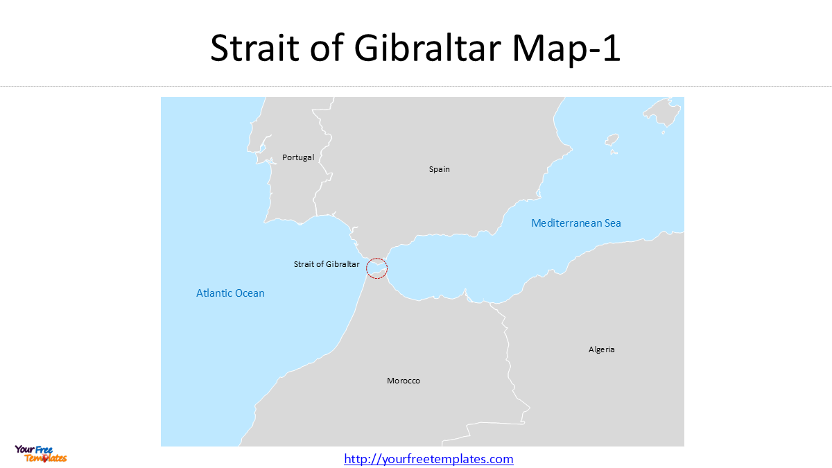
The first slide in your deck zooms in on the Strait of Gibraltar map location itself. At its narrowest point, the strait is only 8.9 nautical miles wide (about 14 kilometers), separating the Iberian Peninsula from North Africa . This is where the Mediterranean Sea meets the Atlantic Ocean, and it is one of the busiest waterways in the world.
Your Strait of Gibraltar map at this scale highlights the surrounding nations: Portugal, Spain, Morocco, and Algeria. It also shows the strategic British Overseas Territory of Gibraltar, a rocky promontory that has been a military stronghold for centuries . The Rock of Gibraltar dominates the northern side of the strait, serving as a sentinel over all vessels passing between the Mediterranean and the Atlantic.
This slide visually answers the fundamental question: Where is the Strait of Gibraltar map location? It is the gateway through which all Mediterranean maritime trade must pass—unless ships take the 5,000-mile detour around the Cape of Good Hope.
Map 2: Expanding West — France and the Pyrenees Connection
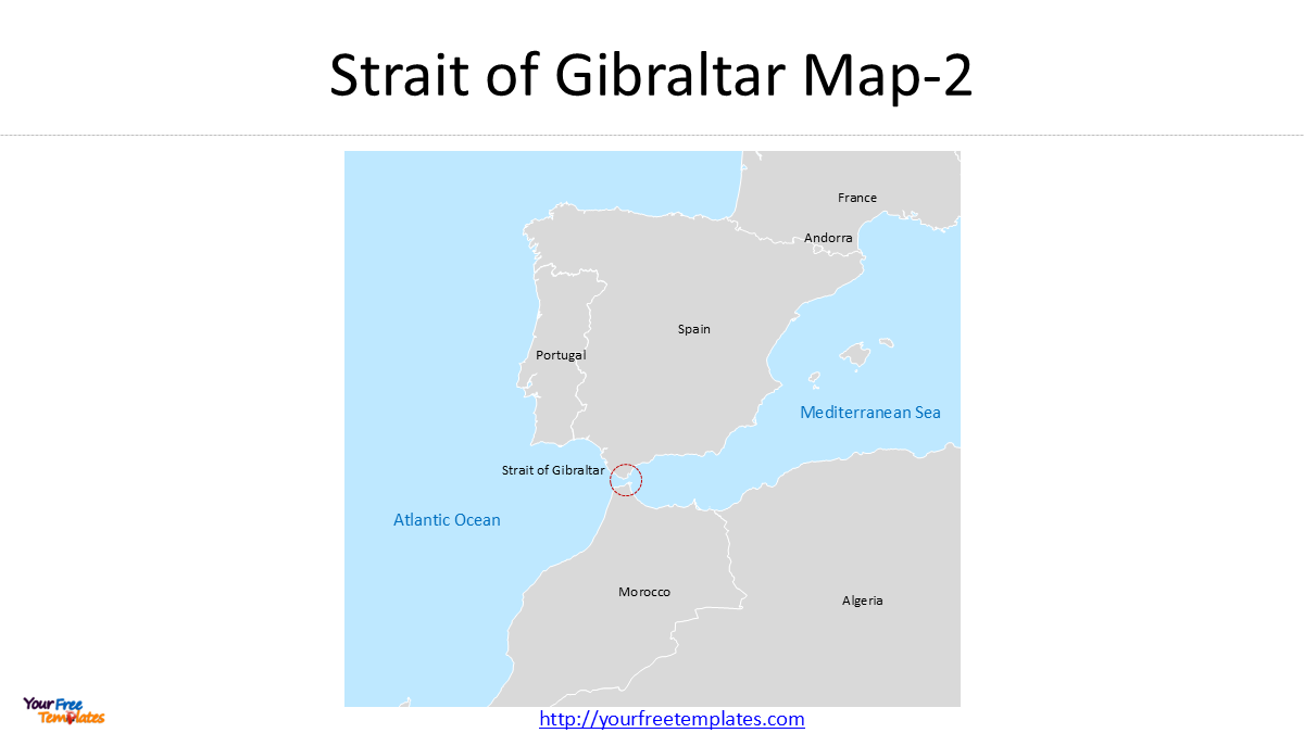
Zooming out, your second Strait of Gibraltar map expands the frame to include France and Andorra. This slide begins to show the strait’s connection to the European heartland.
Why is this important? Because a Strait of Gibraltar map that includes France reminds viewers that the strait is not just a maritime chokepoint; it is the entrance to the Mediterranean’s northern industrial coastline. Major European ports such as Marseille, Barcelona, and Genoa depend entirely on the strait for access to the global ocean. Any disruption at the strait does not just affect Spain and Morocco—it ripples through the entire European Union.
This slide also visually reinforces the geographical reality that the Strait of Gibraltar map location is the only maritime exit for the Mediterranean Sea. Unlike the Strait of Hormuz, which has alternative pipelines (albeit limited), the Mediterranean has no alternative maritime route to the Atlantic. If the Strait of Gibraltar were ever blocked, the entire Mediterranean basin—from Spain to Turkey, from Italy to Egypt—would be cut off from the global ocean.
Map 3: Eastward Expansion — Italy, Tunisia, and Libya
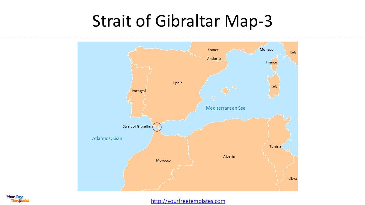
Your third Strait of Gibraltar map continues the eastward expansion, bringing Italy, Tunisia, and Libya into view. This map connects the strait to the central Mediterranean and the North African coastline.
At this scale, the Strait of Gibraltar map tells a story of interdependence. Italy (specifically the islands of Sicily and Lampedusa) sits at the center of the Mediterranean, while Tunisia and Libya face it from the African shore. This region has been a focal point for migration, energy pipelines, and geopolitical tension for decades.
In the context of the current Middle East conflict, this Strait of Gibraltar map highlights a crucial point: With the Strait of Hormuz effectively closed and the Bab-el-Mandeb under threat, the Mediterranean’s eastern entrances are compromised. That means the Strait of Gibraltar is now bearing the full weight of redirected maritime traffic. Oil that would have flowed through the Suez Canal is now being rerouted around the Cape of Good Hope and up through the Strait of Gibraltar to reach European markets. This slide visualizes that dramatic shift in global shipping patterns.
Map 4: The Grand View — North Africa, the Middle East, and the Black Sea
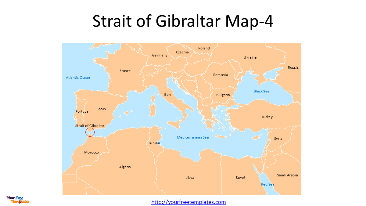
The final slide in your Strait of Gibraltar map series takes the macro view, expanding the frame to include the entire North African coastline, the Middle East, and extending to the Black Sea and the Red Sea. This is where your Strait of Gibraltar map becomes a map of global crisis management.
At this scale, the Strait of Gibraltar map shows:
-
The Black Sea: Connected to the Mediterranean via the Bosphorus Strait and the Dardanelles. This is a critical route for Ukrainian grain and Russian energy exports.
-
The Red Sea: The gateway to the Suez Canal and, beyond it, the Bab-el-Mandeb and the Strait of Hormuz.
-
The entire North African coastline: From Morocco to Egypt, this region is now the frontline of a maritime conflict that spans from the Atlantic to the Persian Gulf.
This final Strait of Gibraltar map tells the full story. With both the Strait of Hormuz and the Bab-el-Mandeb under pressure or effectively closed, the Strait of Gibraltar is no longer just a regional chokepoint—it is the Mediterranean’s last remaining open gateway. Every vessel that wishes to access the Mediterranean from the Atlantic must pass through it. Every oil tanker rerouted from the Suez Canal must navigate it. Every container ship carrying goods from Asia to Europe via the Cape of Good Hope must eventually pass through it.
The 2026 Context: Why the Strait of Gibraltar Map Matters Now More Than Ever
As of March 2026, the global shipping industry is facing a crisis of chokepoint closures. Following the joint US-Israeli strikes on Iran on February 28, 2026, Iran effectively shut down the Strait of Hormuz to commercial shipping. On March 7, 2026, only one commercial vessel passed through Hormuz, and no oil tankers transited at all .
At the same time, the Bab-el-Mandeb strait remains under threat from Houthi forces in Yemen, who have declared that “our fingers are on the trigger at any moment” . Major shipping lines including Maersk, Hapag-Lloyd, CMA CGM, and MSC have paused Red Sea transits and rerouted vessels around the Cape of Good Hope .
What does this mean for the Strait of Gibraltar map? It means that the strait is now the choke point for all Mediterranean-bound traffic that would have previously used the Suez Canal. The Cape of Good Hope route adds thousands of nautical miles to each journey, and the final leg of that journey—entering the Mediterranean—is through the Strait of Gibraltar.
This has transformed the Strait of Gibraltar map location from a regional passageway into a global bottleneck. The volume of vessels passing through it has surged, creating congestion, increasing insurance costs, and raising the strategic importance of the territory of Gibraltar itself.
Conclusion
A Strait of Gibraltar map is often viewed as a geographical curiosity—a narrow gap between Spain and Morocco. But a series of four Strait of Gibraltar map slides—zooming out from the strait to the entire Mediterranean, North Africa, and the Middle East—tells a very different story. It is the story of how a conflict in the Persian Gulf forces the global shipping industry to reroute half the world’s trade through a single 8.9-mile-wide passage.
Your PPT template visualizes the interconnectedness of the world’s maritime chokepoints. When the eastern gates close, the western gate becomes the world’s lifeline. And that gate, the Strait of Gibraltar, is now carrying a burden it has not borne since the days of World War II. A Strait of Gibraltar map is no longer just a reference tool—it is a strategic document for understanding the future of global trade.
Looking for Premium maps, please visit our affiliate site: https://editablemaps.com/ or https://ofomaps.com/
Size:117K
Type: PPTX
Strait of Gibraltar Map Template
Click the link to download it.
Aspect Ratio: Widescreen 16:9
Click the green button to download it.
Download the 16:9 Template