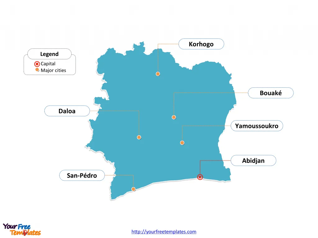
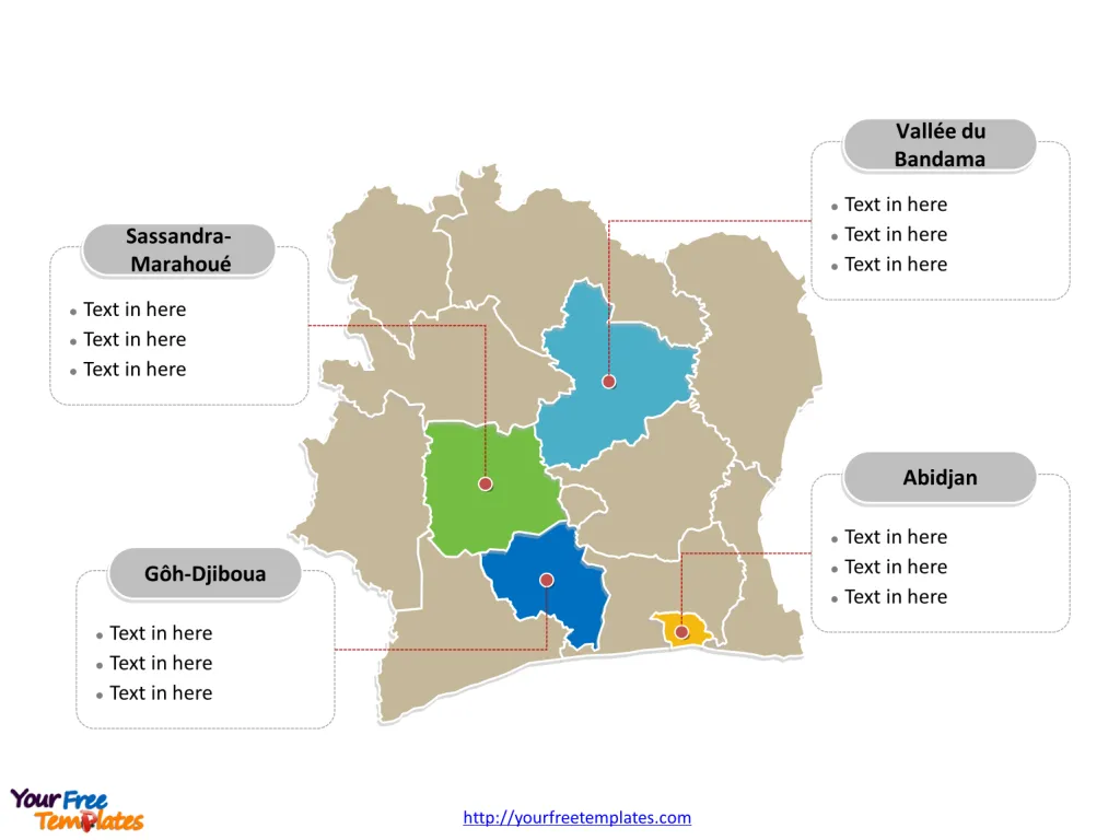
The Ivory Coast Map Template includes two slides. Ivory Coast map with 14 districts, labeling with major districts, Abidjan, Sassandra-Marahoué, Vallée du Bandama, and Gôh-Djiboua. Ivory Coast map labeling with national capital and major cities, Abidjan, Bouaké, Daloa, Korhogo, Yamoussoukro, and San-Pédro.
Ivory Coast, officially known as Côte d’Ivoire, is a country situated on the south coast of West Africa, bordering the Gulf of Guinea. It shares direct national borders with Burkina Faso, Ghana, Guinea, Liberia, and Mali. The country has a population of approximately 28.1 million people, with a significant urban population, and a life expectancy of around 57.4 years for males and 59.9 years for females.
The economy of Ivory Coast is characterized by a GDP of around $70.02 billion, a moderate unemployment rate of 2.64%, and a relatively high inflation rate of 5.28%. Ivory Coast is known for being the world’s largest exporter of cocoa beans and is a member of several international organizations including the African Union, the United Nations, and the World Trade Organization.
Slide 1, Ivory Coast map labeled with capital and major cities.
Ivory Coast’s political capital is Yamoussoukro, and its economic capital and largest city is the port city of Abidjan, other major cities including Bouaké, Daloa, Korhogo, and San-Pédro.
Capital and Major cities on Ivory Coast map
Abidjan: As the economic capital and largest city, Abidjan is a bustling urban center known for its commercial and administrative activities. With a population of 4,395,243, it serves as a major hub for commerce and industry, shaping Ivory Coast’s economic dynamics.
Bouaké: Bouaké, located in the Vallée du Bandama District, is the second-largest city in Ivory Coast, with a population of 536,719. It is a prominent center for cultural and economic activities, contributing to the region’s vitality.

Daloa: Daloa, situated in the Sassandra-Marahoué District, is a significant city with a population of 245,360. It is known for its agricultural and industrial activities, playing a pivotal role in the country’s economic landscape.
Korhogo: Korhogo, part of the Savanes District, is a vibrant city with a population of 243,048. It serves as a key center for trade and cultural exchange, influencing the dynamics of the Savanes region.
Yamoussoukro: As the political capital, Yamoussoukro has a population of 212,670 and holds historical and administrative significance, housing the country’s political institutions and heritage sites.
San-Pédro: San-Pédro, located in the Bas-Sassandra District, is a major port city with a population of 164,944. It serves as a vital center for maritime trade and contributes to the coastal region’s economic activities.
These cities collectively contribute to Ivory Coast’s diverse urban landscape, each playing a unique role in shaping the country’s economic, political, and cultural identity.
Slide 2, Ivory Coast map labeled with major districts.
Ivory Coast is a country divided into 14 districts, Abidjan, Bas-Sassandra, Comoé, Denguélé, Gôh-Djiboua, Lacs, Lagunes, Montagnes, Sassandra-Marahoué, Savanes, Vallée du Bandama, Woroba, Yamoussoukro, and Zanzan. Every individual political subdivision is an editable shape.
Capital and Major Districts on Ivory Coast map
Abidjan Abidjan, the economic capital of Ivory Coast, is a bustling urban center and the country’s largest city, with a population of 4,707,404. It serves as a major hub for commerce, industry, and administration, contributing significantly to Ivory Coast’s economy and regional trade. As an autonomous district, Abidjan plays a pivotal role in the country’s economic landscape.

Sassandra-Marahoué The Sassandra-Marahoué District, with Daloa as its capital, is a region of strategic importance. It encompasses the former Haut-Sassandra and Marahoué Regions and boasts a population of 2,293,304. The district is known for its agricultural and industrial activities, making it a vital center for Ivory Coast’s economic development.
Vallée du Bandama The Vallée du Bandama District, with Bouaké as its capital, is a prominent region with a population of 1,607,497. It comprises the former Hambol, Gbêkê, and Worodougou Regions. The district is recognized for its cultural heritage and economic significance, playing a pivotal role in Ivory Coast’s regional dynamics.
Gôh-Djiboua The Gôh-Djiboua District, with Gagnoa as its capital, is a key center for agriculture and commerce. With a population of 1,605,286, it encompasses the former Dix-Huit Montagnes and Moyen-Cavally Regions, contributing significantly to Ivory Coast’s economic and social vitality.
In summary, Ivory Coast’s capital, major cities, and districts play a crucial role in shaping the country’s economic, cultural, and administrative landscape. From the economic prominence of Abidjan to the agricultural significance of Sassandra-Marahoué and Gôh-Djiboua, each location contributes uniquely to Ivory Coast’s regional dynamics and national development.
Looking for Premium maps, please visit our affiliate site: https://editablemaps.com/ or https://ofomaps.com/
Size: 116K
Type: PPTX
Aspect Ratio: Standard 4:3
Click the blue button to download it.
Download the 4:3 Template
Aspect Ratio: Widescreen 16:9
Click the green button to download it.
Download the 16:9 Template


