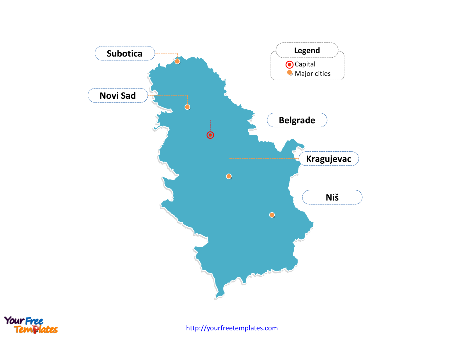
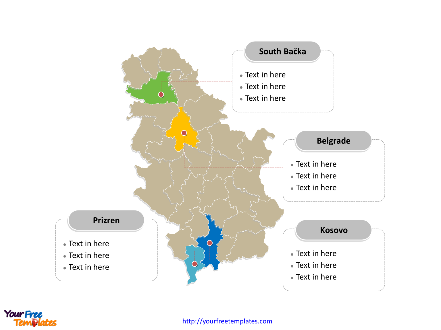
Serbia map with 29 districts, labeling major districts, Belgrade, South Bačka, Kosovo, and Prizren. Serbia Outline map labeled with capital and major cities, Belgrade, Novi Sad, Niš, Kragujevac, and Subotica.
The Map of Serbia Template includes three slides.
Slide 1, Country outline map labeled with capital and major cities.
Serbia is a sovereign state situated at the crossroads of Central and Southeast Europe, covering the southern part of the Pannonian Plain and the central Balkans. It borders Hungary to the north; Romania and Bulgaria to the east; Macedonia to the south; Croatia, Bosnia, Montenegro to the west. Belgrade is the capital and largest city of Serbia, other major cities including Novi Sad, Niš, Kragujevac, and Subotica.

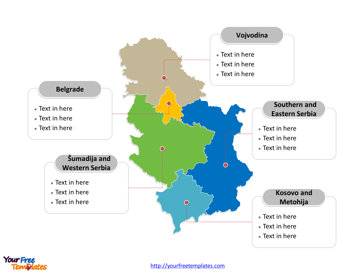
Slide 2, Country political map labeled with major Statistical regions.
Serbia is a country divided into 5 Statistical regions; they are Vojvodina, Belgrade, Šumadija and Western Serbia, Southern and Eastern Serbia, Kosovo and Metohija. Every individual political subdivision is an editable shape.

Slide 3, Country political map labeled with major districts.
Serbia is a country divided into 29 districts, the districts are Belgrade, Bor, Braničevo, Central Banat, Danube, Jablanica, Kolubara, Mačva, Morava, Nišava, North Bačka, North Banat, Pčinja, Pirot, Pomoravlje, Rasina, Raška, South Bačka, South Banat, Srem, Šumadija, Toplica, West Bačka, Zaječar, Zlatibor, Kosovo, Kosovsko-Mitrovica, Kosovsko-Pomoravlje, Peć, and Prizren. Every individual political subdivision is an editable shape.

Size:144K
Type: PPTX
Aspect Ratio: Standard 4:3
Click the blue button to download it.
Download the 4:3 Template
Aspect Ratio: Widescreen 16:9
Click the green button to download it.
Download the 16:9 Template


