Map of France and Belgium has four slides, presenting the outline and sub-divisions of the two countries. The two countries are located in the western European region with the UK, Germany, Netherlands, Luxembourg, Switzerland, Italy, Monaco, Andorra, and Spain.
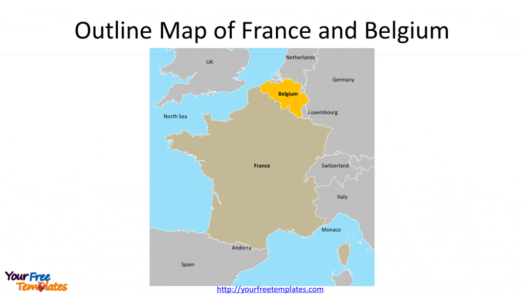
Slide 1, Outline Map of France and Belgium
France and Belgium had been closely in cultural, scientific and technical cooperation among EU member countries due to geographical proximity. It is reported that 40% of Belgians speak French, the Flemish province has French-speaking Community in Belgium. In addition to the outlines of countries, the names of neighboring countries are also labeled in this France and Belgium map.

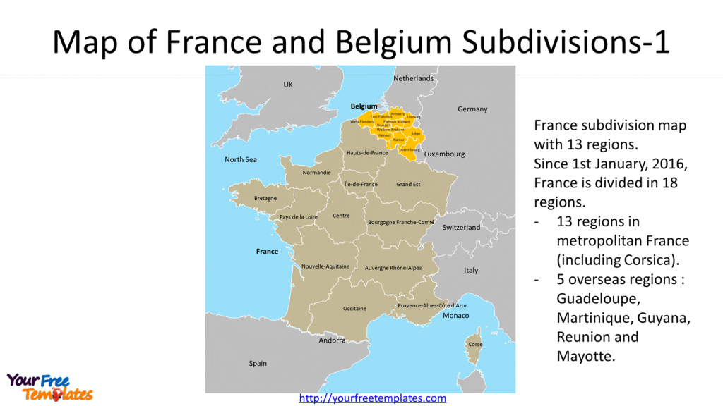
Slide 2, Map of Belgium and France Subdivisions-1
The country boundaries of two countries are showed in this slide, which France subdivision has been with 13 regions for metropolitan France Since 1st January, 2016. They are Auvergne-Rhône-Alpes, Bourgogne-Franche-Comté, Brittany, Centre-Val de Loire, Corsica, Grand Est, Hauts-de-France, Île-de-France, Normandy, Nouvelle-Aquitaine, Occitanie, Pays de la Loire, and Provence-Alpes-Côte d’Azur (PACA). The other 5 overseas regions of France are Guadeloupe and Martinique in Caribbean Sea, Guyana in South America, Reunion and Mayotte in Africa.
While for Belgium, it has ten provinces and the Capital region; they are Antwerp, Brussels-Capital Region, East Flanders, Flemish Brabant, Hainaut, Liège, Limburg, Luxembourg, Namur, Walloon Brabant, and West Flanders.

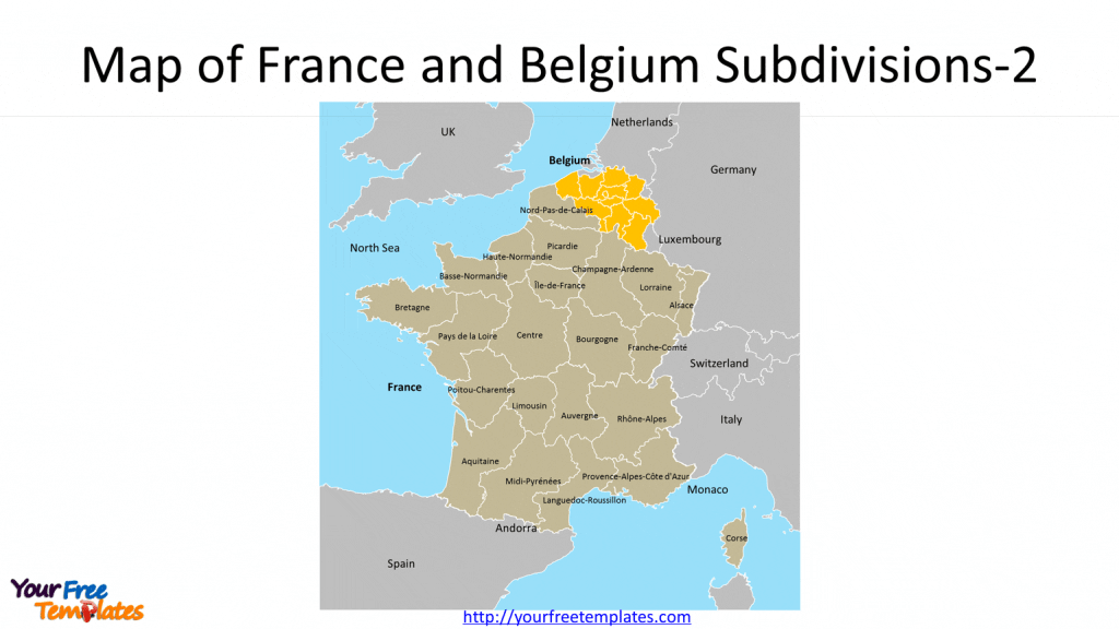
Slide 3, Map of Belgium and France Subdivisions-2
This slide is very similar to slide two except that France subdivision had been the old one with 22 regions for metropolitan France. The old 22 regions were Alsace, Aquitaine, Auvergne, Basse Normandie, Bourgogne, Bretagne, Centre, Champagne-Ardenne, Corse, Franche-Comté, Haute Normandie, Ile-de-France, Languedoc-Roussillon, Limousin, Lorraine, Midi-Pyrénées, Nord-Pas-de-Calais, Pays de la Loire, Picardie, Poitou-Charentes, Provence-Alpes-Côte-d’Azur, and Rhône-Alpes.

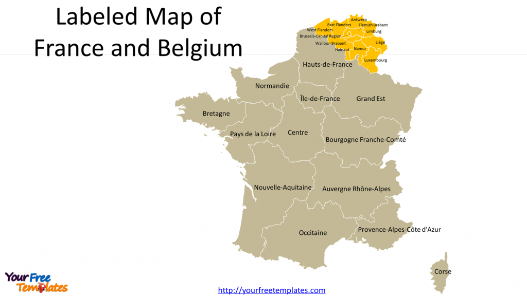
Slide 4, France Belgium map labeled with subdivision names.
France and Belgium map has been amplified to show the names clearly of Belgium provinces.

With every subdivisions grouped by countries, our Benelux map is easily handled to create your presentation. You can also check our Benelux map in the same region.
For premium maps of Belgium and its provinces, please visit our ofomaps.com.
Size:595K
Type: PPTX
[sociallocker]Aspect Ratio: Standard 4:3
Click the link to download it.
Download the 4:3 Template
Aspect Ratio: Widescreen 16:9
Click the link to download it.
Download the 16:9 Template[/sociallocker]


