The Bahrain Map Template includes three slides. Bahrain map with 4 Governorates and 5 Governorates. Bahrain map labeled with capital and major cities, Manama, Riffa, Muharraq, Hamad Town, and A’ali.
Bahrain, an archipelago situated in the Persian Gulf, is strategically located to the east of Saudi Arabia and west of Qatar, with a maritime border with Iran. The nation has a population of around 1.5 million people, with nearly half being foreign nationals. The economy of Bahrain has transitioned from oil dependency to diversification, focusing on sectors such as petroleum processing, refining, aluminum production, and banking, particularly in Islamic finance.
The country plays a crucial role in regional security architecture, hosting the United States Navy’s Fifth Fleet and a United Kingdom naval base. Bahrain’s primary foreign policy focus is on its Gulf Cooperation Council (GCC) neighbors, with close ties to Saudi Arabia and the United Arab Emirates. The nation has also signed significant agreements, such as the US-brokered Abraham Accords with Israel in 2020 and the Comprehensive Security Integration and Prosperity Agreement with the United States in 2023.
Slide 1, Bahrain map labeled with capital and major cities.
Manama is the capital and largest city of Bahrain, other major cities including Riffa, Muharraq, Hamad Town, and A’ali.
Bahrain’s Capital and Major Cities on Bahrain Map
Manama: The Vibrant Capital
Manama, the capital and largest city of Bahrain, is home to an approximate population of 200,000 as of 2020. Long an important trading center in the Persian Gulf, Manama boasts a very diverse population and serves as a significant hub of economic, cultural, and administrative activity. The city’s modern and cosmopolitan atmosphere makes it a favorite destination for visitors from neighboring Saudi Arabia, attracting crowds to its restaurants and bars.

Riffa: A Cultural Gem
Riffa, a major city in Bahrain, is known for its cultural heritage and vibrant urban atmosphere. The city offers a blend of traditional charm and modern developments, making it an inviting destination for those seeking a genuine taste of Bahraini culture.
Muharraq: Historical Significance
Muharraq, situated on the northeastern tip of Bahrain Island, is a significant city with a rich historical and cultural heritage. The city’s relaxed yet conservative lifeways contribute to its allure as a serene haven for residents and a compelling destination for travelers.
Hamad Town: Urban Vibrancy
Hamad Town, known for its urban vibrancy and modern developments, is celebrated for its inviting atmosphere and cultural diversity. The city offers a unique blend of cultural charm and modern living, shaping the region’s diverse urban fabric.
A’ali: Residential Charm
A’ali, with its verdant groves of date palms, offers a blend of residential charm and natural beauty, contributing to Bahrain’s unique urban and rural landscape.
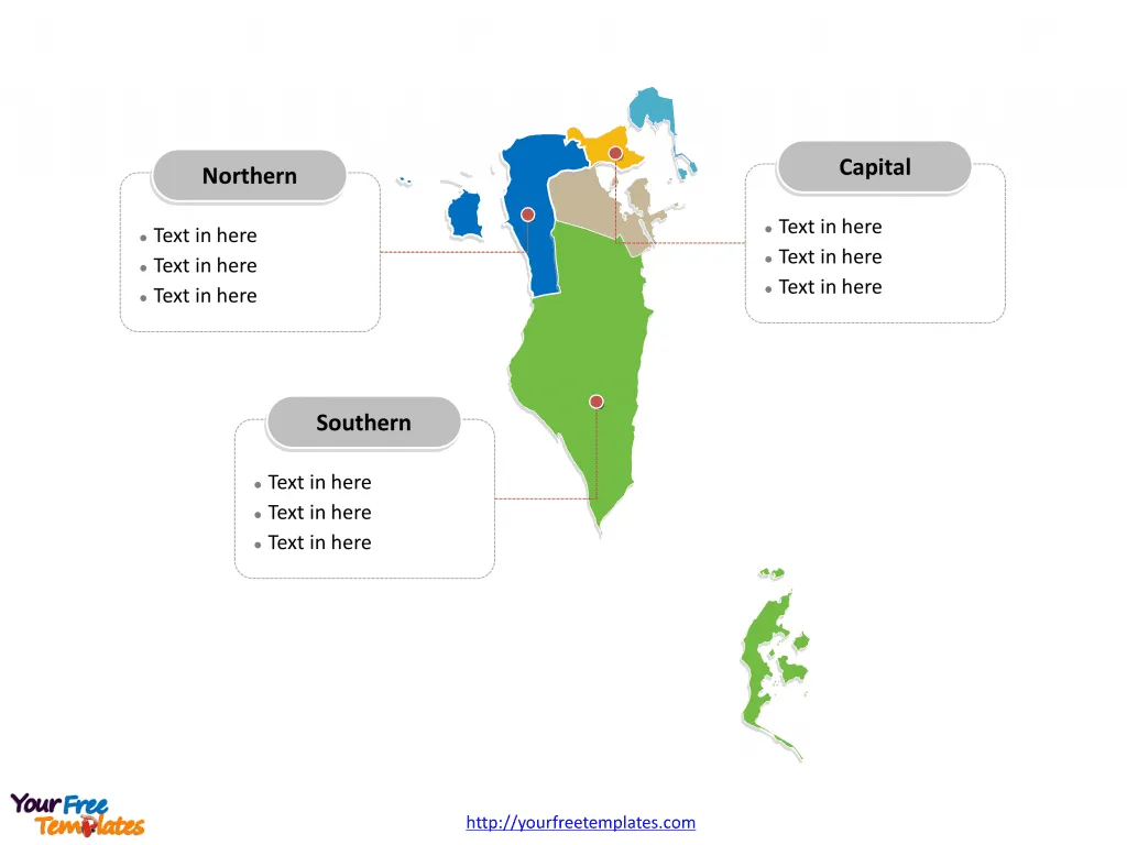
Slide 2, Bahrain map labeled with 5 Governorates.
Bahrain is a country historically divided into 5 Governorates: Capital, Central, Muharraq, Northern, and Southern. Every individual political subdivision is an editable shape.

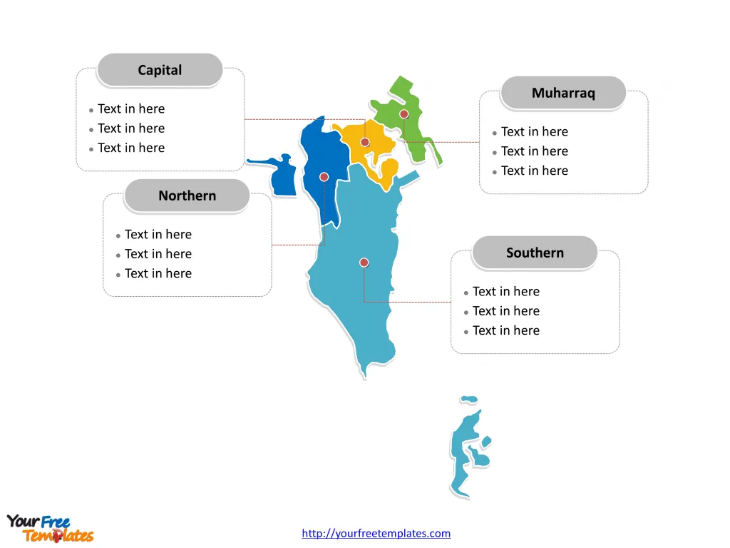
Slide 3, Bahrain map labeled with 4 Governorates.
Bahrain is a country currently divided into 4 Governorates: Capital, Muharraq, Northern, and Southern. Every individual political subdivision is an editable shape.
Major Governorates on Bahrain Map
Capital Governorate
The Capital Governorate, encompassing the capital city of Manama, serves as a significant administrative, economic, and cultural hub, playing a pivotal role in shaping Bahrain’s national identity and development.

Muharraq Governorate
The Muharraq Governorate, with Muharraq as a major city, offers a blend of historical significance and cultural allure, shaping the region’s vibrant and inviting atmosphere.
Northern Governorate
The Northern Governorate, encompassing cities such as Riffa and Hamad Town, is celebrated for its urban vibrancy and cultural diversity, contributing to the region’s diverse urban fabric.
Southern Governorate
The Southern Governorate, known for its residential charm and natural beauty, offers a unique glimpse into Bahrain’s rural charm and cultural traditions, shaping the region’s serene and inviting atmosphere.
Bahrain’s capital, major cities, and significant governorates collectively contribute to the country’s cultural, historical, and administrative landscape, making it a captivating destination for visitors and a serene haven for residents. The diverse array of urban centers and significant governorates showcases Bahrain’s unique blend of historical heritage, urban vibrancy, and administrative significance, making it a compelling subject for exploration and discovery.
Looking for Premium maps, please visit our affiliate site: https://editablemaps.com/ or https://ofomaps.com/
Size: 122K
Type: PPTX
Aspect Ratio: Standard 4:3
Click the blue button to download it.
Download the 4:3 Template
Aspect Ratio: Widescreen 16:9
Click the green button to download it.
Download the 16:9 Template


