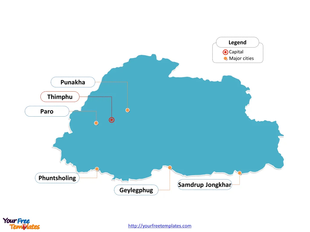
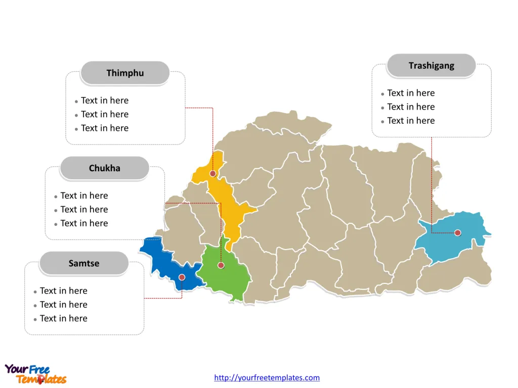
The Bhutan Map Template includes two slides. Bhutan map with 20 districts, labeling major districts, Thimphu, Chukha, Samtse, and Trashigang. Bhutan map labeled with capital and major cities, Thimphu, Phuntsholing, Punakha, Samdrup Jongkhar, Geylegphug, and Paro.
Bhutan, a landlocked country located in the eastern Himalayas, is bordered by India and China. The nation spans approximately 38,394 square kilometers and is home to a population of about 770,000. Bhutan’s economy has been impacted by the COVID-19 pandemic and the closure of borders, with the country being classified as a lower-middle-income country. Despite this, Bhutan has made remarkable progress in reducing poverty and promoting gender equality, with a significant reduction in income inequality. The country’s economy is driven by sectors such as hydropower and tourism, with strong economic and strategic ties with India.
Bhutan’s unique development strategy, founded on the principle of Gross National Happiness, has guided its path towards inclusive and sustainable development. The nation’s abundant water resources and hydropower development have contributed to economic growth and improved access to low-cost electricity, further shaping Bhutan’s economic landscape.
Slide 1, Bhutan map labeled with capital and major cities.
Thimphu is the capital and largest city of Bhutan, other major cities including Phuntsholing, Punakha, Samdrup Jongkhar, Geylegphug, and Paro.
Capital and major cities on Bhutan map
Thimphu: The Enchanting Capital
Thimphu, the capital and largest city of Bhutan, stands as the vibrant heart of the country. With a population of approximately 114,551, Thimphu serves as a significant economic, cultural, and administrative hub, offering a captivating blend of traditional Bhutanese charm and modern development. The city is nestled in the Himalayas and is home to the Tashi Chho Dzong, a magnificent fortress that houses the offices of the royal government.

Phuntsholing: A Gateway to Bhutan
Phuntsholing, situated in the Chukha district, serves as a bustling commercial hub and the primary entry point for travelers entering Bhutan from India. With a population of over 27,658, Phuntsholing plays a pivotal role in shaping the country’s trade and commerce while offering a vibrant urban atmosphere.
Punakha: A Historical Gem
Punakha, known for its rich historical significance, boasts a population of about 6,262. The city, situated in the Punakha district, offers a blend of cultural heritage and stunning natural landscapes, making it a compelling destination for visitors and a serene haven for residents.
Samdrup Jongkhar: A Border Town
Samdrup Jongkhar, located in the Samdrup Jongkhar district, stands out as a significant border town with a population of around 9,325. The city’s strategic location and vibrant atmosphere contribute to Bhutan’s cultural and economic diversity.
Geylegphug: A Cultural Hub
Geylegphug, with a population of approximately 9,858, is celebrated for its cultural richness and warm community spirit. Situated in the Sarpang district, Geylegphug offers a unique glimpse into Bhutan’s traditional heritage and rural charm.
Paro: A Scenic Haven
Paro, with a population of about 11,448, is renowned for its stunning natural beauty and historical significance. The city, located in the Paro district, stands as a captivating destination for visitors and residents, offering a blend of cultural allure and serene landscapes.
Slide 2, Bhutan map labeled with major administration districts.
Bhutan is a landlocked state in South Asia. Our Bhutan template is for the country divided into 20 districts: Banteay Meanchey, Battambang, Kampong Cham, Kampong Chhnang, Kampong Speu, Kampong Thom, Kampot, Kandal, Kep, Koh Kong, Kratié, Mondulkiri, Oddar Meanchey, Pailin, Phnom Penh, Preah Sihanouk, Preah Vihear, Pursat, Prey Veng, Ratanakiri, Siem Reap, Stung Treng, Svay Rieng, and Takéo. Every individual political subdivision is an editable shape.
Major Districts on Bhutan map
Thimphu District
The Thimphu District, encompassing the capital city, serves as a significant administrative, economic, and cultural hub, playing a pivotal role in shaping Bhutan’s national identity and development.

Chukha District
The Chukha District, with Phuntsholing as a notable city, offers a blend of commercial significance and economic influence, shaping the region’s urban and rural landscape.
Samtse District
The Samtse District, with Samtse as a significant town, is celebrated for its cultural heritage and natural beauty, contributing to Bhutan’s diverse urban and rural fabric.
Trashigang District
The Trashigang District, encompassing Trashigang town, offers a blend of historical significance and natural allure, shaping the region’s vibrant and inviting atmosphere.
Bhutan’s capital, major cities, and significant districts collectively contribute to the country’s cultural, historical, and economic landscape, making it a captivating destination for visitors and a serene haven for residents. The diverse array of urban centers and significant districts showcases Bhutan’s unique blend of traditional heritage, urban vibrancy, and natural beauty, making it a compelling subject for exploration and discovery.
Looking for Premium maps, please visit our affiliate site: https://editablemaps.com/ or https://ofomaps.com/
Size: 119K
Type: PPTX
Aspect Ratio: Standard 4:3
Click the blue button to download it.
Download the 4:3 Template
Aspect Ratio: Widescreen 16:9
Click the green button to download it.
Download the 16:9 Template


![Digital Marketing: Opportunity, Strategy, and Action Digital marketing is search engine optimization (SEO), search engine marketing (SEM), content marketing, influencer marketing, content automation, campaign marketing, data-driven marketing,[8] e-commerce marketing, social media marketing, social media optimization, e-mail direct marketing, Display advertising, e–books.](https://yourfreetemplates.com/wp-content/uploads/2019/08/Digital_marketing_1-100x70.gif)


