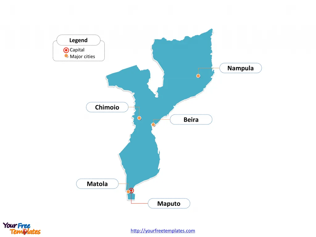
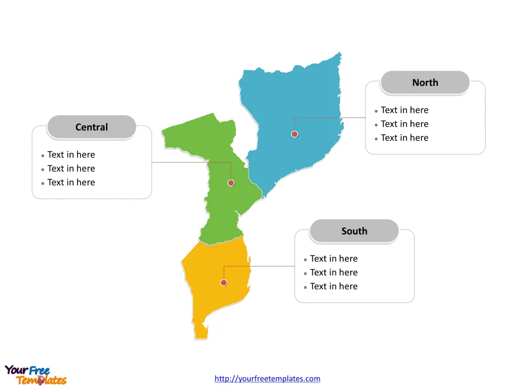
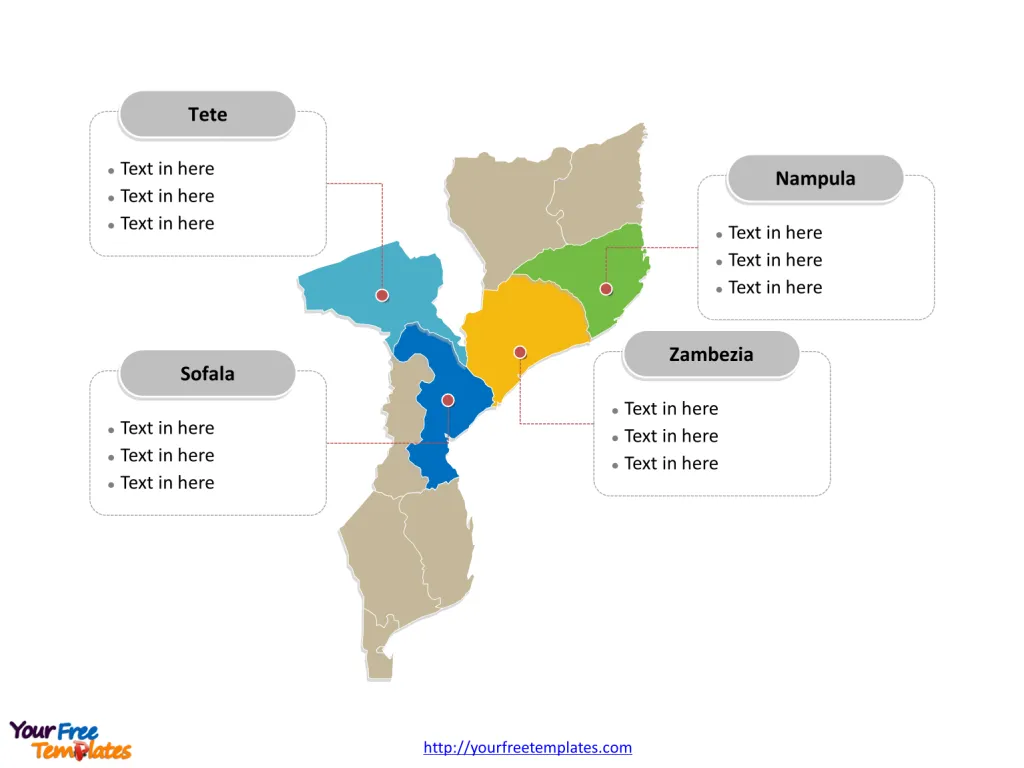
The Mozambique Map Template includes three slides. Mozambique map with ten provinces and one capital city, labeling major provinces, Nampula, Zambezia, Tete, and Sofala. Mozambique map labeled with capital and major cities, Maputo, Matola, Beira, Nampula, and Chimoio.
Location Mozambique is located in Southeast Africa and is bordered by the Indian Ocean to the east, Tanzania to the north, Malawi and Zambia to the northwest, Zimbabwe to the west, Eswatini (formerly Swaziland) and South Africa to the southwest, and the country of Eswatini to the south.
Population As of my last knowledge update in September 2021, Mozambique had an estimated population of around 32 million people. The country is known for its diverse ethnic groups, with the largest being the Makhuwa, Tsonga, and Shona.
Economy Mozambique’s economy is largely based on agriculture, industry, and natural resources. The country is rich in mineral resources such as coal, natural gas, and titanium. Agriculture also plays a significant role, with the majority of the population engaged in subsistence farming. The tourism sector has been growing steadily due to the country’s natural beauty and wildlife.
Neighboring Countries Mozambique shares its borders with several countries, including Tanzania, Malawi, Zambia, Zimbabwe, Eswatini, and South Africa. These neighboring countries have significant impacts on Mozambique’s trade, regional stability, and cultural exchange.
Slide 1, Outline map of mozambique showing its different cities.
Mozambique is a country in southeastern Africa. Maputo is the capital and largest city of Mozambique, other major cities including Matola, Beira, Nampula, and Chimoio.
Maputo
Maputo is the capital and largest city of Mozambique. Located in the southern region, it is a vibrant and diverse city with a rich cultural heritage. The city is known for its beautiful architecture, bustling markets, and stunning waterfront.

Matola
Matola, located in the southern region, is the second most populous city in Mozambique. It is an important industrial and transportation hub, playing a crucial role in the country’s economy.
Beira
Beira is a major port city situated in the central region of Mozambique. As one of the largest cities in the country, Beira is a key center for trade and commerce, particularly due to its strategic location along the Indian Ocean.
Nampula
Nampula, located in the northern region, is one of the largest cities in Mozambique. It serves as an important cultural and economic center, known for its lively markets and historical landmarks.
Chimoio
Chimoio is a city in the central region of Mozambique. It is recognized for its agricultural significance, particularly in the production of fruits and vegetables.
Slide 2, Mozambique map labeled with regions.
Mozambique is a country divided into three regions; they are North, Central, and South. Every individual political subdivision is an editable shape.

Slide 3, Mozambique map labeled with major provinces.
Mozambique is a country divided into ten provinces and one capital city; they are Cabo Delgado, Gaza, Inhambane, Manica, Maputo, Maputo City, Nampula, Niassa, Sofala, Tete, and Zambezia. Every individual political subdivision is an editable shape.
Nampula
Nampula is the most populous province in Mozambique, located in the northern region. It is characterized by its diverse cultural heritage and vibrant economic activities, including agriculture and trade.

Zambezia
Zambezia, also situated in the northern region, is known for its natural beauty and rich cultural traditions. It is an important agricultural region, contributing significantly to the country’s food production.
Tete
Tete, located in the central region, is a province with abundant mineral resources, particularly coal and precious stones. The province plays a crucial role in Mozambique’s mining industry.
Sofala
Sofala, another province in the central region, is home to the city of Beira. It is a key coastal province with a major port, contributing to the country’s maritime trade and transportation.
Mozambique’s major cities and provinces each contribute uniquely to the country’s cultural, economic, and historical landscape, making them integral to Mozambican society and identity.
Looking for Premium maps, please visit our affiliate site: https://editablemaps.com/ or https://ofomaps.com/
Size:105K
Type: PPTX
Aspect Ratio: Standard 4:3
Click the blue button to download it.
Download the 4:3 Template
Aspect Ratio: Widescreen 16:9
Click the green button to download it.
Download the 16:9 Template


