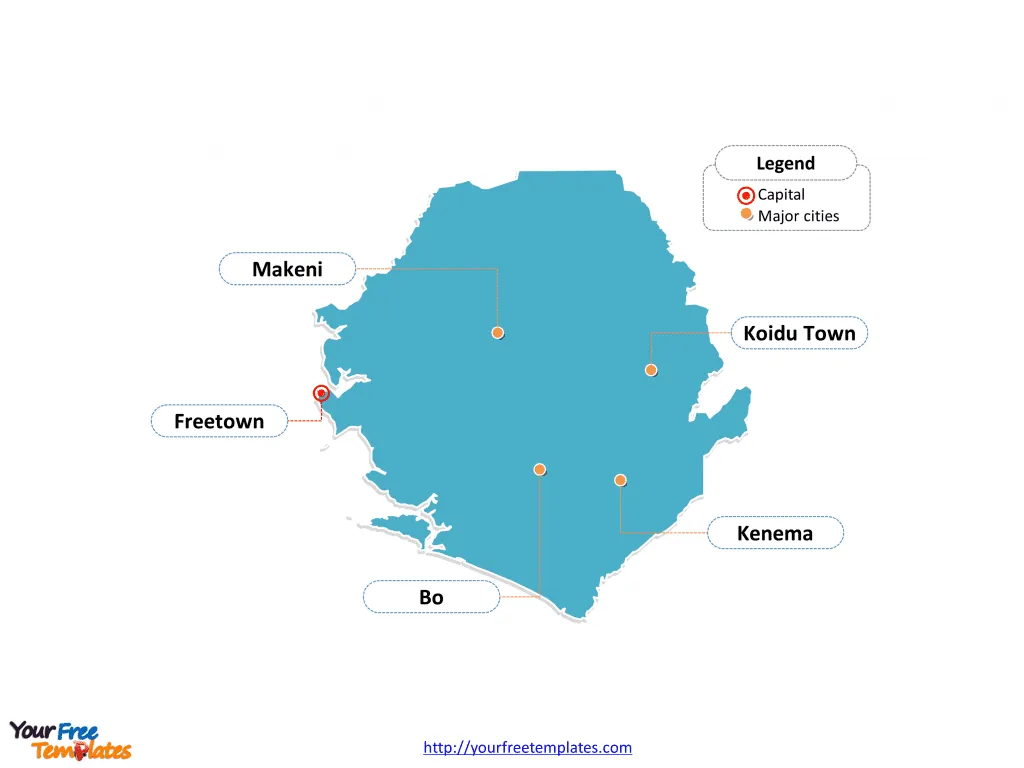
The Sierra Leone Map Template in PowerPoint format includes two slides, that is, the Sierra Leone map and Sierra Leone political map. Firstly, our Sierra Leone map template has capital and major cities on it, which are Freetown, Bo, Kenema, Makeni, and Koidu Town. Secondly, there are 4 regions in our Sierra Leone map template of divisions, labeling the most populated divisions that are Northern Province, Southern Province, the Eastern Province, and the Western Area.
Sierra Leone is a country located on the west coast of Africa with a population of approximately 8.2 million people and a land area of 71,740 square kilometers. Sierra Leone shares its land borders with two countries: Guinea and Liberia. The economy of Sierra Leone heavily relies on agriculture, which accounts for 58.5% of its GDP, making it the largest employer with 80% of the population working in this sector. The country is rich in mineral, fishery, and agricultural resources, offering significant opportunities for investment and development.
However, it faces challenges related to political and social instability, climate vulnerabilities, and the aftermath of a devastating civil war that ended in 2002. The economy is gradually recovering from the impact of the civil war, with a gross domestic product growth rate between 4 and 7% since 2002, despite overdependence on mineral exploitation. Sierra Leone’s economic development has been hampered by an overreliance on mineral resources and neglect of sustainable investments.
Slide 1, Sierra Leone map of outline labeled with capital and major cities.
In addition to Freetown is the capital and largest city of Sierra Leone, other major cities including Bo, Kenema, Makeni, and Koidu Town. So our Sierra Leone map slide has the capital and major cities on the outline. Consequently users can edit city names to create their unique Sierra Leone maps and apply in different presentations.
Capital and major cities on Sierra Leone map
Freetown, the capital and largest city of Sierra Leone, is situated on the country’s scenic western peninsula. It is not only the political and economic hub but also a melting pot of diverse cultures, offering a blend of British colonial architecture, bustling markets, and lively nightlife. The city is also known for its historical significance as a resettlement area for freed slaves, with attractions such as the famous Cotton Tree and the Sierra Leone National Museum.
Bo, the second-largest city, is located in the Southern Province and serves as a vital educational and commercial center. It is home to the noteworthy Bo Stadium and the Bo Government Secondary School, a leading educational institution in the country.
Kenema, also in the Eastern Province, is renowned for its agricultural and diamond mining activities. The city’s bustling marketplaces and vibrant street life offer a glimpse into the region’s local culture and commerce.
Makeni, situated in the Northern Province, plays a pivotal role in the agricultural and trade sectors. The city hosts the University of Makeni, contributing to the region’s educational landscape.
Koidu Town, located in the diamond-rich Kono District, is a crucial center for diamond mining and trade, driving economic activities in the Eastern Province.

Slide 2, Sierra Leone map labeled with regions.
The Sierra Leone map is the country political division of 4 regions. They are Northern Province, Southern Province, the Eastern Province, and the Western Area. Since every individual political subdivision is an editable shape. As a result, you can change the texts, colors, sizes, highlight some map shapes, and add your contents.
Major Provinces on the Sierra Leone map
- Northern Province: Known for its agricultural activities, including rice and cocoa cultivation, and as the location of the historic town of Kabala.
- Southern Province: Home to the picturesque Tiwai Island Wildlife Sanctuary and the bustling city of Bo, it is a significant agricultural and economic region.
- Eastern Province: Renowned for its diamond mining, agricultural production, and vibrant local culture, it is a vital contributor to Sierra Leone’s economy.
- Western Area: Comprising the capital city of Freetown, it serves as the political, economic, and cultural nucleus of the country.

In conclusion, Sierra Leone’s cities and provinces each contribute uniquely to the country’s cultural heritage, economic development, and historical significance, making it a fascinating and diverse nation to explore.
Looking for Premium maps, please visit our affiliate site: https://editablemaps.com/ or https://ofomaps.com/
Size:103K
Type: PPTX
Aspect Ratio: Standard 4:3
Click the blue button to download it.
Download the 4:3 Template
Aspect Ratio: Widescreen 16:9
Click the green button to download it.
Download the 16:9 Template


