
Looking for a Robinson world map download for PowerPoint, presentations, geography projects, or map visualization?
This free template provides a clean Robinson projection world map in three editable PowerPoint slides:
- Robinson World Map Outline
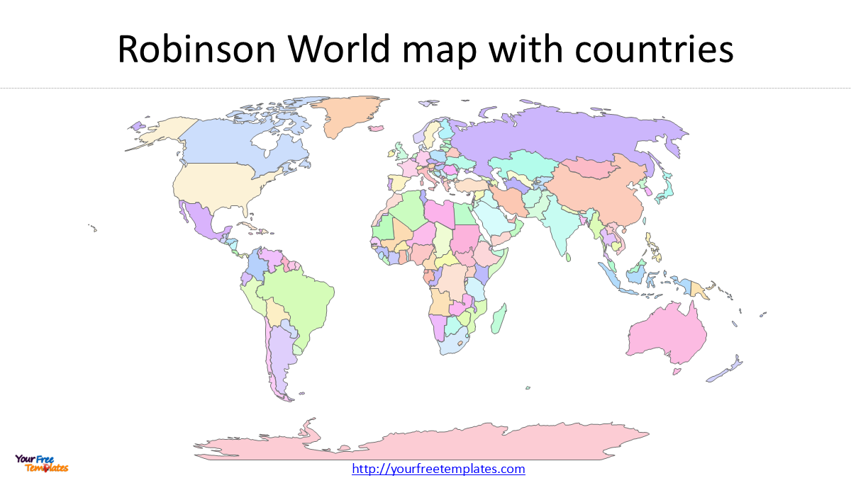
- Robinson World Map with Countries in One Color
- Robinson World Map with Countries in Different Colors
The map is based on Natural Earth country boundaries and uses the Robinson projection (ESRI:54030).
You can check our World map in Equal Earth and Mercator projection below.
- Equal Earth World Map Download
- 7 World Map Regions: Simple Guide to All 195 Countries (2025 Edition)
- World Map Outline in 7 Projections
- World maps Template with Six Continents
- World map with Continents
- World Map free powerpoint templates
Download the Robinson World Map
The three-slide PowerPoint template provides different styles for different presentation needs.
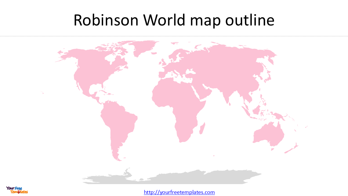
Slide 1: Robinson World Map Outline
The first slide provides a simple country-outline world map.
It works well as a clean geographic background when you want to add your own:
- country names
- cities
- annotations
- arrows
- data
- regional boundaries
Slide 2: Robinson World Map with Countries in One Color
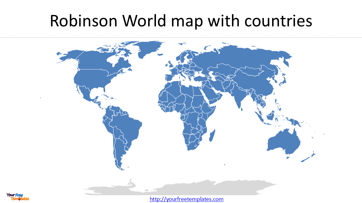
The second slide displays all countries using the same color.
This creates a simple, neutral world map that can be used as a background for presentations, reports, and geographic analysis.
Slide 3: Robinson World Map with Countries in Different Colors
The third slide displays countries using different colors.
This version is useful when you want to visually separate countries or create your own geographic categories.
For example, you can use different colors to represent continents, regions, markets, or other groups.
What Is the Robinson Projection?
The Robinson projection is a pseudocylindrical compromise projection designed for general-purpose world maps.
Rather than preserving one geographic property perfectly, such as area or shape, the Robinson projection attempts to provide a visually balanced representation of the entire world.
It was developed by American cartographer Arthur H. Robinson in 1963 for the Rand McNally map company.
The projection became particularly well known because National Geographic used Robinson for its world maps from 1988 until 1998, before adopting the Winkel Tripel projection.
This history is one reason the Robinson projection has become one of the most recognizable styles of world map.
Robinson Projection — ESRI:54030
In GIS software, the Robinson projection is commonly identified as:
ESRI:54030 — World Robinson
This is an ESRI coordinate reference system identifier, rather than an EPSG code.
The projection uses:
- Projection: Robinson
- CRS: ESRI:54030
- Datum: WGS 84
- Central Meridian: 0°
- Units: meters
In QGIS, you can search for ESRI:54030 when selecting the project CRS.
Why Use Robinson for a World Map?
The main reason to use Robinson is its balanced visual appearance.
A world map has to make compromises because no projection can preserve area, shape, distance, and direction perfectly across the entire globe.
Robinson therefore does not attempt to be an equal-area or conformal projection. Instead, it distributes distortion to create a world map that looks relatively balanced from a global perspective.
This makes Robinson particularly suitable for:
- general-purpose world maps
- geography presentations
- educational materials
- atlases
- business presentations
- global infographics
If your goal is to create a visually balanced world map rather than perform precise geographic measurements, Robinson is a practical choice.
Natural Earth Country Boundaries
The country shapes used in this map come from Natural Earth.
For this presentation-oriented world map, the 1:110m Admin 0 Countries dataset is particularly useful because it provides simplified country boundaries appropriate for a global-scale map.
Natural Earth:
110m Cultural Vectors – Admin 0 Countries
The simplified geometry helps keep the world map clean rather than filling the PowerPoint slide with unnecessary coastline and island details.
Customize the Robinson World Map
The country shapes in the PowerPoint map are editable.
You can change individual country colors, highlight selected countries, add labels, or remove geographic features that are not needed for your presentation.
For example, Antarctica can be removed when you want a more compact world map focused on the populated continents.
This is also useful when creating a customized map for a particular region, industry, market, or presentation topic.
Download the Free Robinson World Map PowerPoint
This free Robinson World Map Download includes three PowerPoint slides:
- Robinson World Map Outline
- Robinson World Map – Countries in One Color
- Robinson World Map – Countries in Different Colors
Projection: Robinson
CRS: ESRI:54030
Data: Natural Earth 1:110m Admin 0 Countries
Format: Editable PowerPoint
[Download the Free Robinson World Map PowerPoint Template]
The Robinson projection provides a distinctive alternative to more familiar rectangular world maps and is particularly suitable when you want a clean, balanced world map for a presentation.
Looking for Premium maps, please visit our affiliate site: https://editablemaps.com/ or https://ofomaps.com/
Size:350K
Type: PPTX
Robinson World Map Download Template
Click the link to download it.
Aspect Ratio: Widescreen 16:9
Click the green button to download it.
Download the 16:9 Template
The map is based on Natural Earth 1:110m country data and uses WGS 84 / ESRI:54030.