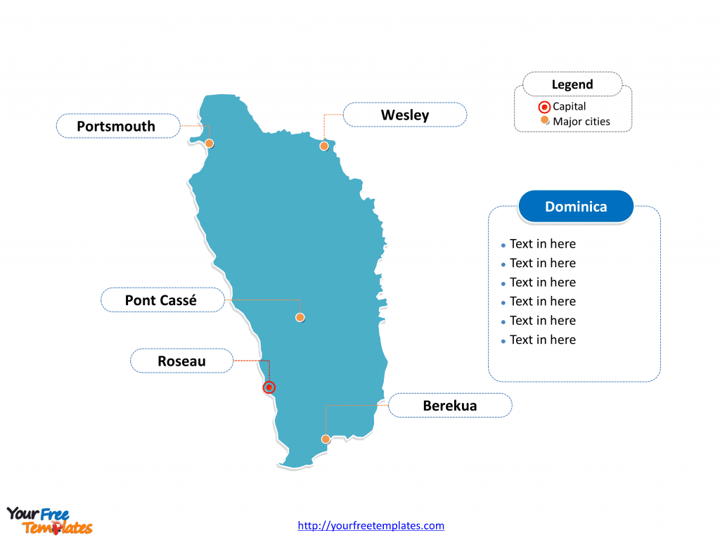
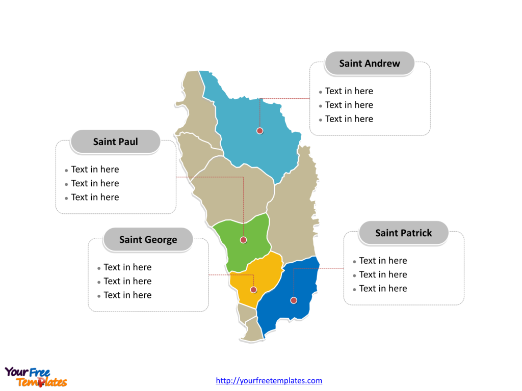
The Dominica Map Template includes two slides. Dominica map with ten parishes, labeling with major parishes, Saint George, Saint Paul, Saint Andrew, and Saint Patrick. Dominica map labeling with national capital and major cities, Roseau, Pont Cassé, Wesley, Berekua, and Portsmouth.
Dominica, officially known as the Commonwealth of Dominica, is an island nation located in the Eastern Caribbean Sea. It is situated in the Lesser Antilles archipelago and shares maritime borders with the French territories of Guadeloupe to the northwest and Martinique to the south-southeast. The island covers an area of 750 square kilometers with a population of approximately 72,412. Dominica’s economy relies on agriculture, tourism, and offshore services, with a GDP per capita of $7,860.
The nation’s closest neighbors are the French overseas departments of Guadeloupe and Martinique. Dominica is known for its lush rainforests, volcanic peaks, and diverse flora and fauna, earning it the nickname “The Nature Island of the Caribbean.”
Slide 1, Dominica map labeled with capital and major cities.
Its capital and largest city is Roseau, other major cities including Pont Cassé, Wesley, Berekua, and Portsmouth.
Dominica’s Capital and Major Cities on Dominica Map
Roseau: The Vibrant Capital
Roseau, the capital and largest city of Dominica, is a bustling urban center nestled on the western coast of the island. With its vibrant blend of historical architecture and modern developments, Roseau serves as a significant economic, cultural, and administrative hub. The city’s rich cultural heritage and stunning natural landscapes make it a compelling destination for visitors and a thriving hub for residents.

Pont Cassé: A Scenic Gem
Pont Cassé, located in the Saint Paul parish, is celebrated for its picturesque landscapes and tranquil atmosphere. The region’s lush greenery and natural beauty contribute to its allure as a serene destination for nature enthusiasts and travelers seeking relaxation.
Wesley: A Coastal Haven
Wesley, situated in the Saint Andrew parish, stands out for its unique coastal beauty and close-knit community. With a focus on preserving its natural surroundings, Wesley offers a tranquil escape and a glimpse into Dominica’s unspoiled coastal charm.
Berekua: A Charming Township
Berekua, located in the Saint Patrick parish, is known for its warm community spirit and rich cultural traditions. The township’s vibrant atmosphere and scenic surroundings make it an inviting destination for those seeking a genuine taste of Dominican culture.
Portsmouth: A Seaside Hub
Portsmouth, situated in the Saint John parish, serves as a significant seaport and academic center. With a focus on marine conservation and sustainable development, Portsmouth offers a unique blend of coastal allure and educational opportunities, making it a captivating destination for visitors and residents alike.
Slide 2, Dominica map labeled with major administration districts.
Dominica is a country divided into ten parishes; they are Saint Andrew Parish, Saint David Parish, Saint George Parish, Saint John Parish, Saint Joseph Parish, Saint Luke Parish, Saint Mark Parish, Saint Patrick Parish, Saint Paul Parish, and Saint Peter Parish. Every individual political subdivision is an editable shape.
Major Parishes on Dominica Map
Saint George Parish
The Saint George Parish, encompassing the capital city of Roseau, serves as a significant administrative, economic, and cultural hub, playing a pivotal role in shaping Dominica’s national identity and development.

Saint Paul Parish
The Saint Paul Parish, with Pont Cassé as a notable township, offers a blend of natural beauty and tranquil charm, contributing to the region’s serene allure within Dominica’s urban and rural fabric.
Saint Andrew Parish
The Saint Andrew Parish, with Wesley as a significant coastal town, is known for its unspoiled coastal beauty and close community ties, adding to Dominica’s natural appeal.
Saint Patrick Parish
The Saint Patrick Parish, encompassing Berekua, is celebrated for its warm community spirit and cultural traditions, shaping the region’s vibrant and inviting atmosphere.
Dominica’s capital, major cities, and significant parishes collectively contribute to the country’s cultural, historical, and natural landscape, making it a captivating destination for visitors and a serene haven for residents.
Looking for Premium maps, please visit our affiliate site: https://editablemaps.com/ or https://ofomaps.com/
Size: 103K
Type: PPTX
Aspect Ratio: Standard 4:3
Click the blue button to download it.
Download the 4:3 Template
Aspect Ratio: Widescreen 16:9
Click the green button to download it.
Download the 16:9 Template


![Digital Marketing: Opportunity, Strategy, and Action Digital marketing is search engine optimization (SEO), search engine marketing (SEM), content marketing, influencer marketing, content automation, campaign marketing, data-driven marketing,[8] e-commerce marketing, social media marketing, social media optimization, e-mail direct marketing, Display advertising, e–books.](https://yourfreetemplates.com/wp-content/uploads/2019/08/Digital_marketing_1-100x70.gif)


