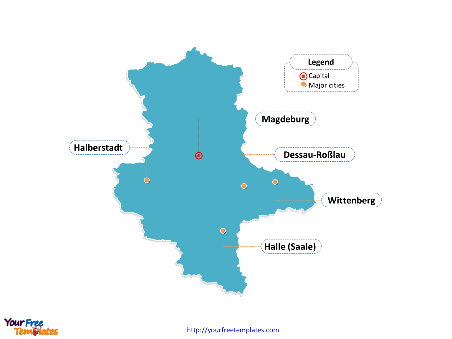
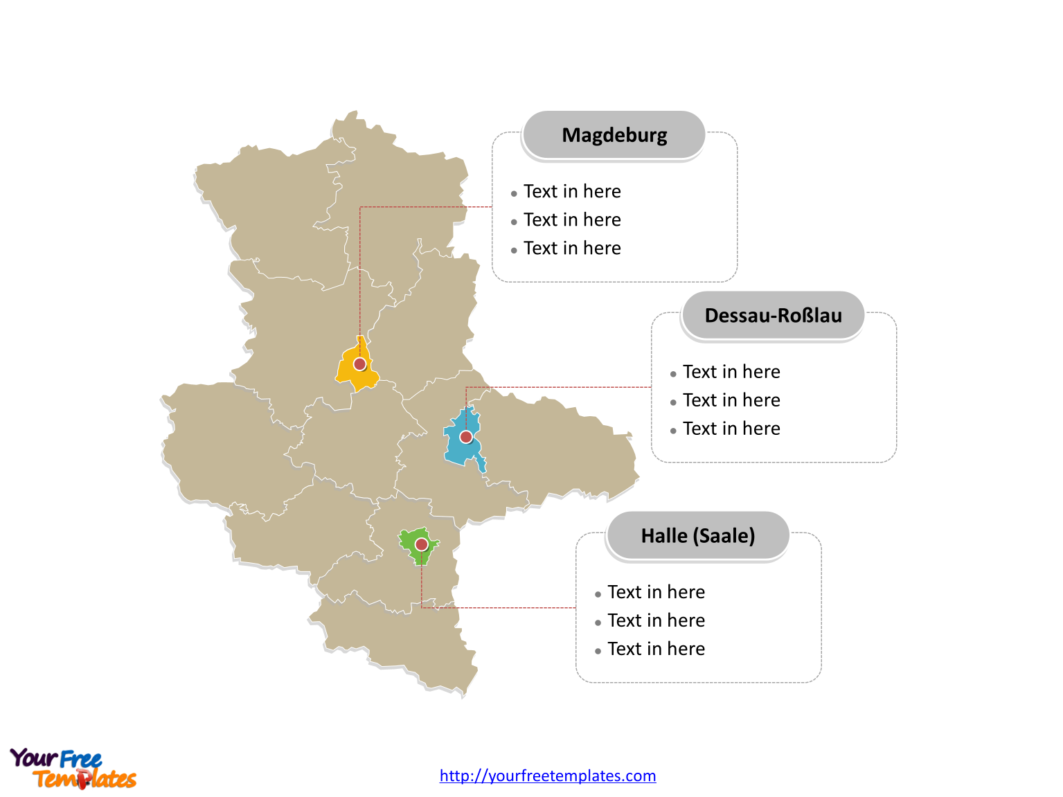
The Saxony-Anhalt Map Template (German: Sachsen-Anhalt karte) in PowerPoint format includes two slides, that is, the Saxony-Anhalt outline map and Saxony-Anhalt political map. Firstly, our Saxony-Anhalt outline map template has capital and major cities on it, which are Halle (Saale), Magdeburg, Dessau-Roßlau, Wittenberg and Halberstadt. Secondly, there are 11 rural districts and three urban districts in our Saxony-Anhalt political map template of divisions, labeling the most populated divisions that are Dessau-Roßlau, Halle (Saale), and Magdeburg. The Sachsen-Anhalt karte is our hand-draw map with more edges than other ordinary Saxony-Anhalt maps, giving more vivid map presentation for your target Germany state.
Slide 1, Saxony-Anhalt map labeled with capital and major cities.
Our Saxony-Anhalt map is for the landlocked federal state of Germany. Saxony-Anhalt borders on the German states of Lower Saxony, Brandenburg, Saxony and Thuringia. It is well known that Magdeburg and Halle is the capital and largest city of Saxony-Anhalt respectively, furthermore, other major cities including Dessau-Roßlau, Wittenberg and Halberstadt. So our Saxony-Anhalt map slide has the capital and major cities on the outline. Therefore users can edit the outline map to create their unique Saxony-Anhalt maps and apply in different reports.

Slide 2, Saxony-Anhalt map labeled with major districts.
The Saxony-Anhalt map is the state political division of 11 rural districts and three urban districts. The 11 districts are Altmarkkreis Salzwedel, Anhalt-Bitterfeld, Börde, Burgenlandkreis, Harz, Jerichower Land, Mansfeld-Südharz, Saalekreis, Salzlandkreis, Stendal, and Wittenberg. The 3 urban districts are Dessau-Roßlau, Halle (Saale), and Magdeburg. What is more, every individual political subdivision is an editable shape. In a word, you can change the texts, colors, sizes, highlight some map shapes, and add your charts. At the same time you can also refer to the fully labeled Saxony-Anhalt map in Wikipedia. Believe it or not, analysts from marketing research companies, consultants from professional firms are very happy with our map templates; because our maps can help to reduce their efforts and create good-looking maps.

Size:127K
Type: PPTX
Aspect Ratio: Standard 4:3
Click the blue button to download it.
Download the 4:3 Template
Aspect Ratio: Widescreen 16:9
Click the green button to download it.
Download the 16:9 Template


![Digital Marketing: Opportunity, Strategy, and Action Digital marketing is search engine optimization (SEO), search engine marketing (SEM), content marketing, influencer marketing, content automation, campaign marketing, data-driven marketing,[8] e-commerce marketing, social media marketing, social media optimization, e-mail direct marketing, Display advertising, e–books.](https://yourfreetemplates.com/wp-content/uploads/2019/08/Digital_marketing_1-100x70.gif)


