

Finding high-quality, accurate map templates for PowerPoint and Google Slides can be a challenge, especially when you need specific details like road networks or surrounding countries. That’s why we’ve developed a new set of UK and Ireland map templates that are not only visually clean but also technically precise, fully editable, and ready to use right out of the box.
Whether you are preparing a business report, a geography lesson, or a sales strategy document, these three distinct layouts give you the flexibility to choose the exact level of detail you need. Plus, each slide features beautifully formatted Latin-style placeholder paragraphs (Lorem Ipsum) to ensure your layout looks balanced and professional from the very first draft.
1. UK and Ireland Map Template-The Frame Map with Surrounding Countries
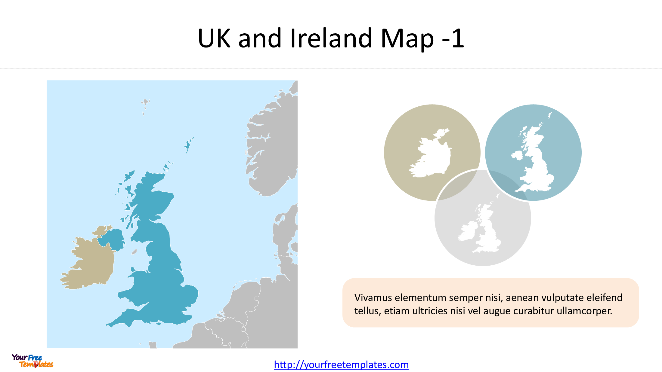
The first template provides a broader context, showing the United Kingdom and Ireland alongside neighboring countries. This is ideal for presentations that need to discuss trade routes, political geography, or regional strategy.
Key Features:
-
High-Quality Outlines: The map includes clear, editable outlines for the UK, Ireland, and surrounding nations.
-
Data-Driven Accuracy: This template is built using the Natural Earth
ne_50m_admin_0_countriesdataset, ensuring de facto boundaries are represented correctly. -
Ready-Made Callouts: A beautifully styled, rounded text box containing decorative Lorem Ipsum typography sits beside overlapping country silhouettes. You can easily replace the Latin text with your own insights while keeping the polished design.
2. UK and Ireland Map Template-The Two-Country Boundary Map
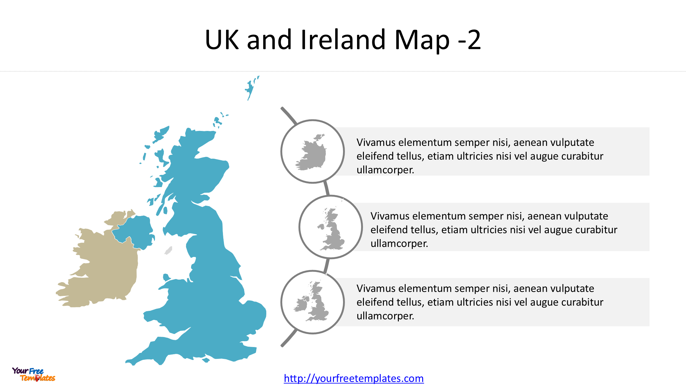
If your presentation focuses strictly on the relationship between the UK and Ireland, this second slide is perfect. It strips away the surrounding nations to give a clean, focused view of the two countries.
Key Features:
-
Clear National Boundaries: The border between the Republic of Ireland and Northern Ireland is clearly defined, making it an excellent visual aid for discussions on history, politics, or logistics.
-
Timeline Layout: This slide features a modern, vertical timeline design connected to three circular map icons. Next to each icon is a pre-formatted Lorem Ipsum text box, allowing you to outline three distinct points or historical milestones effortlessly.
3. UK and Ireland Map Template-The Detailed Road Network Map
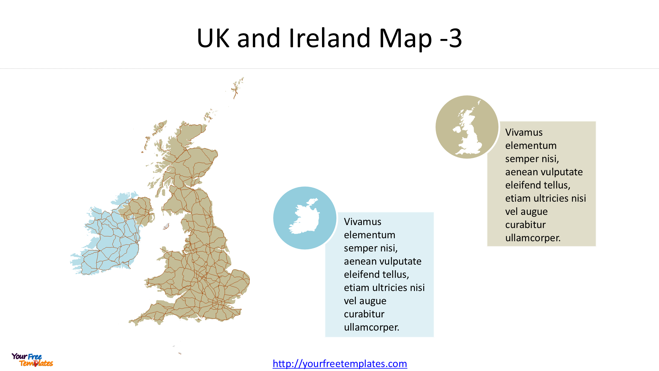
Our third template is a standout for logistics and infrastructure presentations. It overlays a detailed road network onto the base map of the UK and Ireland.
Key Features:
-
Comprehensive Road Data: This slide illustrates the major transport arteries across both islands, perfect for discussing supply chains, transportation planning, or regional connectivity.
-
Layered Editing: The road network and the country shapes are on separate layers. You can choose to highlight specific routes, fade the background map, or adjust the line colors to match your brand.
-
Sleek Callout Boxes: This slide includes two distinct, color-coded callout boxes filled with Lorem Ipsum text. These are strategically placed to draw the viewer’s eye to specific regions of the road map.
 The Technical Advantage: Precision You Can Trust
What sets these editable map templates apart is the underlying data. We have used the Natural Earth 1:50m dataset for the base shapes and processed all coordinates using the ETRS_1989_LAEA (EPSG:3035) projection system.
This combination provides a harmonized, equal-area projection that is perfect for representing the geography of Europe. You won’t find distorted shapes or misaligned borders here.
Why Use Lorem Ipsum Placeholders?
A common struggle in slide design is visualizing how the final text will interact with the graphics. By including neatly formatted Lorem Ipsum paragraphs, we’ve taken the guesswork out of the design. You can instantly see how much text fits in each section, ensuring your presentation remains clean and readable. Just click and type over the placeholder text to insert your real content!
Start exploring these templates today and give your next presentation a professional edge.
You can check other UK and Ireland maps from our site.
- Most populated city in United Kingdom 1-10
- Largest Cities in UK 11-20
- Free United Kingdom Map with 4 Countries
- UK Northern Ireland Map with 11 Districts
- 9 England Region Map
- 6 Metropolitan counties of England map
- Republic of Ireland Map with 31 Local Authorities
- Map of Ireland and Northern Ireland
Looking for Premium maps, please visit our affiliate site: https://editablemaps.com/ or https://ofomaps.com/
Size:359K
Type: PPTX
UK and Ireland Map Templates download
Click the link to download it.
Aspect Ratio: Widescreen 16:9
Click the green button to download it.
Download the 16:9 Template