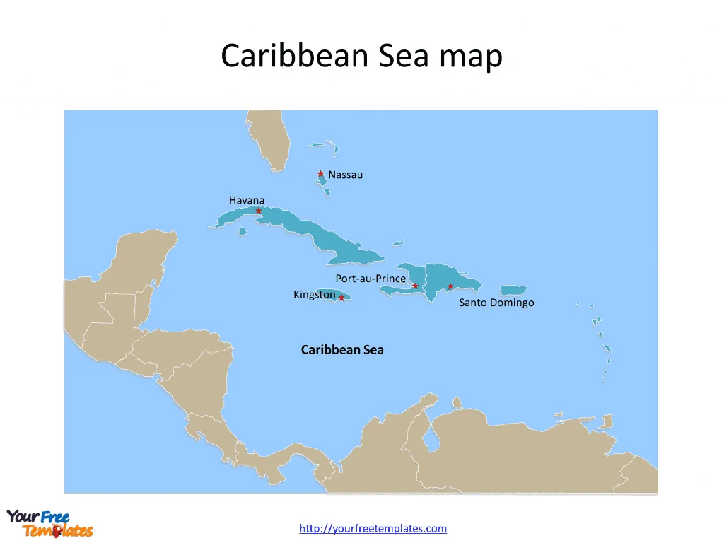
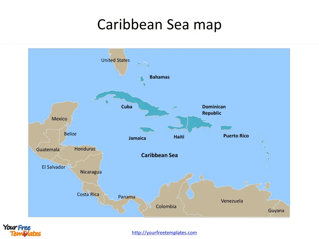
The Map of Caribbean Sea Template in PowerPoint format includes two slides, that is, the Caribbean Sea outline map and Caribbean Sea political map. Firstly, our Caribbean Sea map free templates have major Capitals on it. Secondly, there are 5 countries in our Caribbean Sea map free templates, highlighting the most important countries.
The Caribbean Sea, a region known for its breathtaking natural beauty and vibrant culture, is home to a diverse array of countries and cities that each contribute to the rich tapestry of life in this part of the world. Among these, the Bahamas, Cuba, the Dominican Republic, Haiti, and Jamaica stand out for their unique histories, cultures, and contributions to the Caribbean’s identity.
Slide 1, Map of Caribbean Sea labeled with capital and major Capitals
Our Map of Caribbean Sea is for a sea of the Atlantic Ocean in the tropics of the Western Hemisphere. The major Capitals in Caribbean Sea are including Havana, Kingston, Port-au-Prince, Santo Domingo, and Nassau. You can found them in our Caribbean Sea map free templates.
Major Cities in the Caribbean Sea Map
Havana, Cuba
Havana, the capital city of Cuba, is the heart of the country’s cultural and political life. Known for its colorful colonial architecture, vibrant music scene, and rich history, Havana offers a glimpse into Cuba’s complex past and its spirited present.
Kingston, Jamaica
As the capital and largest city of Jamaica, Kingston is a bustling metropolis that serves as the cultural and economic hub of the island. Known for its significant contribution to reggae music and its vibrant arts scene, Kingston embodies the soul of Jamaica.

Port-au-Prince, Haiti
Port-au-Prince, the capital of Haiti, is a city of contrasts, where historical sites and cultural richness coexist with the challenges of modern urban life. Despite facing significant hardships, the city remains a center of Haitian culture and resilience.
Santo Domingo, Dominican Republic
Santo Domingo, the capital of the Dominican Republic, is the oldest continuously inhabited European settlement in the Americas. Its Colonial Zone is a UNESCO World Heritage site, reflecting the city’s rich history and its role in the colonization of the New World.
Nassau, Bahamas
Nassau, the capital of the Bahamas, is known for its balmy climate, stunning beaches, and vibrant markets. As a popular tourist destination, Nassau showcases the Bahamas’ natural beauty and hospitality.
Slide 2, Caribbean Sea map labeled with major Countries
It is noted that the Map of Caribbean Sea is the country political division of there are 5 countries: Bahamas, Cuba, Dominican Republic, Haiti and Jamaica. Furthermore there are 10 neighboring countries: Belize, Colombia, Costa Rica, Guatemala, Honduras, Mexico, Nicaragua, Panama, United States and Venezuela.
Major Countries in the Caribbean Sea map
Bahamas
The Bahamas, an archipelago of over 700 islands, is celebrated for its pristine beaches, clear waters, and rich marine life, making it a premier destination for tourists seeking relaxation and adventure.
Cuba
Cuba, the largest Caribbean island, is known for its revolutionary history, iconic leaders, and rich cultural output in music, dance, and art. Its economy is marked by state control, with tourism playing a significant role.

Dominican Republic
Sharing the island of Hispaniola with Haiti, the Dominican Republic is known for its diverse landscapes, from tropical rainforests to alpine ranges, and for its vibrant culture, especially in music and sports.
Haiti
Haiti, with a history of colonial occupation, slavery, and revolutions, has a rich cultural heritage shaped by African, French, and indigenous Taíno influences. It faces significant social and economic challenges.
Jamaica
Jamaica is renowned for its influence on music, particularly reggae, its athletic prowess, and its distinct cuisine. The island’s economy is heavily reliant on services, with tourism being a major sector.
The Caribbean Sea region, with its major cities and countries, is a vibrant and diverse area that continues to captivate the imagination of people around the world, offering a unique blend of natural beauty, cultural richness, and historical depth.
Looking for Premium maps, please visit our affiliate site: https://ofomaps.com/
Size:152K
Type: PPTX
Aspect Ratio: Standard 4:3
Click the blue button to download it.
Download the 4:3 Template
Aspect Ratio: Widescreen 16:9
Click the green button to download it.
Download the 16:9 Template


![Digital Marketing: Opportunity, Strategy, and Action Digital marketing is search engine optimization (SEO), search engine marketing (SEM), content marketing, influencer marketing, content automation, campaign marketing, data-driven marketing,[8] e-commerce marketing, social media marketing, social media optimization, e-mail direct marketing, Display advertising, e–books.](https://yourfreetemplates.com/wp-content/uploads/2019/08/Digital_marketing_1-100x70.gif)


