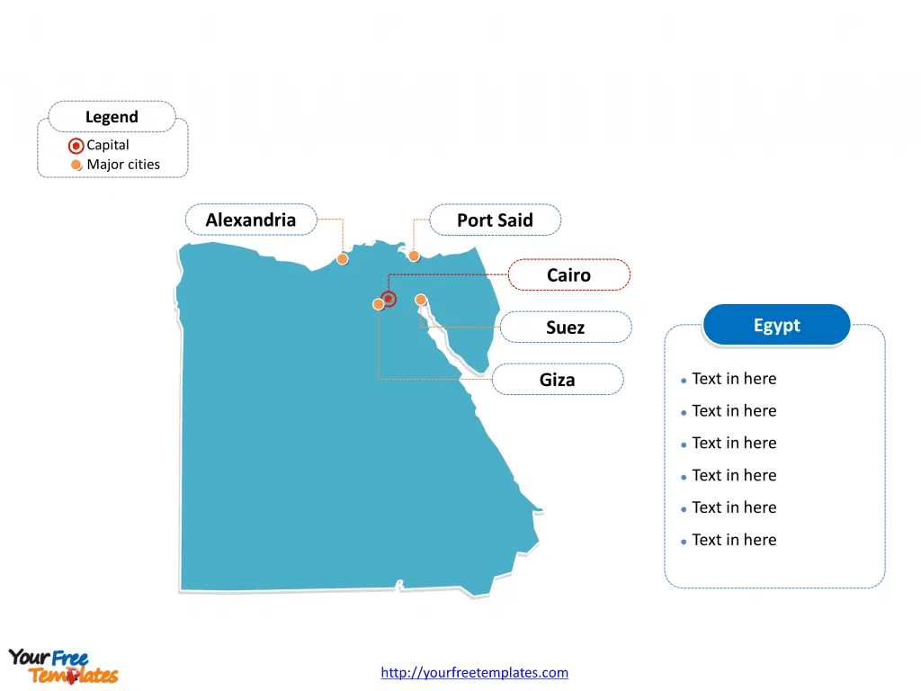
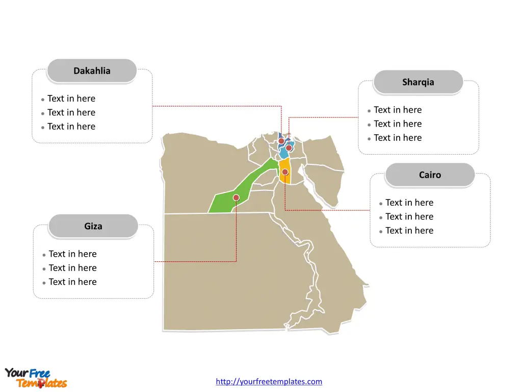
The Egypt Map Template includes two slides. Egypt map with 27 governorates, highlighting Dakahlia, Giza, Cairo,and Sharqia governorates. Egypt map of outline labeled with Cairo, Alexandria, Giza, Port Said, and Suez cities.
Egypt, located in the northeastern corner of Africa, is a transcontinental country, with the Sinai Peninsula forming a land bridge to Southwest Asia. With a population exceeding 100 million, Egypt is the most populous country in the Arab world and the third-most populous in Africa. The nation’s economy is diverse, with key sectors including tourism, agriculture, manufacturing, and natural gas production.
Egypt’s strategic location at the crossroads of Africa, Asia, and Europe has historically made it a vital center for trade and commerce. The country shares its borders with Libya to the west, Sudan to the south, and Israel and the Gaza Strip to the northeast, reflecting its geopolitical significance in the region. The Nile River, which runs through the country, has played a crucial role in shaping Egypt’s history, culture, and economy.
Slide 1, Egypt map labeled with capital and major cities.
Its capital and largest city is Cairo, other major cities including Alexandria, Giza, Port Said, and Suez.
Major Cities on Egypt Map
Cairo
Cairo, the capital and largest city of Egypt, is a vibrant metropolis and a melting pot of history, culture, and modernity. With a population exceeding 20 million, Cairo is one of the most populous cities in Africa and the Middle East. It is renowned for its iconic landmarks, including the Pyramids of Giza, the Sphinx, and the historic Cairo Citadel. The city serves as a hub for education, commerce, and tourism, as well as a center for government and administration.

Alexandria
Alexandria, situated on the Mediterranean coast, is Egypt’s second-largest city, known for its rich Hellenistic heritage and stunning waterfront. The city boasts a population of over 5 million and is celebrated for its ancient library, the Bibliotheca Alexandrina, as well as its well-preserved Greco-Roman monuments and artifacts.
Giza
Giza, located southwest of Cairo, is famous for being home to the Great Pyramids and the Sphinx, which are among the most recognizable and enduring symbols of ancient Egyptian civilization. The city, with a population of over 9 million, has a significant place in Egypt’s tourism industry and historical legacy.
Port Said
Port Said, a vital port city at the northern entrance of the Suez Canal, is a strategic center for trade and maritime activities. The city’s cosmopolitan atmosphere, with a population of over 750,000, reflects its role as a melting pot of cultures and a key link between the Mediterranean and the Red Sea.
Suez
Suez, located at the southern entrance of the Suez Canal, plays a critical role in global trade and maritime transport. The city’s strategic location and industrial activity make it a significant economic center in Egypt, with a population exceeding 750,000.
Slide 2, Egypt map labeled with major administration districts.
Egypt map shows the country divided into 27 governorates, Matruh, Alexandria, Beheira, Kafr el-Sheikh, Dakahlia, Damietta, Port Said, North Sinai, Gharbia, Monufia, Qalyubia, Sharqia, Ismailia, Giza, Faiyum, Cairo, Suez, South Sinai, Beni Suef, Minya, New Valley, Asyut, Red Sea, Sohag, Qena, Luxor, and Aswan. The most populated governorates are Cairo, Dakahlia, Giza, and Sharqia. Every individual political subdivision is an editable shape.
Major Governorates on Egypt Map
Dakahlia
Dakahlia Governorate, with its capital in Mansoura, is known for its agricultural productivity, particularly in the production of rice and cotton. The governorate is also recognized for its historical significance, with various archaeological sites and landmarks.

Giza
The Giza Governorate, which includes the city of Giza, is celebrated for being the home of the iconic Pyramids and the Sphinx. It is a major cultural and historical center, attracting tourists from around the world.
Cairo
Cairo Governorate, encompassing the capital city, is the political, cultural, and economic heart of Egypt, housing key government institutions, educational centers, and a diverse urban landscape.
Sharqia
The Sharqia Governorate, with its capital in Zagazig, is an important agricultural region known for its production of citrus fruits, vegetables, and cotton. The governorate also has historical and cultural significance, with various ancient sites and traditions.
In conclusion, Egypt’s major cities and governorates represent a tapestry of historical, cultural, and economic significance, each contributing to the country’s rich heritage and contemporary development.
Looking for Premium maps, please visit our affiliate site: https://editablemaps.com/ or https://ofomaps.com/
Size: 100K
Type: PPTX
Aspect Ratio: Standard 4:3
Click the blue button to download it.
Download the 4:3 Template
Aspect Ratio: Widescreen 16:9
Click the green button to download it.
Download the 16:9 Template


