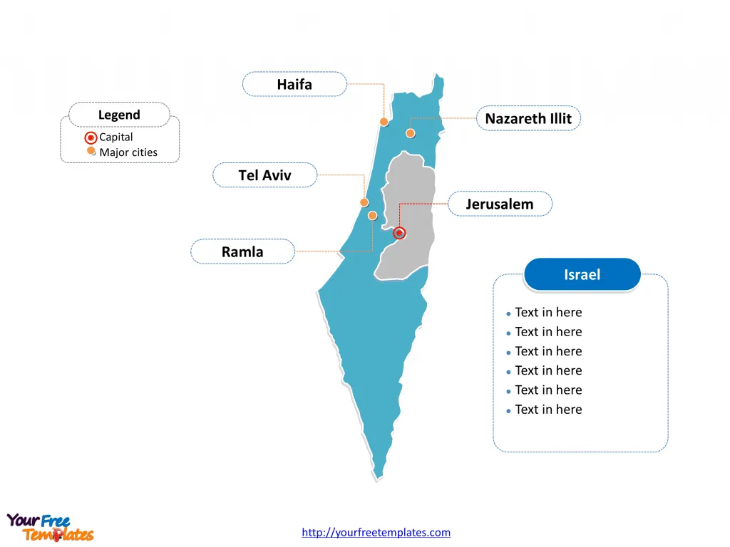
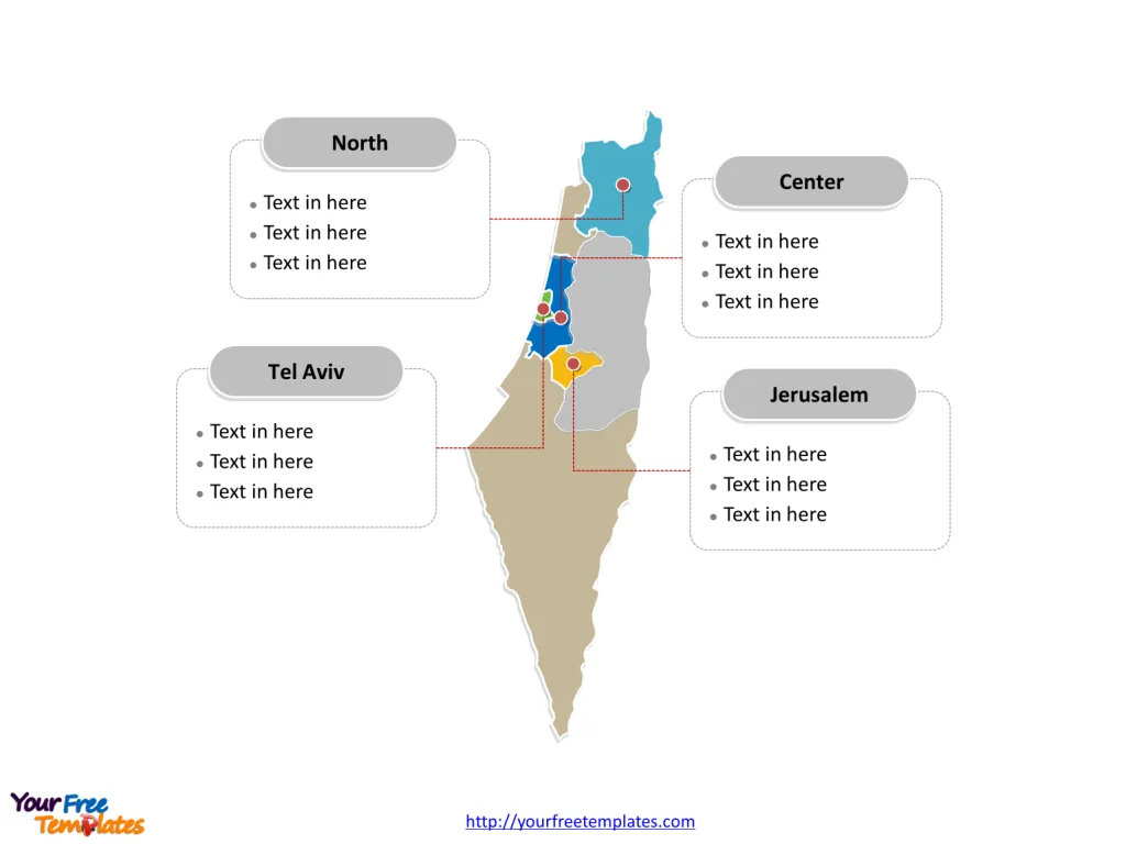
The Israel Map Template includes two slides. Israel map with six main administrative districts, labeling with major districts, Center, North, Tel Aviv, and Jerusalem. Israel map labeling with national capital and major cities, Jerusalem, Tel Aviv, Haifa, Ramla, and Nazareth Illit.
Location Israel is located in the Middle East, bordered by Lebanon to the north, Syria to the northeast, Jordan to the east, and Egypt to the southwest. It has a coastline along the Mediterranean Sea to the west.
Population As of 2021, Israel’s population was estimated to be around 9.3 million people. The country has a diverse population, with a majority of Jewish inhabitants, as well as significant Arab and other minority groups.
Economy Israel has a technologically advanced market economy driven by innovation and entrepreneurship. Key sectors include technology, pharmaceuticals, agriculture, and defense. The country is known for its high-tech industry and has a strong focus on research and development.
Slide 1, Israel map labeled with capital and major cities.
Capital and Major Cities on Israel map
Jerusalem Jerusalem holds great religious and historical significance and serves as Israel’s capital. The city is a melting pot of cultures, boasting iconic sites like the Western Wall, the Church of the Holy Sepulchre, and the Dome of the Rock. It is a vibrant center for spirituality, history, and modern urban life.

Tel Aviv Tel Aviv, often referred to as “the city that never sleeps,” is a bustling metropolis renowned for its vibrant nightlife, beautiful beaches, and thriving arts and culture scene. It is also a hub for technology and innovation, earning it the moniker “Silicon Wadi.”
Haifa Haifa, located on the slopes of Mount Carmel and facing the Mediterranean Sea, is known for its stunning landscapes and the beautiful Bahá’í Gardens. It is a major industrial and shipping center, with a diverse population and a rich cultural heritage.
Ramla Ramla, one of Israel’s ancient cities, is celebrated for its historical architecture, including the White Mosque and the colorful market. It is a place where history and modernity converge, offering a glimpse into Israel’s diverse cultural tapestry.
Nazareth Illit Nazareth Illit, located in the Galilee region, is a thriving city known for its picturesque setting and its proximity to biblical sites. It is a center of commerce and culture, offering a blend of modern amenities and historical charm.
Slide 2, Israel map labeled with major districts.
Israel is a country six main administrative districts, known as mehozot – Center, Haifa, Jerusalem, North, Southern, and Tel Aviv Districts, as well as the Judea and Samaria Area in the West Bank. Every individual political subdivision is an editable shape.
Major Districts on Israel map
Center The Central District is the heart of Israel’s economic and cultural activity. It encompasses Tel Aviv and its surrounding areas, serving as the country’s financial and technological hub. The region is characterized by a dynamic blend of modernity and tradition, with a diverse population and a thriving urban landscape.

North Israel’s Northern District, encompassing cities like Haifa and Nazareth Illit, is known for its natural beauty, including the Galilee and Golan Heights. It is a region rich in history and religious significance, with a blend of Jewish, Arab, and Druze communities, offering a unique cultural mosaic.
Tel Aviv Tel Aviv, often considered a district in its own right, is a dynamic and cosmopolitan urban center. It is a melting pot of cultures, with a lively arts scene, world-class dining, and a reputation as a global innovation and startup hub.
Jerusalem Jerusalem, as a district, is a microcosm of Israel’s diverse heritage and religious significance. It is a city of immense historical and spiritual importance, attracting visitors from across the globe to its ancient sites and vibrant streets.
In conclusion, Israel’s capital, major cities, and districts encapsulate the country’s rich tapestry of history, culture, and modernity. From the ancient streets of Jerusalem to the vibrant urban landscape of Tel Aviv, these locales offer a glimpse into Israel’s multifaceted identity and enduring allure.
Looking for Premium maps, please visit our affiliate site: https://editablemaps.com/ or https://ofomaps.com/
Size: 116K
Type: PPTX
Aspect Ratio: Standard 4:3
Click the blue button to download it.
Download the 4:3 Template
Aspect Ratio: Widescreen 16:9
Click the green button to download it.
Download the 16:9 Template


