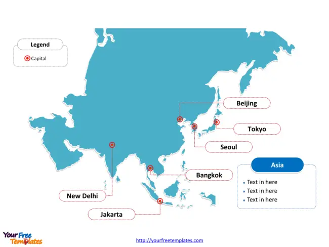
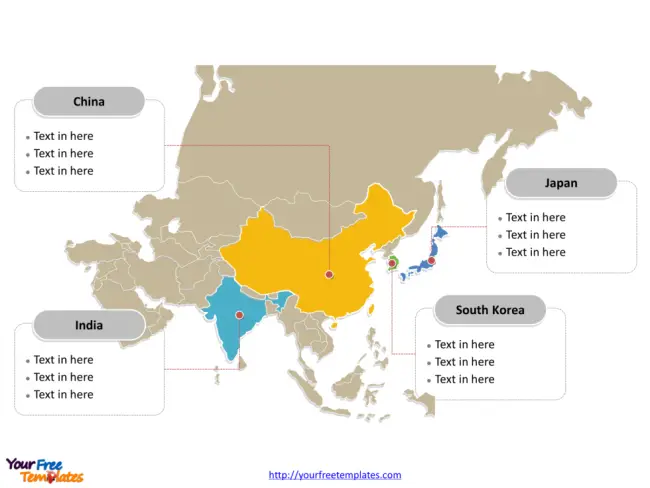
The Map of Asia Template in PowerPoint format includes two slides, that is, the continent outline and political map. Firstly, our continent outline map free templates have major cities on it, which are Beijing, Bangkok, Jakarta, New Delhi, Seoul, and Tokyo. Secondly, there are 46 countries in our free templates, highlighting the most important countries that are China, India, Japan and South Korea on this continent map.
Maps are powerful tools that not only guide us through the physical world but also offer insights into history, culture, and political landscapes. Asia, the largest continent on Earth, is a tapestry of diverse geographies, peoples, and nations. Its maps, whether blank or detailed, serve as a starting point for education, exploration, and understanding.
Understanding Asia Through Its Maps
Our blank Asia map is for the continent located in Eastern and Northern of the world. It shares the continental boundaries of Eurasia with the continent of Europe and the continental area of Afro-Eurasia with both Europe and Africa. Firstly the Pacific Ocean is surrounding the continent from the east. Secondly Indian Ocean is surrounding the continent from the south. Thirdly the Arctic Ocean is surrounding Asia from the north. The major cities in Asia are including Beijing, Bangkok, Jakarta, New Delhi, Seoul, and Tokyo. You can found them in our wonderful free templates.
The Blank map of Asia Map: A Learning Tool
A blank Asia map is more than just an empty outline; it’s an invitation to delve into the continent’s geographic diversity. It is an essential educational resource used in classrooms to teach geography, to challenge students to recall and mark countries, capitals, and significant landforms or water bodies.
Uses of a Blank Map:
- Education:Students use blank maps to practice labeling countries, cities, and physical features.
- Quiz Competitions: Blank maps serve as a basis for testing geographic knowledge.
- Planning and Analysis: Researchers and planners use blank maps for project planning or demographic studies without the distraction of pre-labeled text.

Asia map labeled with major Countries.
In contrast, a detailed map of Asia is a rich document displaying countries, boundaries, and cities. .
Elements of a Detailed Asia Map:
- Political Boundaries: Clearly delineated lines showing the borders between the 46 countries within Asia.
- Human Geography: Locations of major cities like Tokyo, Shanghai, and Mumbai, as well as infrastructure like roads and airports.
Significance of Maps in Asian Context
Understanding Asia through its maps is crucial for several reasons:
- Cultural Appreciation: Asia is incredibly diverse, with thousands of languages and ethnic groups, and maps can help illustrate the cultural and political divisions within the continent.
- Economic Interests: Asia is a global economic powerhouse, and maps can highlight trade routes, economic zones, and resource distributions.
- Strategic Importance: With ongoing territorial disputes and strategic alliances, current maps can provide insights into geopolitical tensions and cooperation.
It is noted that the political map of Asia is the country political division of there are 46 countries. To name a few of them, they are China, India, Japan, Russia, Indonesia, Turkey, South Korea, Saudi Arabia, Iran, and Thailand.
We selected and highlighted the four most important countries; they are China, India, Japan and South Korea. What is more, every individual political subdivision is an editable shape. The labels and shapes are grouped by layers.
In a word, you can change the texts, colors, sizes, highlight some map shapes, and add your charts. At the same time you can also refer to the fully labeled Map of Asia in Wikipedia Asia.

Looking for country bundle, please visit Asia countries map

Size: 176K
Type: PPTX
Aspect Ratio: Standard 4:3
Click the blue button to download it.
Download the 4:3 Template
Aspect Ratio: Widescreen 16:9
Click the green button to download it.
Download the 16:9 Template


