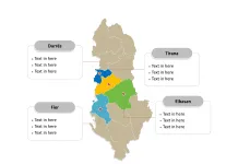
The Bosnia and Herzegovina Map Template includes three slides. Free Bosnia and Herzegovina map with two “entities” and one district, 10 cantons and 7 counties for Federation of Bosnia and Herzegovina, Serb Republic respectively. Bosnia and Herzegovina Outline map labeled with capital and major cities, Sarajevo, Banja Luka, Tuzla, Zenica, and Bijeljina.
Slide 1, Bosnia and Herzegovina map of outline labeled with capital and major cities.
Bosnia and Herzegovina sometimes called Bosnia-Herzegovina (BiH), and, in short, often known informally as Bosnia, is a country in Southeastern Europe located on the Balkan Peninsula. Bordered by Croatia to the north, west, and south; Serbia to the east; Montenegro to the southeast; and the Adriatic Sea to the south. Following the dissolution of Yugoslavia, Bosnia and Herzegovina proclaimed independence in 1992. Sarajevo is the capital and largest city, other major cities including Banja Luka, Tuzla, Zenica, and Bijeljina.

Slide 2, Bosnia and Herzegovina map labeled with two entities and one district.
Bosnia and Herzegovina is a country divided into two “entities” and one district; they are Federation of Bosnia and Herzegovina, Serb Republic, and Brčko District. Every individual political subdivision is an editable shape.

Slide 3, Bosnia and Herzegovina map labeled with major cantons.
The Federation of Bosnia and Herzegovina entity consists of ten cantons, they are Bosnian Podrinje, Central Bosnia, Herzegovina-Neretva, Posavina, Sarajevo, Tuzla, Una-Sana, West Bosnia, West Herzegovina, and Zenica-Doboj; Republika Srpska has 7 counties, they are Banja Luka, Doboj, Bijeljina, Vlasenica, Sarajevo-Romanija, Foča, and Trebinje. Every individual political subdivision is an editable shape. Detailed Bosnia and Herzegovina Editable map of political administrative divisions please refer to Wikipedia Bosnia and Herzegovina.

Size:148K
Type: PPTX
Aspect Ratio: Standard 4:3
Click the blue button to download it.
Download the 4:3 Template
Aspect Ratio: Widescreen 16:9
Click the green button to download it.
Download the 16:9 Template


