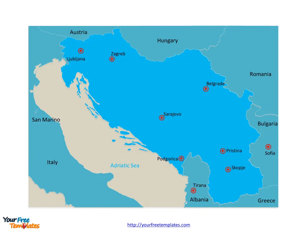
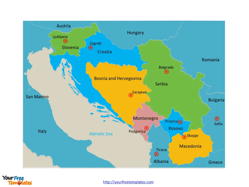
The Yugoslavia Map Template includes two slides. Former Yugoslavia map with 7 countries, they are Serbia, Croatia, Bosnia and Herzegovina, Slovenia, Montenegro, Macedonia, and Kosovo. Yugoslavia map labeled with capitals in this region, Belgrade, Zagreb, Sarajevo, Ljubljana, Podgorica, Skopje, and Pristina.
Location Yugoslavia was a country located in Southeastern and Central Europe. It bordered Italy, Austria, Hungary, Romania, Bulgaria, Greece, and Albania. Following the breakup of Yugoslavia, the region is now comprised of independent countries including Serbia, Croatia, Bosnia and Herzegovina, Montenegro, Slovenia, Kosovo, and North Macedonia.
History Yugoslavia was formed after World War I and underwent various iterations before its dissolution in the 1990s. It was initially known as the Kingdom of Serbs, Croats, and Slovenes before adopting the name Yugoslavia in 1929. The country faced internal conflicts and wars during the 1990s, leading to its eventual breakup into multiple independent nations.
Population At its peak, Yugoslavia had a diverse population consisting of various ethnic groups, including Serbs, Croats, Bosniaks, Slovenes, Montenegrins, Macedonians, and others.
Economy Yugoslavia’s economy was characterized by a mix of socialist and market-oriented policies. It faced economic challenges, particularly in the 1980s, leading to high inflation and a growing national debt. The breakup of Yugoslavia further impacted the economies of the newly formed independent states.
Slide 1, Yugoslavia map labeled with capitals of socialist republics.
Yugoslavia was a country in Southeast Europe during most of the 20th century. The major cities are Belgrade, Zagreb, Sarajevo, Ljubljana, Podgorica, Skopje, and Pristina.

Belgrade
Belgrade, the capital of Serbia, is a vibrant city situated at the confluence of the Sava and Danube rivers. It has been a focal point of both historical and contemporary importance, serving as a center for culture, arts, and commerce.
Zagreb
Zagreb, the capital of Croatia, is known for its charming medieval old town and vibrant cultural scene. It is a city rich in history and architectural heritage, attracting visitors with its museums, galleries, and open-air markets.
Sarajevo
Sarajevo, the capital of Bosnia and Herzegovina, is a city with a diverse cultural and religious mosaic. It holds historical significance and is renowned for its blend of Eastern and Western influences, evident in its architecture and way of life.
Ljubljana
Ljubljana, the capital of Slovenia, is a picturesque city nestled at the foot of the Alps. It is celebrated for its green spaces, Baroque and Art Nouveau architecture, and a lively cultural ambiance.
Podgorica
Podgorica, the capital of Montenegro, is a city that has undergone significant transformation over the years. It serves as a hub of political and economic activity, showcasing a mix of modern and historical elements.
Skopje
Skopje, the capital of North Macedonia, is a city with a rich historical and cultural heritage. It is known for its diverse architectural styles and the blending of ancient and modern influences.
Pristina
Pristina, the capital of Kosovo, is a city with a unique and evolving identity. It is a center of political and cultural activity, reflecting the resilience and spirit of its people.
Slide 2, Yugoslavia map labeled with national capitals.
Partition of yugoslavia. After an economic and political crisis in the 1980s and the rise of nationalism, Yugoslavia broke up along its republics’ borders into 7 countries; they are Serbia, Croatia, Bosnia and Herzegovina, Slovenia, Montenegro, Macedonia, and Kosovo.

The former Yugoslavia has transformed into seven independent countries, each with its own distinct identity and governance.
- Serbia
- Capital: Belgrade
- A landlocked country known for its rich history, vibrant culture, and natural beauty.
- Croatia
- Capital: Zagreb
- A country renowned for its stunning coastline, historic cities, and diverse cultural heritage.
- Bosnia and Herzegovina
- Capital: Sarajevo
- A nation characterized by its blend of cultures, historical landmarks, and breathtaking landscapes.
- Slovenia
- Capital: Ljubljana
- A country celebrated for its alpine scenery, medieval towns, and a thriving arts and culinary scene.
- Montenegro
- Capital: Podgorica
- A nation known for its Adriatic coastline, rugged mountains, and a rich cultural tapestry.
- North Macedonia
- Capital: Skopje
- A country with a diverse heritage, ancient ruins, and scenic landscapes.
- Kosovo
- Capital: Pristina
- A country with a unique cultural identity and a history shaped by its geopolitical significance.
The major cities and independent nations that emerged from the former Yugoslavia continue to contribute to the region’s diverse tapestry of cultures, histories, and traditions.
Looking for Premium maps, please visit our affiliate site: https://editablemaps.com/ or https://ofomaps.com/
Size:229
Type: PPTX
Aspect Ratio: Standard 4:3
Click the blue button to download it.
Download the 4:3 Template
Aspect Ratio: Widescreen 16:9
Click the green button to download it.
Download the 16:9 Template


