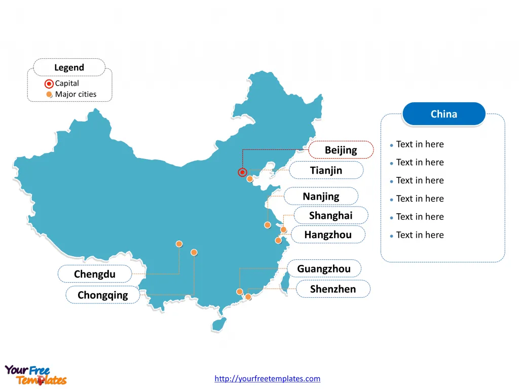
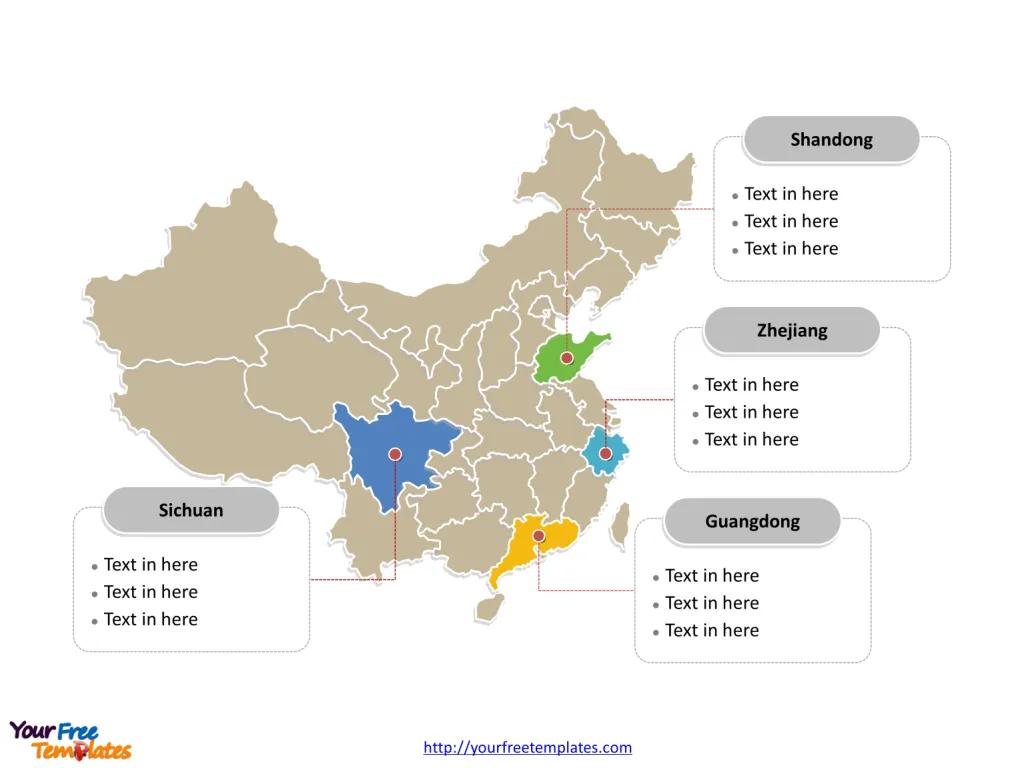
The China Map Template in PowerPoint format includes two slides, that is, the country outline map and the political map. Firstly, our outline map download has capital and major cities on it, which are Beijing, Shanghai, Tianjin, Guangzhou, Shenzhen, Hangzhou, Chongqing, Chengdu, and Nanjing. Secondly, there are 22 provinces in our political map download, five autonomous regions, four municipalities and 3 Special Administrative Regions in our China map template of divisions, labeling the most populated provinces that are Guangdong Province, Shandong Province, Sichuan Province, and Zhejiang Province.
Nestled in the heart of East Asia, China’s vast landscape stretches from the deserts of the west to the oceanic borders of the east. As the world’s third-largest country by area, China offers a geographical tapestry as diverse as its cultural heritage.
Slide 1, Map of China labeled with capital and major cities
Our China slide is for the republic country in East Asia. It is the world’s most populous state with over 1.3 billion population. There are lots of neighboring countries. They are Vietnam, Laos, and Myanmar (Burma) are from Southeast Asia; India, Bhutan, Nepal, Afghanistan, Pakistan from South Asia. Tajikistan, Kyrgyzstan and Kazakhstan from Central Asia. Russia, Mongolia, and North Korea from Inner Asia and Northeast Asia. In this slide, its capital and largest city is Beijing and Shanghai respectively, other major cities including Tianjin, Guangzhou, Shenzhen, Hangzhou, Chongqing, Chengdu, and Nanjing. You can found them in our China map download.
Major Cities:
- Beijing: The capital city, Beijing is the political and cultural heartbeat of China, known for landmarks like the Forbidden City and the Great Wall.
- Shanghai: China’s largest city, Shanghai, stands as a global financial hub with a skyline punctuated by futuristic skyscrapers.
- Guangzhou: A major port city, Guangzhou is the trade and transportation center in southern China, bustling with economic activity.

Slide 2, China Map labeled with major provinces.
It is noted that the Map of China is the country political division of 34 divisions.
Firstly, there are 22 provinces; they are Hebei, Shanxi, Liaoning, Jilin, Heilongjiang, Jiangsu, Zhejiang, Anhui, Fujian, Jiangxi, Shandong, Henan, Hubei, Hunan, Guangdong, Hainan, Sichuan, Guizhou, Yunnan, Shaanxi, Gansu, and Qinghai.
Secondly, there are five autonomous regions; they are Inner Mongolia Autonomous Region, Guangxi Zhuang Autonomous Region, Tibet Autonomous Region, Ningxia Hui Autonomous Region, and Xinjiang Uyghur Autonomous Region.
Thirdly, there are four municipalities; they are Beijing, Tianjin, Shanghai and Chongqing.
Lastly, there are three Special Administrative Regions; they are Hong Kong Special Administrative Region, Macau Special Administrative Region, and Taiwan.

Major Provinces:
- Guangdong: Bordering Hong Kong and Macau, Guangdong is an economic juggernaut, leading in manufacturing and export.
- Sichuan: Renowned for its spicy cuisine and the adorable giant pandas, Sichuan is a province of culinary and natural wonders.
- Yunnan: Home to dramatic landscapes and a mosaic of ethnic minorities, Yunnan is a province rich in biodiversity and cultural heritage.
What is more, every individual political subdivision is an editable shape. The labels and shapes are grouped by layers. In a word, you can change the texts, colors, sizes, highlight some map shapes, and add your charts. At the same time you can also refer to the fully labeled Map of China in Wikipedia.
Believe it or not, analysts from marketing research companies, consultants from professional firms think highly of our website yourfreetemplates.com; Most important of all, our maps can help to reduce their efforts and create good-looking maps.
Size: 147K
Type: PPTX
Aspect Ratio: Standard 4:3
Click the blue button to download it.
Download the 4:3 Template
Aspect Ratio: Widescreen 16:9
Click the green button to download it.
Download the 16:9 Template


